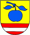
Vyšné Opátske
| Vyšné Opátske | ||
|---|---|---|
| coat of arms | map | |

|
|
|
| Basic data | ||
| State : | Slovakia | |
| Kraj : | Košický kraj | |
| Okres : | Košice IV | |
| Region : | Košice (region) | |
| Area : | 4.191 km² | |
| Residents : | 2,623 (Dec. 31, 2019) | |
| Population density : | 626 inhabitants per km² | |
| Height : | 200 m nm | |
| Postal code : | 040 01 | |
| Telephone code : | 0 55 | |
| Geographic location : | 48 ° 42 ' N , 21 ° 17' E | |
| License plate : | KE | |
| Kód obce : | 599913 | |
| structure | ||
| Community type : | district | |
| Structure of the district area: | 2 cadastral areas | |
| Administration (as of November 2018) | ||
| Mayor : | Viktor Mikluš | |
| Address: | Miestny úrad Košice-Vyšné Opátske Nižná úvrať 25 04001 Košice |
|
| Statistics information on statistics.sk | ||
Vyšné Opátske (until 1927 Slovak "Opatovce"; Hungarian Szilvásapáti - until 1882 Apátiszilvás ) is a district of Košice , in Okres Košice IV in eastern Slovakia, southeast of the city center.
The place was mentioned in writing for the first time in 1344 and was incorporated in 1968.
It consists of the cadastral parishes Nižná Úvrať and Vyšné Opátske .
Web links
Commons : Vyšné Opátske - collection of pictures, videos and audio files

