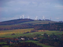
Vysoká (Chrastava)
| Vysoká | ||||
|---|---|---|---|---|
|
||||
| Basic data | ||||
| State : |
|
|||
| Region : | Liberecký kraj | |||
| District : | Liberec | |||
| Municipality : | Chrastava | |||
| Geographic location : | 50 ° 50 ' N , 14 ° 59' E | |||
| Height: | 400 m nm | |||
| Residents : | 22 (March 1, 2001) | |||
| Postal code : | 463 31 | |||
| License plate : | L. | |||
| traffic | ||||
| Street: | Chrastava - Růžek | |||


Vysoká (German Hohendorf ) is a district of the city of Chrastava in the Czech Republic . It is located two kilometers northeast of the center of Chrastava and belongs to the Okres Liberec .
geography
Vysoká lies in the western foothills of the Jizera Mountains . The scattered settlement is located on the right above the Jeřice ( Görsbach ) valley on a hill that is surrounded by the Polní potok ( Saugraben ) in the east , the Od Kameniště brook in the north and the Vítkovský potok ( Wittigbach ) in the west . To the north rise the Výhledy ( Gickelsberg , 569 m) and the Vítkovský kopec ( Wittigberg , 503 m), in the northeast the Spálený vrch ( Brandberg , 581 m), the Lysý vrch (Kahleberg, 643 m) and the Kameniště ( Neundorfer Steinberg , 608 m), east of Závětří (432 m), in the southeast of Novoveský vrch ( Neudörfler Berg , 511 m) and south of Ovčí hora ( Schafberg , 496 m).
Neighboring towns are Polní and Horní Vítkov in the north, Vysoký and Albrechtice u Frýdlantu in the northeast, Růžek and Nová Ves in the east, Horní Chrastava in the south, Chrastava and Dolní Chrastava in the southwest, Pekařka in the west and Dolní Vítkov in the northwest.
history
Hundorf was first mentioned in writing in 1411. On a map of the Bunzlauer Kreis ( Regni bohemiae circulus boleslavensis ) from 1770, the village is still listed as Hundorf . The place name Hohendorf can be found for the first time in 1786 in Jaroslaus Schaller's topography of the Kingdom of Bohemia . At that time, the village belonging to the Grafenstein lordship consisted of seven properties. Its inhabitants lived from agriculture.
In 1832, Hohendorf consisted of eight houses with 64 German-speaking residents. The small village belonged to the municipal court of Ober-Kratzau. The parish was Kratzau . Until the middle of the 19th century Neudörfel remained subject to the allodial rule of Grafenstein.
After the abolition of patrimonial Hohendorf formed from 1850 a district of the municipality of Ober-Kratzau / Hořejší Chrastava in the Bunzlauer Kreis and judicial district of Kratzau . From 1868 the village belonged to the Reichenberg district . Since the end of the 19th century, some of the residents have been earning their living from wage labor in the Kratzau factories. The Czech place name Vysoká has also been used since 1924 . After the Munich Agreement , it was incorporated into the German Reich in 1938; until 1945 Hohendorf belonged to the Reichenberg district . After the end of the Second World War, Vysoká came back to Czechoslovakia. In 1946 and 1947, most of the German-Bohemian residents were expelled. Most of the houses in the small village have remained uninhabited since then. 1948 Vysoká was incorporated together with Horní Chrastava to Chrastava and at the same time assigned to the Okres Liberec-okolí. Since 1960 the village has belonged again to the Okres Liberec . In 1991 Vysoká had no permanent residents. In 1992 the Havlíček couple began building the largest European breeding station for Akhal-Teke children on the western edge of Vysoká . A safari complex with a hotel, restaurant, sports facilities and animal clinic was to be built on the 150 hectare site. Only the breeding station with almost 200 pedigree horses was realized, which went bankrupt in 1995. At the end of 2003 the Svoboda family bought the property and set up the Vysoká horse farm in it, which was expanded in 2009 to include the Liberec Hotel .
In 2001 the village consisted of eight houses in which 22 people lived. In total, the place consists of 18 houses, most of which are used for recreational purposes.
Local division
Vysoká is part of the Horní Chrastava cadastral district.
Attractions
- crossroads
- Vysoká a wide view of the of offers to the south Jeřice and Neisse -carrying Grottauer pool ( Hrádecká pánev ) to Jeschke comb .
Web links
Individual evidence
- ↑ http://www.chrastava.cz/muzeum/cesky/bul0205.htm
- ↑ http://www.chrastava.com/listy/bull206.pdf
- ↑ Jaroslaus Schaller: Topography of the Kingdom of Bohemia , Fourth Part - Bunzlauer Kreis, 1786, p. 298
- ↑ Johann Gottfried Sommer , Franz Xaver Maximilian Zippe The Kingdom of Böhmen, Vol. 2 Bunzlauer Kreis, 1834, pp. 286–287
- ↑ http://www.farmavysoka.cz/hotel-historie.php?lang=cs
- ↑ http://www.czso.cz/csu/2009edicniplan.nsf/t/010028D080/$File/13810901.pdf


