Weidgraben (Weingartener Relief Canal)
| Pasture ditch | ||
|
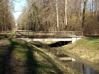
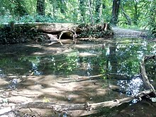
Weidgraben below the Gießbach estuary |
||
| Data | ||
| Water code | DE : 23756222 | |
| location |
Hard levels
|
|
| River system | Rhine | |
| Drain over | Weingarten Relief Canal → Pfinz → Rhine → North Sea | |
| Emergence | on the eastern edge of the Rossweid industrial park near Hagsfeld 49 ° 1 ′ 44 ″ N , 8 ° 28 ′ 26 ″ E |
|
| Source height | 113 m above sea level NHN | |
| muzzle | from the left into the Weingartener relief canal at the bridge under the motorway Coordinates: 49 ° 3 ′ 16 ″ N , 8 ° 29 ′ 54 ″ E 49 ° 3 ′ 16 ″ N , 8 ° 29 ′ 54 ″ E |
|
| Mouth height | 112 m above sea level NHN | |
| Height difference | 1 m | |
| Bottom slope | 0.27 ‰ | |
| length | 3.7 km | |
|
no longer used aqueduct of the irrigation ditch in Weingartener Wiesental over the Weidgraben |
||
The Weidgraben is a 3.7 kilometer long drainage ditch in the northeast of the independent city of Karlsruhe and in the municipality of Weingarten (Baden) in the district of Karlsruhe , which was re - routed in the course of the Pfinz-Saalbach correction (Pfisako, 1934–1962).
geography
course
According to the official digital water management network (AWGN), the Weidgraben begins at a pipe outlet on Greschbachstrasse in the Rossweid industrial park near Karlsruhe- Hagsfeld . According to other information, the origin lies in the Untere Hub northwest of Durlach and around 2.5 kilometers south of Greschbachstrasse ( ⊙ , 114 m above sea level ). Of the lower stroke of Weidgraben passes through an agricultural area, passes under at the junction Karlsruhe-Nord the motorway 5 (Karlsruhe- Heidelberg ) and then runs verdolt to Greschbach road.
From the pipe outlet, the Weidgraben runs almost 500 meters to the east, crosses under the motorway again and immediately afterwards the Pfinz relief canal in a culvert . Immediately after the culvert, the Beungraben from Karlsruhe- Grötzingen flows from the right . From here the Weidgraben follows the motorway in a straight three kilometers long, which runs around 100 meters further west to north-northeast. More streams and ditches flow into the Weidgraben from the right, including the Gießbach , which branches off from the Pfinz in Grötzingen .
Most of the moat is in the forest or on the edge of the forest; Areas around the Aussiedlerhöfe Im Brühl , east of the Weidgraben and south of the Gießbach estuary, as well as the Weingartener Wiesental shortly before the confluence of the Weidgraben into the Weingartener relief canal are used for agriculture . This canal branches off from the Walzbach in Weingarten (Baden) ; it flows 1.5 kilometers below the mouth of the pasture ditch coming from the left to the Pfinz, here called Pfinzkorrektion .
In the entire course from Greschbachstrasse, the Weidgraben lies in nature or landscape protection areas or forms the border between them: Nature reserve Weingartener Moor and the landscape protection areas Füllbruch-Vokkenau , Gießbachniederung-Im Brühl , broken forest area of the old Kinzig-Murg-Rinne and Weingartener Wiesental .
Tributaries
Hierarchical list of tributaries and ![]() lakes from source to mouth. Length of water, lake area and height according to the corresponding layers on the LUBW online map. Other sources for the information are noted.
lakes from source to mouth. Length of water, lake area and height according to the corresponding layers on the LUBW online map. Other sources for the information are noted.
Developed on Greschbachstrasse on the eastern edge of the Rossweid industrial park near Hagsfeld ( 113 m above sea level ).
- ☓ Culvert under the Pfinz relief canal ( ⊙ ).
- Buried from the right, 2.3 km ( ⊙ , 114 m above sea level ). Branch from Gießbach (see below, ⊙ , 118 m above sea level ) west of Grötzingen, follows the Pfinz relief canal and crosses under it twice in culverts.
- from the right several drainage ditches from the area around the Aussiedlerhöfe Im Brühl, through which there are only temporary flows .
- Gießbach from the right ( ⊙ , 113 m above sea level ), arises at the Hühnerloch weir in Grötzingen ( ⊙ , 120 m above sea level ) as a branch from the Pfinz .
- Main ditch from the right ( ⊙ , 113 m above sea level ), drains swamp forests in the Weingartener Moor nature reserve .
- Werrenhäuslesgraben, from the right ( ⊙ 113 m above sea level ), 2.5 km, is being built on Bundesstrasse 3 at the residential area Werrabronn ( ⊙ 118 m above sea level ).
- Ruchgraben from the right ( ⊙ , 112 m above sea level ), 2.9 km. Arises in the south of the community Weingarten ( ⊙ , 115 m above sea level ).
- Torfgraben, from the right ( ⊙ 113 m above sea level ), 1.1 km. Created at the Weingarten fairground ( ⊙ 114 m above sea level ).
- (Graben am Ober Wiesental) from the right ( ⊙ 113 m above sea level ), 0.6 km. Arises at the edge of the forest near Gewann Brüchle ( ⊙ 113 m above sea level ).
After 3.7 km it flows into the Weingartener relief canal at the bridge under the motorway.
history
In front of the Pfisako there was a body of water, sometimes referred to as a Weidgraben , which arose in the meadows north of Durlach and to the right of the Pfinz and flowed into the Gießbach roughly where the Weingarten relief canal of the Pfinz correctional flows today. The pouring stream was shortened during the Pfisako; previously it flowed north of Blankenloch into the Pfinz.
This body of water is referred to as the Weidgraben in topographic maps from 1876 and 1936 as well as in district overviews of Durlach and Grötzingen from the end of the 19th century. In a topographical map from 1840, the body of water is labeled as Gieſsbach , whereas today's Gießbach is labeled as Die Gieſs . In a publication on meadow irrigation in the region from 1995, the body of water is referred to as a watering ditch . Other, more local names were re-union digging in the lower reaches at Blankenloch and Füllbruchgraben in the area of Füllbruchs.
During the Pfisako, the Weidgraben in its current course, the Pfinz correction, the Weingarten relief canal and the Pfinz relief canal were created. The filling breach between the Pfinz relief canal in the south, the Pfinz in the west, the Autobahn in the east and the Pfinz correction in the north was set up as a retention area for floods in the Pfinz. Today's Weidgraben bypasses the retention area in the east and is the receiving water of the waters flowing in from the east. The old course of the pasture ditch through the filling quarry is still present as a mostly dry ditch and is referred to as Rossweid ditch in the AWGN .
According to an agreement from 1954, 70 percent of the maintenance costs of the Weidgraben are borne by the motorway office and 30 percent by the city of Karlsruhe and the community of Weingarten (Baden).
Web links
- Map of the pasture ditch and its catchment area on: Landesanstalt für Umwelt Baden-Württemberg (LUBW) ( information )
-
 Map with all coordinates: OSM | WikiMap
Individual evidence
LUBW
Official online waterway map with a suitable section and the layers used here: of the pasture ditch and its catchment area
General introduction without default settings and layers: State Institute for the Environment Baden-Württemberg (LUBW) ( notes )
- ↑ a b c Height according to the contour line image on the topographic map background layer or the digital terrain model of the online map.
- ↑ a b Length according to the waterway network layer ( AWGN ) .
- ↑ Protected areas according to the relevant layers, nature partly according to the biotope layer .
- ↑ Lake area after the layer standing waters .
- ↑ Length measured on the background layer topographic map .
Other evidence
- ↑ Josef Schmithüsen : Geographical land survey: The natural space units on sheet 161 Karlsruhe. Federal Institute for Regional Studies, Bad Godesberg 1952. → Online map (PDF; 5.1 MB)
- ↑ a b c Günther Malisius: Die Pfinz: Once a lifeline, now local recreation and always corrected . (= Contributions to the history of Durlach and the Pfinzgau , Volume 5). Freundeskreis Pfinzgaumuseum, Historical Association Durlach eV (Ed.). Regional culture publishing house, Ubstadt-Weiher 2011, ISBN 978-3-89735-681-8 . P. 55.
- ↑ measuring table sheet 6916 Carlsruhe from 1876 in the Deutsche Fotothek
- ↑ United States Army Corps of Engineers (Ed.): 6916 Karlsruhe , 1952 (based on a German topographic map from 1936, digitized at Brigham Young University ).
- ↑ District overview plan Durlach , printed in 1879, at the Generallandesarchiv Karlsruhe .
- ↑ Grötzingen district overview plan , printed in 1884, at the General State Archives in Karlsruhe .
- ↑ Topographisches Bureau Baden (ed.), W. Winckens (arr.): Topographical map over the Grand Duchy of Baden. According to the general land survey of the Grand Ducal Military Topographical Bureau. Sheet 16, Karlsruhe. Karlsruhe 1840 ( digitized at the Heidelberg University Library ).
- ^ Map in: Dieter Hassler (Ed.): Wässerwiesen: History, technology and ecology of irrigated meadows, streams and ditches in Kraichgau, Hardt and Bruhrain. Regional culture publisher, Ubstadt-Weiher 1995, ISBN 3-929366-20-7 , p. 221.


