
Walzbach (Pfinz)
|
Walzbach Weingarter Bach (in the lower reaches) Lachengraben (in the mouth area) Dreckwalz (older name) |
||
.jpg) Walzbach in Weingarten with market bridge, Walk'schem house and Catholic church. |
||
| Data | ||
| Water code | DE : 2375626 | |
| location |
Kraichgau
|
|
| River system | Rhine | |
| Drain over | Pfinz → Rhine → North Sea | |
| source | Source of hunger 3 km east-southeast of Wössingen 49 ° 0 ′ 13 ″ N , 8 ° 39 ′ 0 ″ E |
|
| Source height | 206 m above sea level NHN | |
| muzzle | from the right into the Pfinzkorrektion between Spöck and Neuthard Coordinates: 49 ° 7 '7 " N , 8 ° 30' 58" E 49 ° 7 '7 " N , 8 ° 30' 58" E |
|
| Mouth height | 110 m above sea level NHN | |
| Height difference | 96 m | |
| Bottom slope | 4.7 ‰ | |
| length | 20.6 km | |
| Catchment area | 55.807 km² | |
The Walzbach is a 20 kilometer long stream in the north of the Baden-Württemberg district of Karlsruhe , which arises in the southwestern Kraichgau , enters the Upper Rhine Plain near Weingarten (Baden) and flows there from the right into the Pfinzkorrektion . In Weingarten, the Weingartener relief channel branches off , which flows to the Pfinzkorrektion via a shorter route.
Names
In the local dialect, "Bach" is feminine ; Today's Bahnhofstrasse in Weingarten used to be called An der Bach .
In the official digital water management network (AWGN) the Walzbach bears the local name Weingarter Bach for the section below Weingarten and Lachengraben below the mouth of the Grombach .
In maps of the 19th century, the water is called Dreckwalz or Dreckwalzbach , in older sources the names “The brook, called the Waltzendreck” (1617) and “Walz, den Dreck Bach” (1738) can be found. These names are mostly attributed to the yellow to dark brown color of the water in heavy rain, which is the result of the high sediment load from the loess area of the Kraichgau.
Local names no longer in use today were Waldbach im Oberlauf and Heiliger Graben in Büchenau .
geography
Source of hunger
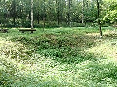
The Walzbach rises from the Hungerquelle (also Hungerbrunnen ), an episodic pouring artesian spring . The name " Hungerquelle " refers to the popular belief that a pouring of the karst spring heralds bad harvests and inflation . According to information from 1817, the source poured in 1563, 1571, 1636, 1699, 1744 and 1771. According to a report by the Wössinger Schultheiss from 1816, the year without a summer , the pouring that year was so large that it would have been possible to operate a mill wheel . When the hunger spring dried up in 1800, the hole was thrown and the spring was damned, so the mayor.
In the last few years the hunger source poured out in 2003, in February 2011 and in June 2013. The water comes out in gushes and air bubbles rise constantly. On average, the spring pours every seven to eight years for a few months. The source of hunger has been designated as an extensive natural monument since 1989 . It is located in a forest clearing not far from the border between Walzbachtal and Königsbach-Stein and south of the nature reserve Wössinger Waldwiesen , about three kilometers east-southeast of Wössingen .
- Source of hunger

with bulk
without pouring

.jpg)
course
Kraichgau
Turning approximately west-northwest at the source of hunger, the Walzbach reaches the outskirts of Wössingen after about 2.5 kilometers through the Schifftal . In doing so, she passes the Lausquelle , which is also a designated natural monument. The Walzbach is accompanied by a riparian forest strip for almost the entire course to Wössingen; the biotope maps show the stream as remote from nature and straightened out. Above the county road 3565 (Wössingen– Stein ) the brook crosses a forest island in which the water has also been straightened, but is developing into near-natural structures.
On the outskirts of Wössingen the Walzbach flows on the right edge of the floodplain; In the floodplain is the Brühl flood retention basin, which is not permanently dammed, with a normal flood retention area of 6,840 cubic meters. The approximately one kilometer long Wössinger Verdolung begins around 350 meters below the retention basin . Within the twisted section, the Walzbach flows from the right to the Falltorgraben, which drains the area around the quarries of the cement works in the northeast of Wössingen.
On the western outskirts of Wössingen the Kraichgaubahn ( Heilbronn - Karlsruhe ) crosses the Walzbach; Just under a kilometer further follows the federal road 293 (Heilbronn– Pfinztal ). Also between Wössingen and Jöhlingen , both districts of Walzbachtal, the stream bed is straightened and remote from nature, but mostly accompanied by a strip of alluvial forest.
On the outskirts of Jöhlingen, the Walzbach flows through the Seewiesen flood retention basin, which is not permanently dammed, with a normal flood retention area of 46,000 cubic meters. The retention basin marks the beginning of the two-kilometer-long Jöhlinger Verdolung, within which the Walzbach flows into three trenches, which are also rotten in their lower reaches.
Below Jöhlingen the valley narrows, through which the state road 559 (Jöhlingen - Weingarten (Baden) - Leimersheim ferry ) runs. In two opposite arcs, the Walzbach first flows north and then heads west. In the biotope mapping, the stream is described in this section as predominantly natural with the character of a flatland stream and some features of a low mountain stream. The water is partly meandering with impact and sliding slopes and is mostly bordered by a narrow strip of wood.
About halfway between Jöhlingen and Weingarten is the Am Alten Schloss flood retention basin with a 7.5 meter high earth dam and a normal flood retention area of around 175,000 cubic meters. The name of the retention basin refers to the Schmalenstein moated castle down the valley , the few remains of which flow around the Walzbach split into two arms.
A little below the castle ruins, the Walzbach reaches the built-up area of the community of Weingarten. The stream crosses the upper village, which is located in the relatively narrow valley; the mill channels of three closed mills are still flowed through. In the center of the village, Bundesstrasse 3 (Karlsruhe– Heidelberg ) crosses the Walzbach on the Marktbrücke. The one kilometer-long Weingarten Verdolung begins around 100 meters below the bridge and ends shortly after the train station on the Heidelberg – Karlsruhe line .
Upper Rhine Plain
At the point where it enters the Upper Rhine Plain, the Walzbach has formed an alluvial cone on which the lower village of Weingarten lies. The branch of the Weingarter relief canal is located on the western edge of the village .
From the tee of the relief canal known as Weingarter Bach , the water runs north to northwest along the county road 3539 to Stutensee - Staffort . The Weingarter Bach passes through the Waldbrücke district and the Weingarten sewage treatment plant.
After crossing under the federal autobahn 5 (Karlsruhe – Heidelberg), the Weingarter Bach turns north to northeast, leaves the forest it has flowed through since the Waldbrücke and reaches the Staffort field. Here the stream flows between small dams at a high altitude, the water level is partly above the ground level. The high elevation is likely to be the result of the “stream cleaning” practiced for centuries, during which the sediments were dug out of the stream bed and deposited on the bank. According to the biotope mappings, the water is mostly accompanied by field trees and smaller reed stands . Flowing east of Staffort, the stream crosses under the 3679 district road to Büchenau and then crosses the New Canal on an aqueduct .
About 600 meters west of Büchenau flows from the right and southeast of the Grombach , which arises in the Kraichgau and drains the area north of the catchment area of the Walzbach. Running north from the mouth of the Grombach under the name Lachengraben , the stream crosses under the state road 558 ( Friedrichstal - Bruchsal ) and then follows the district road 3528 towards Stutensee- Spöck . Spöck from the pools trench extends in approximately 100 meters distance parallel to herein as Pfinzkorrektion designated Pfinz , in which the stream approximately midway between Spöck and Neuthard flows from the right.
Weingarten relief canal
| Weingarten relief canal | ||
 The Weidgraben (from the right) joins the Weingarten relief canal |
||
| Data | ||
| Water code | DE : 2375622 | |
| location |
Hard levels
|
|
| River system | Rhine | |
| Drain over | Pfinz → Rhine → North Sea | |
| Branch | from the Walzbach on the western edge of Weingarten 49 ° 3 ′ 32 ″ N , 8 ° 31 ′ 8 ″ E |
|
| Source height | 114 m above sea level NHN | |
| muzzle | from the right into the Pfinzkorrektion east of Stutensee- Blankenloch 49 ° 3 ′ 57 ″ N , 8 ° 29 ′ 27 ″ E |
|
| Mouth height | 112 m above sea level NHN | |
| Height difference | 2 m | |
| Bottom slope | 0.63 ‰ | |
| length | 3.2 km | |
| Catchment area | 18.549 km² | |
The Weingarten relief canal built during the Pfinz-Saalbach correction (1934–1962) branches off from the Walzbach on the western outskirts of Weingarten. At the branch there is a settlement basin, which is around 2500 square meters in size and originally built as a sludge trap. The trapezoidal profile of the canal used for flood protection is dimensioned for a discharge of ten cubic meters per second.
Turning west to south-west, the relief channel runs - accompanied on the south side by a tall tree hedge - on the northern edge of the Weingartener Wiesental , a former meadow watering area . At around 600 meters, the canal flows through the Dörnich forest area , in which there are several burial mounds . Between the edge of the forest and the federal autobahn 5, the Weidgraben flows from the left , which follows the autobahn from Karlsruhe and takes in several ditches from the nature reserve Weingartener Moor and the Pfinzsebenarm Gießbach .
To the west of the autobahn, the canal turns in a long arc to the north - following the course of the Wiesental - and crosses under the state road from Weingarten to Stutensee- Blankenloch . From the motorway, following the border between the Wiesental on the left and a wooded area on the right, the canal enters the wooded area completely for its last 500 meters. The Weingarten relief channel opens around 1.5 kilometers east of Blankenloch at the Cross Lach Avenue left on here as Pfinzkorrektion called Pfinz . As a rule, the Pfinz does not have any water above the confluence, as the runoff is directed around 1.3 kilometers upstream through a weir into the Heglach arm .
Tributaries
Hierarchical list of the tributaries and ![]() lakes of the Walzbach from the source to the mouth. The only inflow of the Weingarten relief channel is the Weidgraben:
lakes of the Walzbach from the source to the mouth. The only inflow of the Weingarten relief channel is the Weidgraben:
tributaries of the Weidgraben see → Weidgraben (Weingarten relief channel) # tributaries
Length of water, lake area, catchment area and altitude according to the corresponding layers on the LUBW online map. Other sources for the information are noted.
![]() Map with all coordinates of the tributaries of the Walzbach: OSM
Map with all coordinates of the tributaries of the Walzbach: OSM
The Walzbach rises from the hunger source 3 km east-south-east of Wössingen ( ⊙ , 206 m above sea level ), in the forest meadows not far from the border between Walzbachtal and Königsbach-Stein .
- Passed at about 187 m above sea level. NHN not permanently ponded reservoirs Brühl ( ⊙ ) at the upper edge of Wössingen.
- Brühlbach , from the left to about 182 m above sea level. NHN ⊙ , 200 m long stream in a meadow on the outskirts of Wössing.
-
Falltorgraben , from the right to about 179 m above sea level. NHN ⊙ in Wössingen, twisted tributary to the also twisted Walzbach, 1.9 km and 3.9 km² including its tributaries. Arises at about 193 m above sea level. NHN south of Wickenberg on federal road 293 ⊙ .
- Muldengraben , from the right to about 191 m above sea level. NHN ⊙ on the federal highway 293, 0.7 km. Arises at about
- Wickenberggraben , from the left to about 192 m above sea level. NHN ⊙ north of federal highway 293, 0.5 km. Arises at about
- Höllgraben , from the right to about 180 m above sea level. NHN ⊙ at the Gewann
- Flows through at about 192 m above sea level. NHN the not permanently dammed Langental retention basin ( ⊙ ).
- Brunnenstubenbach , from the right to about 177 m above sea level. NHN ⊙ on the outskirts of Jöhlingen, 0.5 km. Arises at about
- Flows through at about 175 m above sea level. NHN directly at the confluence with the Grund is the not permanently built-in retention basin Grund ( ⊙ ).
- Bollandergraben , from the right to about 156 m above sea level. NHN ⊙ on Weingartener Strasse, 1.0 km. Arises at about
Mouth from the right into the Pfinzkorrektion between Stutensee- Spöck and Neuthard ( ⊙ 110 m above sea level )
history
bridges
The Marktbrücke, on which Bundesstraße 3 crosses the Walzbach in the center of Weingarten today, was built in 1823 according to plans by Johann Gottfried Tulla . In the classical style, the bridge is unusually richly designed compared to other designs in Tulla. Before 1823 there was a wooden walkway at this point. Carts and carriages had to travel to around 100 meters in the bed of the Walzbach. This also affected the traffic on one of the most important post roads in Germany, which led through Weingarten. The construction of the bridge was complicated because the required height above the stream made it difficult to access adjacent buildings. The executed design of Tulla made the demolition of several buildings necessary. As an appraiser, Tulla had rejected a draft for a two-arched bridge that had been submitted in 1808 because he saw problems with blockages during floods.
The first bridge was built in Wössingen in 1768. Before that, the Walzbach could only be crossed at fords with stepping stones for pedestrians. Only at the rectory was there a footbridge so that the priest did not have to walk over the stepping stones in regalia .
Flood
.jpg)
Floods in the Walzbach are mostly the result of thunderstorms . According to the records of a pastor from Weingarten, the water was "head high" on September 19, 1730; all bridges and footbridges were washed away. During a flood on May 22, 1746, three people died in Weingarten; three houses collapsed. An ox that was carried away in Jöhlingen is said to have got stuck on an archway in Weingarten. Further floods in Weingarten were on October 28, 1824, May 31, 1889, April 19, 1906 and May 7, 1931. In Wössingen, on May 27, 1947, a downpour on the watershed between Pfinz and Walzbachtal flooded the town center 1.5 meters high. After a thunderstorm and a downpour on March 3, 1969, the sewer system in Wössingen overflowed; in addition, the water was backed up by the bridge of the Kraichgaubahn.
In the Weingartener Unterdorf, several ditches branched off, which served to relieve the flood and were used for irrigation or drainage when watering the meadows . These were the Ruchgraben through the Kanalstrasse to the left and south and the Breitwiesengraben through the Luisenstrasse to the right and north. Both trenches are still there today; according to the AWGN, they begin at pipe outlets on the edge of Weingarten. Another ditch branched off to the left of the Walzbach and ran through the Spitalstraße into the Weingartener Wiesental, an approximately three-kilometer-long meadow watering area west of Weingarten. It is believed that a ditch in the Wiesental is an older course of the Walzbach and that today's Weingarter Bach was only created after 1700. This is supported by the fact that the Weingarter Bach leaves the Walzbach alluvial cone over a relatively high area, which the field name Sandfeld refers to. In addition, the Wiesentalgraben is referred to in old sources as "the Bach".
Meadow irrigation and mills
Meadow irrigation was carried out in all neighboring communities of the Walzbach, with Weingarten watering by far the largest areas. Compared to other rivers and streams in the region, the watering was relatively disorganized; After a number of plans and declarations of intent, the community of Weingarten employed two waterers from 1889 who carried out the meadow irrigation. Even after the Second World War, irrigation systems were modernized, for example by building concrete traps . After the middle of the 20th century, the importance of meadow irrigation waned; Weingarten was watered until the early 1980s.
In Wössingen, Jöhlingen and Weingarten, the Walzbach was used to drive mills . There were two mills in Wössingen; a mill in Unterwössingen mentioned in 1699 was still in operation in 1971. A mill in Oberwössingen is only mentioned in 1500. In Jössingen there was at least one mill, the meadow mill. There were four mills in Weingartener Oberdorf, three of which were mentioned in 1441. The fifth Weingartener mill, the Lohmühle , was located in the lower village below the junction of the trench into the meadow valley. She was blamed for flooding in the lower village. In 1891 the community bought the mill, shut down the mill and used the building as a hospital. Since 2003, a water wheel at the former lower mill in Weingarten has been a reminder of the former mill on the Walzbach.
There were numerous conflicts over the use of the Walzbach between the neighboring communities. Before the Reichsdeputationshauptschluss 1803, the communities belonged to three different territories, which made the resolution of conflicts difficult. As a rule, the complaints were directed against the respective upper berth, who was accused of using too much water. In 1856 Staffort accused Weingarten of having caused large parts of the Staffort district to be flooded by opening weirs after heavy rainfall. Weingarten rejected the claim for damages, as the Stafforter district had been flooded "since imaginable times" when it rained. Conflicts could also arise within the communities, for example when the mill and meadow irrigation competed for water. In 1795, the community of Weingarten agreed with the owner of the Lohmühle that the meadows would be watered. When the community wanted to water outside of these times in 1815 to exterminate the field mice in the Wiesental, the miller protested violently, but could not prevail against the community.
Verdolung and renaturation
In Wössingen the Walzbach was overtaken from 1956. The Verdolung was the basis for the construction of the local sewer system, the overflows of which were connected to the stream. In Weingarten, the initial plans provided for the Walzbach in the center of the village and in the lower part of the village. The market bridge should be broken off; A road traffic junction was to be created on the area that would become available. After protests, the local council decided in March 1977 to forego the “Verdolung” in the town center.
Together with the Verdolung in Weingarten, the flood retention basin Am Alten Schloss was created , which replaced a smaller retention basin built shortly after the Second World War. When dimensioning the basin, it was assumed that the maximum outflow during floods would be 22 cubic meters per second. In the retention basin, which was completed in 1977, a small permanent damming was created, which became the center of a wet biotope.
In the middle of Weingart, the Walzbach was redesigned in the mid-1990s with sturgeon stones and plantings. Brown trout and crayfish can be detected in this section . Also in the 1990s, the branch of the Weingarten relief canal was rebuilt in such a way that more water flows back into the Weingarten Bach. Since the Pfinz-Saalbach correction, the Weingarter Bach had become largely inoperative and was mostly dry. Today the relief canal is connected to the Walzbach via a natural stone ramp and a fish ladder ; the former sludge settling basin at the beginning of the canal was rebuilt in a natural way.
Web links
- Map of the Walzbach and its catchment area on: State Institute for the Environment Baden-Württemberg (LUBW) ( information )
Individual evidence
LUBW
Official online waterway map with a suitable section and the layers used here: of the Walzbach and its catchment area
General introduction without default settings and layers: State Institute for the Environment Baden-Württemberg (LUBW) ( notes )
- ↑ a b c d e Height according to the contour line image on the topographic map background layer or the digital terrain model of the online map.
- ↑ a b c Length according to the waterway network layer ( AWGN ) .
- ↑ Catchment area summed up from the sub-catchment areas according to the basic catchment area layer (AWGN) .
- ↑ Name after the layer water name .
- ↑ a b c d Protected areas according to the relevant layers, nature partly according to the biotope layer .
- ↑ Profile HRB Brühl at LUBW (accessed on August 22, 2019).
- ↑ Profile HRB Seewiesen at LUBW (accessed on August 22, 2019).
- ↑ Profile HRB Am Alten Schloss at LUBW (accessed on 23 August 2019).
- ↑ Cross profiles generated from the digital terrain model of the LUBW's online map server.
- ↑ a b Catchment area after the basic catchment area layer (AWGN) .
- ↑ a b Lake area according to the layer standing waters .
Other evidence
- ↑ a b Josef Schmithüsen : Geographical land survey: The natural space units on sheet 161 Karlsruhe. Federal Institute for Regional Studies, Bad Godesberg 1952. → Online map (PDF; 5.1 MB)
-
^ Albert Nikolaus: Heimatbuch Weingarten (Baden). Published by the Bürger- und Heimatverein Weingarten, Weingarten 2000, pp. 22, 77.
The author, who died in 1943, was the pastor of Weingarten. - ↑ a b Overview plan of the Weingarten district, sheet I, drawing 1895, printed in 1898 at the General State Archives Karlsruhe .
- ↑ measuring table sheet 6917 Weingarten from 1876 in the Deutsche Fotothek .
- ^ Wilhelm Kelch: A thousand years of vineyards. 985-1985. Volume 1, published by the municipality of Weingarten (Baden), Weingarten (Baden) 1985, p. 136.
- ↑ a b Thomas Adam: Meadow watering from Walzbach, Weingarter Bach and Grombach. In: Dieter Hassler (Ed.): Wässerwiesen: History, technology and ecology of the irrigated meadows, streams and ditches in Kraichgau, Hardt and Bruhrain. Verlag Regionalkultur, Ubstadt-Weiher 1995, ISBN 3-929366-20-7 , pp. 231–245, here p. 231.
- ^ Nikolaus, Heimatbuch Weingarten , p. 23.
- ↑ Topographisches Bureau Baden (ed.), W. Winckens (edit.): Topographical map of the Grand Duchy of Baden: according to the general land survey of the Grand Ducal military topographical bureau. Sheet 17 Bretten Karlsruhe 1841 at the Heidelberg University Library .
- ↑ Natural event. In: Proteus or manifolds from the realms of literature, art, nature and life. No. 23/1817 (March 19, 1817) p. 92 ( digitized version at the Bavarian State Library ).
- ↑ Spotted water in the famine source. Website of the Walzbachtal community, July 1, 2013 (accessed on August 22, 2019).
- ↑ Information board The "Hungerquelle" of the Walzbachtal community, as of August 16, 2019.
- ^ Hassler, Thousand Years of Trouble , in: Hassler, Wässerwiesen , pp. 40–61, here p. 42.
- ↑ Dieter Hassler: A thousand years of effort and no end. The history of brook construction in Kraichgau, Hardt and Bruhrain. In: Hassler, Wässerwiesen , pp. 40–61, here p. 61.
- ↑ Information board at the southern abutment of the Marktbrücke, as of August 16, 2019.
- ^ Nikolaus, Heimatbuch Weingarten , pp. 95-104.
- ^ Community Walzbachtal (ed.): Wössingen in the course of time. Walzbachtal 1971, p. 37.
- ^ Nikolaus, Heimatbuch Weingarten , p. 29 f.
- ^ Nikolaus, Heimatbuch Weingarten , p. 102 f.
- ↑ Walzbachtal, Wössingen , pp. 114 f, 138.
- ^ Nikolaus, Heimatbuch Weingarten , pp. 24–26.
- ^ Nikolaus, Heimatbuch Weingarten , p. 28.
- ^ Adam, Wiesenwässerung from Walzbach, Weingarter Bach and Grombach, in: Hassler, Wässerwiesen , p. 231–245, here p. 233.
- ^ Adam, Wiesenwässerung from Walzbach, Weingarter Bach and Grombach, in: Hassler, Wässerwiesen , pp. 231–245, here p. 238 f.
- ^ Adam, Wiesenwässerung from Walzbach, Weingarter Bach and Grombach, in: Hassler, Wässerwiesen , pp. 231–245, here pp. 242 f.
- ↑ Walzbachtal, Wössingen , pp. 32, 34.
- ↑ Nikolaus, Heimatbuch Weingarten , p. 297, 325–334.
- ^ Roland Jürgen Felleisen: Checkered history of the Weingartener mills. In: Weingartener Heimatblätter. 21 (2004) pp. 18-20.
- ^ Adam, Wiesenwässerung from Walzbach, Weingarter Bach and Grombach, in: Hassler, Wässerwiesen , pp. 231–245, here pp. 233, 236 f.
- ^ Adam, Wiesenwässerung from Walzbach, Weingarter Bach and Grombach, in: Hassler, Wässerwiesen , p. 231–245, here p. 241 f.
- ^ Adam, Wiesenwässerung from Walzbach, Weingarter Bach and Grombach, in: Hassler, Wässerwiesen , pp. 231–245, here pp. 237 f.
- ↑ Walzbachtal, Wössingen , p. 117 f.
- ↑ Ruth Aich: The second rescue of the Tullabrücke. A historic municipal council resolution. In: Weingartener Heimatblätter. 25 (2008) pp. 26-27.
- ↑ Kelch, Tausend Jahre Weingarten , pp. 436–438.
- ^ Adam, Wiesenwässerung from Walzbach, Weingarter Bach and Grombach, in: Hassler, Wässerwiesen , pp. 231–245, here p. 246.
- ↑ Kirsten Etzold: Artificially linked water worlds. The Walzbach in Weingarten has become a showcase. In: Weingartener Heimatblätter. 19 (2002) pp. 20–21 (unspecified reprint from the Badische Neuesten Nachrichten ).