Weingartenfels
| Weingartenfels | ||
|---|---|---|
|
Bohemian Forest Tower on the Weingartenfels (2012) |
||
| height | 898 m above sea level NHN | |
| location | Bavaria , Germany | |
| Mountains | Upper Palatinate Forest | |
| Coordinates | 49 ° 31 '27 " N , 12 ° 37' 55" E | |
|
|
||
| particularities | Bohemian Forest Tower ( AT ) | |
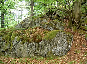
The 898 m above sea level. NHN high Weingartenfels is a rock formation marked as a natural monument on the summit of the plain , the highest mountain in the Schwandorf district . It is located in the Schönsee municipality, right on the border with the Czech Republic . The Velký Zvon rises north of the mountain . In 2006 a new measurement of the mountain was carried out and the previously indicated height of 896 m above sea level. NHN at 898 m above sea level NHN corrected. Not far from the tower is at 893.7 m above sea level. NHN height a trigonometric point.
The European main watershed Elbe - Danube runs over the summit of the Weingartenfels . The waters of its north-eastern slope run over Radbuza , Berounka , Moldau , Elbe into the North Sea . The waters of its north, west and south slopes flow over Schwarzach , Naab and Danube into the Black Sea .
Bohemian Forest Tower
At the top of the mountain stands the 30.17 m high Bohemian Forest Tower . The wooden structure was built in 1983 and offers a good view in all directions, especially towards Bohemia . On a clear day you can see the highest peaks of the Bavarian Forest .
The starting point for a one-hour hike to the Bohemian Forest observation tower is the parking lot at the former Reichenstein ski center at the entrance to Stadlern or the parking lot on the road that connects Dietersdorf with Stadlern.
Web links
- The Bohemian Forest Tower is the highest point in the district
- Stadlern village youth
- The Bohemian Forest observation tower on the Weingartnerfels (at onetz.de)
- Views of the weather camera on the tower (live)
Individual evidence
- ↑ a b c d Böhmerwaldturm a landmark on oberpfalznetz.de from August 16, 2008, accessed on January 7, 2015
- ↑ a b Map services of the Federal Agency for Nature Conservation ( information )

