Viking Friesian Way
| Viking Friesian Way | |||||||||||||||||||||||||||||||||||||||||||||||||
|---|---|---|---|---|---|---|---|---|---|---|---|---|---|---|---|---|---|---|---|---|---|---|---|---|---|---|---|---|---|---|---|---|---|---|---|---|---|---|---|---|---|---|---|---|---|---|---|---|---|

|
|||||||||||||||||||||||||||||||||||||||||||||||||
| overall length | 167 km / 177 km | ||||||||||||||||||||||||||||||||||||||||||||||||
| location |
|
||||||||||||||||||||||||||||||||||||||||||||||||
| Starting point |
Sankt Peter-Ording 54 ° 18 ′ 15 ″ N , 8 ° 39 ′ 4 ″ E |
||||||||||||||||||||||||||||||||||||||||||||||||
| Target point |
Maasholm 54 ° 41 ′ 4 ″ N , 9 ° 59 ′ 27 ″ E |
||||||||||||||||||||||||||||||||||||||||||||||||
| Places along the way | Sankt Peter-Ording , Tönning , Friedrichstadt , Haithabu , Schleswig , Kappeln , Maasholm | ||||||||||||||||||||||||||||||||||||||||||||||||
| difficulty | light | ||||||||||||||||||||||||||||||||||||||||||||||||
| Traffic volume | low | ||||||||||||||||||||||||||||||||||||||||||||||||
| Website URL | wikinger-friesen-weg.de | ||||||||||||||||||||||||||||||||||||||||||||||||
|
Route
|
|||||||||||||||||||||||||||||||||||||||||||||||||
The Wikinger-Friesen-Weg is an approximately 180 kilometer long cycle path between the North Sea and the Baltic Sea in northern Schleswig-Holstein (in the Schleswig region ). The cycle path connects the town of Sankt Peter-Ording on the North Frisian peninsula Eiderstedt with Maasholm in fishing .
The route of the Wikinger-Friesen-Weg begins on the North Frisian peninsula Eiderstedt and leads via Tönning to the Dutch town of Friedrichstadt and from there through the river landscapes of the Eider and Treene to Schleswig . From Schleswig the path leads along the banks of the Schlei to the mouth of the mucus at Maasholm. The themed cycle path can be combined with the North Sea Cycle Path , the Ox Path and the Baltic Sea Cycle Path . On individual sections, the route divides into a north and south section (such as north and south of the Schlei), which can, however, be combined with each other.
The themed cycle path connects historical and archaeological monuments in southern Schleswig. Among other things, the route passes Gottorf Castle , the Viking settlement of Haithabu and the Danish border wall Danewerk . The cycle path is based on the former trading route of the Danish Vikings to the Eider, Treene and Schlei. At the Danewerk the path crosses the historic ox path . The path leads from west to east through the three landscape forms marshland , geest and hill country . The stretch towards the North Sea is relatively flat. In the Schlei region, slight inclines are to be expected.
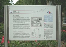
The Viking-Friesen-Weg is signposted throughout with a small, stylized blue-white-red Viking ship. At the edge of the route, information boards provide information about the life of the Danes and North Frisians in the Viking Age in Schleswig. Audio files for the individual stations for an MP3 player can also be downloaded from the themed cycle path's website.
literature
- Wikinger-Friesen-Weg - In the footsteps of the Northmen, a voyage of discovery between the North and Baltic Seas . Spiralo 1: 50,000, BVA Bielefelder Verlag 2007, ISBN 978-3-87073-416-9
Web links
Individual evidence
- ↑ In the footsteps of the Vikings at www.sh-tourismus.de. Retrieved December 30, 2017.
- ↑ a b c Wikinger-Friesen-Weg ( Memento from December 31, 2017 in the Internet Archive ) at www.adfc-tourenportal.de. Retrieved December 30, 2017.
- ↑ Cycling on the trail of Vikings and Frisians at www.ndr.de. Retrieved December 30, 2017.
