
Zentsū-ji
.jpg)

The Zentsū-ji ( Japanese 善 通 寺 ) with the Go Byōbu-uragogakuzan (屏風 浦 五岳 山) and Tanjōin (誕生 院) in Zentsūji in the prefecture of Kagawa on the Japanese island of Shikoku is the main temple of the Zentsūji direction (善 通 寺 派) of the Shingon -Buddhism. In the traditional count it is the 75th temple on the Shikoku pilgrimage route . The temple is located at the birthplace of the founder of Shingon in Japan, Kōbō Daishis . Together with the Kōya in Wakayama Prefecture and the Tō-ji in Kyōto , the Zentsū-ji is one of the "Three Great Temples of Kōbō ".
history
When Kōbō Daishi returned from China in 807, he built a Qinglong-si ( Chinese 青龍寺 / 青龙寺 ) temple in Xi'an on a piece of land that his father, Saeki Yoshimichi, had made available to him . To thank his father, he used the characters of his father's first name, namely 善 通 , Sino-Japanese read "Zentsū", as the name for the temple.
In the Kamakura period, the Tanjō-in was created on the premises of the Saeki family. Throughout the Edo period , the two complexes were viewed as separate temples until they were combined into one temple after 1868.
investment
(In the following: ⦿ = national treasure , ◎ = important cultural asset of Japan )
The spacious complex covers 4500 m² and is divided into the older part, which is simply called "Temple Area" ( 伽藍 , Garan) or "Eastern Temple Area" ( 東 院 , Tō-in). In addition, there is the "western temple area" ( 西 院 , Sai-in), which is also called the “birthplace” ( 誕生 院 , Tanjō-in), 70 m away .
In the intermediate area, the two small temples Kezo-in ( 華 蔵 院 ) and Kanchi-in ( 観 智 院 ) are next to commercial and residential buildings.

Tō-in
You enter this part either from the south through the “Great South Gate” ( 南 大門 , Minami Daimon; a - see map), or from the east through the “Red Gate” ( 赤 門 , Akamon; b). The former was built after the victory in the Russo-Japanese War . It's high enough to ride under.
The “main hall” ( 金堂 , Kondō; ◎; c) is located on this site . The original structure was burned down in 1558 by the troops of Miyoshi Jikkyū ( 三好 実 休 ; 1527–1862) in 1558 during the civil wars in the 16th century . The current building dates from 1699. The main cult figure, the "Healing Buddha" ( 薬 師 如 来 , Yakushi Nyorai) is unusually large at more than 3 m and was made around 1700. Behind the main hall is the hexagonal “Sutra-Speicher” ( 経 堂 , Kyōdō; d) and to the right of it the “Kanjinsho” ( 勧 進 所 ; h), a pavilion for asking for donations. In the north there are two small shrines, the "Ryūōsha" ( 龍王 社 ; e) from 1808 and the "Tenjinsha" ( 天神 社 ; 1914; f) surrounded by trees and water . On the eastern edge is the "Shakadō" ( 釈 迦 堂 ; g), rebuilt in the Empo era (1673–1681).
In the southern part are the "bell tower" ( 鐘楼, Shōrō ; i) from the end of the Edo period with a bell from 1958. Today's five-story "pagoda" ( 五 重 塔 ; Gojū-no-tō; ◎; j) was Erected in 1845 by order of Emperor Ninkō and completed in 1902 with a height of 45 m. The two large "camphor trees" nearby ( 大 楠 , Ōkusu; k) are said to have stood there as early as Kōbō's father's time. Under the tree on the left are two tiny shrines dedicated to "Gosha Myōjin" ( 五 社 明 神社 ). Further in the southern part near the "Middle Gate" ( 中 門 , Chūmon; l) the memorial of the Saeki family ( 佐伯 祖廟 , Saeki Sobyō) and on the southeastern edge the stone stupas for priests Hōnen , Ashikaga Takauji and a pavilion are located Tabidaishidō ( 旅 大師 堂 ).
Through the “Middle Gate” you continue to the south-west to the Sai-in.

Sai-in
The Sai-in is entered after crossing a ditch through the "Niō Gate" ( 仁王 門 ; m), ie through a gate with the figures of the two temple guards on the right and left, the Niō. A second gate, the “Chokushi Gate” ( 勅使 門 ; n) was reserved for the imperial messenger only. The covered walkway leads to the “Founder's Hall” ( 御 影 堂 , Miedō; o). It stands where the Saeki ( 佐伯 家 ) house once stood, where Kōbō Daishi was born. The current building was constructed in 1831 and repaired in 1936. Under the Miedō there is a 100 m long corridor that you can walk through in the dark. This is called "Kaidan meguri" ( 戒壇 め ぐ り , roughly " walking around the altar"). The monks do this to memorize sutras. From the founder hall you get to the “treasure house” ( 宝物 館 ; t) of the temple. The old spring of the Saeki house "Ubuyu" ( 産 湯 の 井 戸, Ubuyu no ido ; v) belongs to the Miedō .
To the north, the Miedō adjoins various buildings, including the “Shōryōden” ( 聖 霊 殿 ; p) from 1940 with a square floor plan and copper roof, the tiny “Jizōdō” ( 地 蔵 堂 , 1940; q), the “Gomaden” ( 護 摩殿 , 1940; r) and Shinrandō ( 親 鸞 堂 ; s) dedicated to Shinran . The large assembly hall further north bears the name "Henshōkaku" ( 編 照 閣 ; u). The Sai-in can be left through the western gate, the "Shogaku Gate" ( 正 覚 門 ; w), where the path leads outside over the "Bridge of Salvation of the World" ( 済 世 橋 , Saiseibashi).
South of the covered corridor to the Miedō is the water basin "Mikage no ike" (見 影 の 池; W), for example "Water basin of the reflection of the gaze", and even further south are the buildings of the abbey (A) and the guest house (G).
Treasure house
- ⦿ Head piece of a gilded bronze rod (金銅 錫杖 頭, Kondōshaku jōtō) from the 8th to 9th centuries ( national treasure ), usually only seen as a photo.
- ⦿ First part of the Ichiji ichibutsu Hokke-kyō Sutra (一字 一 仏 法 華 経 序 品), usually only seen as a copy.
- ◎ A standing Kichijōten (木造 吉祥 天 立 像), a 135 cm tall wooden figure from the 10th to 11th centuries.
- ◎ A standing Jizō bosatsu (木造 地 蔵 菩薩 立 像), a 116 cm tall wooden figure from the 10th to 11th centuries.
Pictures (to-in)

South gate with pagoda
South gate with pagoda

Main hall, bell tower and pagoda

Shakadō

One of the two camphor trees

Chūmon


Pictures (Sai-in)

Niō Gate

View through the Niō gate through the colonnade

Miedō

Shinrandō

Image from the Hokke Sutra

Text from the Hokke Sutra

_and_right_(Agy%C5%8D)_of_the_sanmon_gate_at_Zents%C5%AB-ji_in_Zents%C5%AB-ji_City_Kagawa_pref.jpg)


Individual evidence
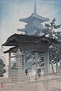
- ↑ A woodcut by Kawase Hasui .
literature
- Folder of the temple
- Kagawa-ken no rekishisampo henshu iinkai (Ed.): Zentsu-ji . In: Kagawai-ken no rekishi sampo. Yamakawa Shuppan, 2013. ISBN 978-4-634-24637-9 . Pp. 159 to 161.
- Oguri, Doei: Kukai. Shikoku hachijuhachi kosho no arukikata. Chukei no Bunko, 2011. ISBN 978-4-8061-4067-2 .
Web links
Coordinates: 34 ° 13 '30.4 " N , 133 ° 46' 26.9" E