
Zittauer Hut
| Zittauer Hütte ÖAV hut category I |
||
|---|---|---|
 |
||
| location | in the Wildgerlostal on the Lower Gerlossee; Salzburg , Austria | |
| Mountain range | Zillertal Alps | |
| Geographical location: | 47 ° 9 '45.3 " N , 12 ° 7' 26.8" E | |
| Altitude | 2328 m above sea level A. | |
|
||
| builder | Warnsdorf section of the DuOeAV | |
| owner | Alpenverein Warnsdorf-Krimml of the PES | |
| Built | 1901 | |
| Construction type | hut | |
| Development | Material ropeway | |
| Usual opening times | Mid June to mid October | |
| accommodation | 7 beds, 66 camps | |
| Winter room | 10 bearings | |
| Hut directory | ÖAV DAV | |

The Zittauer Hütte is a high alpine refuge in the Warnsdorf-Krimml section of the Austrian Alpine Club . It is located at 2328 m above sea level. A. in Wildgerlostal in the Hohe Tauern National Park .
history
Mountain enthusiastic pioneers from German Bohemia made a significant contribution to the development of the Alps for mountain sports . So that was at the foundation section Warnsdorf the DuOeAVs from northern Bohemia in 1887 of the Central Committee of the DuOeAVs the territory of the Krimmler Ache proposed and the Wilden Gerlos as a work area. Krimml with the then famous Krimml waterfalls was chosen as a base for further activities .
With the construction of the narrow-gauge railways in Pinzgau and Zillertal , the north side of the Reichenspitz group, especially the valley of the Wild Gerlos, was increasingly included in lively tourism. A refuge was therefore to be built at the lower Gerlossee, which could be reached from both Krimml and Gerlos . The construction work for the hut and the associated paths began in 1900 and the hut was inaugurated on August 9, 1901. The hut is named "Zittauer Hütte" in honor of the largest group of club members from Zittau in Saxony .
The hut was continuously expanded and rebuilt in the following 100 years: the construction of the first material ropeway in 1967, a small power plant in 1987, a sewage system in 1997 and the complete renovation and expansion of the hut in 2001 should be mentioned in particular.
Visitor numbers
In the first few years after the hut opened, only a few hundred visitors came to the hut each year. The reason was the long and arduous approach from Krimml. This changed significantly with the construction of Gerlosstrasse in 1930 and its expansion in 1962. Today, several thousand visitors come to the hut every year.
environmental Protection
The location of the hut in a very sensitive, high alpine region requires a great deal of effort to minimize the impact of the many human visitors on the ecosystem. This is also expressly required by the statutes of the Hohe Tauern National Park , in whose core zone the hut is located. In 2001 the hut was awarded the environmental seal of approval for Alpine Club huts for exemplary fulfillment of these criteria .
power supply
The hut is supplied with electrical energy from its own small hydroelectric power station. For this purpose, part of the water runoff from the nearby Wildgerloskees glacier was collected and fed through pipes to a water turbine. Since a connection to the public power grid is not possible due to the large distances, the system is operated in island mode. Problems are caused by the strongly fluctuating amounts of water and the high content of fine sand in the water, which leads to very high levels of wear on the system components. In the long term, the glacier retreat and the resulting decrease in the amount of water are already making themselves felt .
Water supply
The supply of the hut with drinking and usable water is ensured by a spring about 250 m away from the hut with a spring discharge of about 0.35 l / s . The water is pumped to the hut via a sand trap and disinfected there with a UV disinfection system before it is discharged to the consumer point .
Sanitation
The location of the hut makes some very complex demands on the sewage disposal :
- Strongly changing temperatures
- The hut is only managed four months a year
- A very high required degree of purification of the wastewater due to the sensitive ecosystem
For this reason, a pilot plant was installed in 1997, in which mechanical pre-cleaning was combined with a fully biological two-chamber sewage treatment plant . Measurements showed that the sewage water flowing off is clean enough that it can seep into the blocky terrain, while the sewage sludge is temporarily stored in a buffer tank and brought to the valley at the end of the season and composted there.
Hiking opportunities
rise
From Gerlos you can drive to the Gasthaus Finkau ( 1419 m ) at the end of the Durlaßboden reservoir . From there the path leads through the Wildgerlostal to the Zittauer Hütte in about three hours.
Transitions to other huts
There are two high-alpine crossings from the Zittauer Hütte:
- Via the Roßkarscharte ( 2687 m ) into the Rainbachtal to the Richterhütte ( 2374 m ) in approx. 5 hours
- Over the Rainbachscharte ( 2720 m ) into the Krimmler Achental to the Krimmler Tauernhaus ( 1622 m ) in about 5 hours
Alpine and ski tours
The Zittauer Hütte is the ideal base for the following peaks:
- Gabler ( 3263 m ) in about 3½ hours
- Reichenspitze ( 3303 m ) in approx. 4½ hours
- Wildgerlosspitze ( 3280 m ) in about 5 hours
- Wildkarspitze ( 3076 m ) in approx. 3½ hours
All of these tours lead over a glaciated area; Marked and developed paths are only available in parts. High alpine equipment and experience are required to carry out the tours .

Zittauer Hut

Zittauer Hütte with Lower Wildgerlossee
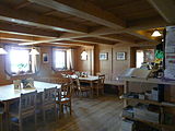
Guest room

Zittauer Hut


literature
- Map: Alpine Association Map Zillertal Alps, Eastern Sheet . No. 35/3, 1: 25000
- Guide: Walter Klier : Alpine Club Guide Zillertal Alps . Bergverlag Rudolf Rother, 12th edition, 2009, ISBN 978-3-7633-1269-6
- Austrian Alpine Association (Ed.): Festschrift 100 years of the Warnsdorf Alpine Association . 1987
- Austrian Alpine Association (publisher): Wasserfallweg Krimml Waterfalls from Natural History Guide to the Hohe Tauern National Park . 2001
- Austrian Alpine Association (Hrsg.): Festschrift 25 Years of the European Nature Conservation Diploma - Krimml Waterfalls . 1992
Web links

Cadastral municipality: Krimml
Locations: Hochkrimml | Oberkrimml | Unterrimml
Village:
Krimml |
Rotten:
Wood rat •
Oberkrimml |
Settlements:
Hochkrimml •
Nothdorf |
Scattered houses:
Krimmler Achental •
Wildgerlostal
Other locations:
Duxeralm •
Filzstein •
Gerlosplatte •
Krimmler Tauernhaus •
Toll •
Richterhütte •
Warnsdorfer Hütte •
Zittauer Hütte
Counting district: Krimml