
Sânpaul, Cluj
Sânpaul
Sânpalu Unguresc | |
|---|---|
.JPG) Wooden church in Sumurducu | |
 Coat of arms | |
 Location in Cluj County | |
 Sânpaul Location in Romania | |
| Coordinates: 46°52′14.88″N 23°25′9.48″E / 46.8708000°N 23.4193000°E | |
| Country | Romania |
| County | Cluj |
| Subdivisions | Berindu, Mihăiești, Sânpaul, Sumurducu, Șardu, Topa Mică |
| Government | |
| • Mayor (2020–2024) | Ovidiu Colceriu (PNL) |
| Area | 93.22 km2 (35.99 sq mi) |
| Elevation | 428 m (1,404 ft) |
| Population (2021-12-01)[1] | 2,314 |
| • Density | 25/km2 (64/sq mi) |
| Time zone | EET/EEST (UTC+2/+3) |
| Postal code | 407530 |
| Area code | (+40) 02 64 |
| Vehicle reg. | CJ |
| Website | www |
Sânpaul (Hungarian: Magyarszentpál, Szentpál) is a commune in Cluj County, Transylvania, Romania. It is composed of six villages: Berindu (Nádasberend), Mihăiești (Nádasszentmihály), Sânpaul, Sumurducu (Szomordok), Șardu (Magyarsárd), and Topa Mică (Pusztatopa).
Demographics
According to the census from 2002 there was a total population of 2,563 people living in this commune; of this population, 86.57% were ethnic Romanians, 12.99% ethnic Romani, and 0.42% ethnic Hungarians.[2] At the 2021 census, Sânpaul had a population of 2,314, of which 71.43% were Romanians and 20.1% Romani.
Natives
- Ioan Alexandru (1941–2000), poet, essayist, and politician
References
-
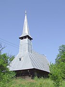
 Wooden church in Berindu
 -
 Wooden church in Mihăiești
 -
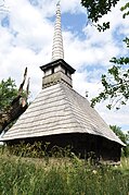
 Wooden church in Sânpaul
 -
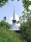
 Wooden church in Șardu


This Cluj County location article is a stub. You can help Wikipedia by expanding it. |