Húnavatn

|
|
| Basic data | |
|---|---|
| State : |
|
| Region: | Norðurland vestra |
| Constituency : | Norðvesturkjördæmi |
| Sýsla : | Austur-Húnavatnssýsla |
| Population: | 371 (January 1, 2019) |
| Surface: | 2705 km² |
| Population density: | 0.14 inhabitants / km² |
| Post Code: | 541 |
| politics | |
| Community number | 5612 |
| Head of the municipal council: | Björn Magnússon |
| Contact | |
| Address of the municipal administration: | Húnavöllum 541 Blönduós |
| Website: | www.hunavatnshreppur.is |
| map | |

Coordinates: 65 ° 31 ′ N , 20 ° 22 ′ W |
|
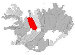
The rural community Húnavatn ( isl. Húnavatnshreppur ) is located in northwest Iceland in the region Norðurland vestra .
On January 1, 2019, the community had 371 inhabitants. The seat of the municipal administration is in Blönduós .
geography
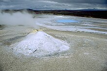
The municipality stretches in a slightly southeastern direction from Húnafjörður , part of the large Húnaflói Bay, to the highlands of the Hofsjökull glacier . In the south is Hveravellir with its hot springs. The Langjökull glacier is located in the southwest of the municipality .
The highland slope Kjölur leads from Hveravellir through the entire municipality to the neighboring town of Blönduós . East of the Kjölur, the river Blanda is dammed up to form the 57 km² large reservoir Blöndulón . Another body of water is the Hóp lagoon lake , which lies on the border with the neighboring municipality of Húnaþing vestra to the west . To the east of the Hóp is the eponymous lake Húnavatn .
In the north of the municipal area of the lake is Svínavatn which the river Svínadalsá , bounded by the Svínadalur is flowing fed. To the west of the lake is the Vatnsdalsfjall and Vatnsdalur massif .
Surrounding communities are in the north Blönduós , in the east Skagafjörður , in the south Bláskógabyggð , in the southwest Borgarbyggð , in the west Húnaþing vestra .
history
The municipality was formed on January 1, 2006 through the merger of the four rural municipalities Sveinsstaðahreppur , Torfalækjarhreppur , Svínavatnshreppur and Bólstaðarhlíðarhreppur .
The municipality of Áshreppur had 66 inhabitants on December 1, 2005 and merged on June 10, 2006 with the municipality of Húnavatn ( Húnavatnshreppur ) under their name. The main line of business is agriculture.
Þingeyrar
In Þingeyrar on the east side of the Hóp (and on the west side of the Húnavatn ) Iceland's first monastery was founded in the early 12th century. It was abandoned in 1550, making it the longest-standing monastery in Iceland. The current church, the Þingeyrakirkja , dates back to the 19th century and was consecrated in 1877.
Population development
As in many municipalities in Iceland, after years of population decline in 2006, after years of population growth, Hunavatn saw population growth again, which did not continue in 2007.
| date | Residents (area 2006) |
|---|---|
| Dec 1, 1997 | 461 |
| Dec. 1, 2003 | 416 |
| Dec. 1, 2004 | 414 |
| Dec 1, 2005 | 405 |
| Dec 1, 2006 | 463 |
traffic
In the north of the municipality, the Hringvegur runs southeast of the Hóp past to Blönduós, from where it later leads again through the municipality (northeast of the Svínavatn ) to Varmahlíð .
Web links
- Community website (Icelandic)
- Hveravellir (multilingual)
- ( Page no longer available , search in web archives: Þingeyrar (English) )
