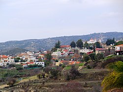
Agios Amvrosios (Limassol District)
|
Agios Amvrosios Άγιος Αμβρόσιος |
||
|---|---|---|
|
|
||
| Basic data | ||
| State : |
|
|
| District : | Limassol | |
| Geographic coordinates : | 34 ° 47 ' N , 32 ° 50' E | |
| Height above d. M .: |
521 m |
|
| Surface: | 14.4819 km² | |
| Residents : | 323 (2011) | |
| LAU-1 code no .: | CY-02 | |
| Website: | www.agiosambrosios.org | |
| View of Agios Amvrosios | ||
Agios Amvrosios (also Agios Ambrosios , Greek Άγιος Αμβρόσιος ) is a municipality in the Limassol district in Cyprus . At the 2011 census it had 323 inhabitants.
Location and surroundings
Agios Amvrosios is located in the southern center of the island of Cyprus at an altitude of 521 meters, about 63 km southwest of the capital Nicosia , 20 km northwest of Limassol and 35 km east of Paphos .
The place is located about 13 km from the Mediterranean Sea in the interior of the island in the southern foothills of the Troodos Mountains . The river Krios flows past the place . The western part of the British military base Akrotiri begins south of the community on the coast . Agios Amvrosios is known for its wine production.
Places in the area are Agios Therapon and Vouni in the north, Kato Kivides and Pano Kivides in the east, Sotira and Paramali in the south, Prastio in the south-west, Pachna in the west and Kissousa in the north-west.
Population development
| year | 1881 | 1911 | 1931 | 1960 | 1973 | 1982 | 2001 | 2011 | |
| Residents | 165 | 212 | 252 | 365 | 337 | 304 | 310 | 323 | |
| Source: 1881-2001 :, 2011: | |||||||||
Web links
- The community site (English)


