Amiandos
|
Amiandos Αμίαντος Amiyanto |
||
|---|---|---|
|
|
||
| Basic data | ||
| State : |
|
|
| District : | Limassol | |
| Geographic coordinates : | 34 ° 55 ' N , 32 ° 56' E | |
| Height above d. M .: |
980 m |
|
| Surface: | 9.226 km² | |
| Residents : | 228 (2011) | |
| LAU-1 code no .: | CY-02 | |
| View of Amiandos | ||
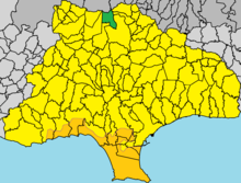
Amiandos ( Greek Αμίαντος , Turkish Amiyanto ) is a municipality in the Limassol district in Cyprus . At the 2011 census it had 228 inhabitants.
Location and surroundings
Amiandos is located in the middle of the island of Cyprus at about 980–1100 meters altitude, about 46 km southwest of the capital Nicosia , 26 km northwest of Limassol and 48 km northeast of Paphos .
The village is about 27 kilometers from the Mediterranean coast located in the Troodos Mountains and comprises the villages of Kato Amiandos and the higher park with more than 1300 meters Pano Amiandos . The neighboring district of Nicosia begins north of the municipality . The area is still dominated by the former Amiantos mine , where asbestos was extracted. The mine cleared forests and polluted the air and water. The area around the mine and the site was connected by a railroad to Limassol, from where the asbestos was shipped.
Places in the vicinity are Kakopetria in the Nicosia district in the north, Kyperounda in the northeast, Dymes in the east, Pelendri in the southeast, Moniatis in the south and southwest and Pano Platres and behind Troodos in the west.
history
The history of Amiandos is closely linked to the asbestos mine, so the place takes its name from the mine. The place was originally called Hadjiktori, but later renamed Kato Amiandos. Since 1904 there has been mining activities in the area, initially by the local population of the surrounding places. The population peaked before the 1950s, when the work in the mine was still done by hand and several thousand people were employed in the mine. After 1950, machines were increasingly used, so that the population slowly decreased. After the mine was closed in 1988, the population sank much faster, especially the upper village of Pano Amiandos was more and more deserted, which was exacerbated by increasing urbanization . Both places, Pano and Kato Amiandos, were united to Amiandos in 2005.
The former asbestos mining area was renatured between 2013 and 2015 by a project of the Ministry of Agriculture, Resources and Environment of the Republic of Cyprus . The 14 hectares of treeless and rubble mountain slopes were planted with trees and bushes and an artificial lake was created.
Web links
- Amiandos at cyprusalive.com (English)
Individual evidence
- ^ Statistical Service> Population - Place of Residence, 2011. cystat.gov.cy, accessed September 28, 2019 . (Download)
- ↑ a b c Amiantos Village , cyprusisland.net, accessed on September 28, 2019 (English)
- ↑ Amiantos , cyprusalive, accessed on September 28, 2019 (English)
- ↑ Welcome , amiandos.eu, accessed on September 28, 2019 (English)
- ↑ Latest News , amiandos.eu, accessed on September 28, 2019 (English)


