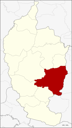
Amphoe Wapi Pathum
|
Wapi Pathum วาปีปทุม |
|
|---|---|
| Province: | Maha Sarakham |
| Surface: | 605.77 km² |
| Residents: | 114,382 (2013) |
| Population density : | 188.1 U / km² |
| ZIP : | 44120 |
| Geocode : | 4409 |
| map | |

|
|
Amphoe Wapi Pathum (in Thai อำเภอ วาปีปทุม ) is a district ( amphoe - administrative district) in the province of Maha Sarakham . The province of Maha Sarakham is located in the center of the northeast region of Thailand , the so-called Isan .
geography
Amphoe Kae Dam borders the following districts (clockwise from the south): Amphoe Na Dun , Na Chueak , Borabue , Mueang Maha Sarakham and Kae Dam in the province of Maha Sarakham, as well as Amphoe Si Somdet , Chaturaphak Phiman , Kaset Wisai and Pathum Council of the Province of Roi Et .
history
The history of Amphoe Wapi Pathum goes back to Müang Wapi Pathum, which was changed to an amphoe around 1900.
administration
Provincial Administration
The district of Wapi Pathum is divided into 15 tambon ("subdistricts" or "communities"), which are further subdivided into 240 muban ("villages").
| No. | Surname | Thai | Muban | Pop. |
|---|---|---|---|---|
| 1. | Nong Saeng | หนอง แสง | 28 | 20,982 |
| 2. | Kham Pom | ขาม ป้อม | 16 | 6,619 |
| 3. | Suea Kok | เสือ โก้ ก | 19th | 10,293 |
| 4th | Dong Yai | ดง ใหญ่ | 16 | 5,044 |
| 5. | Pho Chai | โพธิ์ชัย | 12 | 4,601 |
| 6th | Hua Ruea | หัว เรือ | 21st | 10,470 |
| 7th | Khaen | แคน | 17th | 6,630 |
| 8th. | Ngua Ba | งัว บา | 19th | 8,318 |
| 9. | Well kha | นา ข่า | 16 | 8,794 |
| 10. | Ban Wai | บ้าน หวาย | 17th | 7,442 |
| 11. | Nong Hai | หนอง ไฮ | 17th | 7,888 |
| 12. | Pracha Phatthana | ประชา พัฒนา | 11 | 4,459 |
| 13. | Nong Thum | หนอง ทุ่ม | 10 | 4.030 |
| 14th | Nong Saen | หนอง แสน | 10 | 4,321 |
| 15th | Khok Si Thonglang | โคก สี ทองหลาง | 11 | 4,491 |
Local administration
There is one municipality with "small town" status ( Thesaban Tambon ) in the district:
- Wapi Pathum (Thai: เทศบาล ตำบล วาปีปทุม ), consisting of parts of the Tambon Nong Saeng.
There are also 15 " Tambon Administrative Organizations " ( องค์การ บริหาร ส่วน ตำบล - Tambon Administrative Organizations, TAO):
- Nong Saeng (Thai: องค์การ บริหาร ส่วน ตำบล หนอง แสง )
- Kham Pom (Thai: องค์การ บริหาร ส่วน ตำบล ขาม ป้อม )
- Suea Kok (Thai: องค์การ บริหาร ส่วน ตำบล เสือ โก้ ก )
- Dong Yai (Thai: องค์การ บริหาร ส่วน ตำบล ดง ใหญ่ )
- Pho Chai (Thai: องค์การ บริหาร ส่วน ตำบล โพธิ์ชัย )
- Hua Ruea (Thai: องค์การ บริหาร ส่วน ตำบล หัว เรือ )
- Khaen (Thai: องค์การ บริหาร ส่วน ตำบล แคน )
- Ngua Ba (Thai: องค์การ บริหาร ส่วน ตำบล งัว บา )
- Na Kha (Thai: องค์การ บริหาร ส่วน ตำบล นา ข่า )
- Ban Wai (Thai: องค์การ บริหาร ส่วน ตำบล บ้าน หวาย )
- Nong Hai (Thai: องค์การ บริหาร ส่วน ตำบล หนอง ไฮ )
- Pracha Phatthana (Thai: องค์การ บริหาร ส่วน ตำบล ประชา พัฒนา )
- Nong Thum (Thai: องค์การ บริหาร ส่วน ตำบล หนอง ทุ่ม )
- Nong Saen (Thai: องค์การ บริหาร ส่วน ตำบล หนอง แสน )
- Khok Si Thonglang (Thai: องค์การ บริหาร ส่วน ตำบล โคก สี ทองหลาง )
Individual evidence
- ↑ 2013 population statistics ( Thai ) Department of Provincial Administration. Retrieved July 30, 2014.
Web links
Coordinates: 15 ° 51 ' N , 103 ° 23' E
