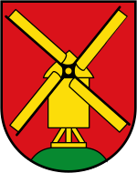
Biemenhorst
|
Biemenhorst
City of Bocholt
Coordinates: 51 ° 48 ′ 35 ″ N , 6 ° 35 ′ 0 ″ E
|
|
|---|---|
| Height : | 25 m above sea level NN |
| Area : | 7.81 km² |
| Residents : | 5400 (Jan 1, 2009) |
| Population density : | 691 inhabitants / km² |
| Incorporation : | 1st January 1975 |
| Postal code : | 46395 |
| Area code : | 02871 |
Biemenhorst is the most populous district of the city of Bocholt in the Borken district .
location
Biemenhorst, together with Lankern and Mussum, forms the southern border of Bocholt. Dingdener Strasse separates Biemenhorst from Mussum to the west. In the north, Biemenhorst is separated from the inner-city areas of Rosenberg and Fildeken by the B 67 . In the east Biemenhorst borders on the Rheder Bauerschaft Büngern and in the south on the district of Lankern and Dingden ( Hamminkeln ).
history
Finds of grave fields from the 5th and 6th centuries indicate that the area of today's Biemenhorst was settled early. Biemenhorst was mentioned for the first time under the name “Bimolt” - which means something like “bi dem holte” .
Before 1858 the community of Biemenhorst was re-established by hiving off from the parish of Bocholt. It was the smallest independent community in the Liedern-Werth district .
On January 1, 1975, Biemenhorst became a district of Bocholt, which was accompanied by a major change in the townscape . Due to the short distance to the city center , a lot of living space was created and the clear natural separation between Biemenhorst and Bocholt was eliminated.
Development
As on the entire Lower Rhine and in Westmünsterland , the development in Biemenhorst is characterized by single-family and semi-detached houses . Due to the proximity to the city center and the relatively low building land prices, the number of inhabitants has increased enormously since the regional reform of 1975, so that Biemenhorst is now considered the most populous district of Bocholt.
As part of the further development of the district, a new town center was built on Birkenallee. With banks, supermarkets and medical practices, it ensures local supplies for both Biemenhorst and the neighboring districts of Mussum and Lankern.
Transport links
The north-facing B 67 can be reached via two driveways and enables a quick connection to the Münsterland and the Lower Rhine . Four streets (Dingdener Straße, Biemenhorster Weg, Schulstraße and Franzstraße) undercut the traffic artery built as an elevated street , which means that Bocholt's core city can be reached directly. The main traffic axis within Biemenhorst is Birkenallee, on which all important institutions of the district are located, with the sports club, schools, kindergartens and the district center.
The public transport is the bus Bocholt operated GmbH, but has some gaps due to the extensive redevelopment. The C4 line only serves the eastern area every half hour with the city center, while the western areas, including the frequently frequented district center, rely on a taxi bus line on demand .
Until 1960, Biemenhorst had a stop on the Wesel – Bocholt railway line . The station at km 18.2 was only in operation for a few years.
economy
There are only a few pronounced commercial zones compared to living space. The only areas where manufacturing can be found are along Dingdener Straße, at Waldschlößchen and in the area between the community center and B 67 .
Web links
- Biemenhorst in the Westphalia Culture Atlas
Individual evidence
- ↑ Stephanie Reekers: The regional development of the districts and communities of Westphalia 1817-1967 . Aschendorff, Münster Westfalen 1977, ISBN 3-402-05875-8 , p. 215 .
- ^ Federal Statistical Office (ed.): Historical municipality directory for the Federal Republic of Germany. Name, border and key number changes in municipalities, counties and administrative districts from May 27, 1970 to December 31, 1982 . W. Kohlhammer, Stuttgart / Mainz 1983, ISBN 3-17-003263-1 , p. 310 .
- ^ Description of the Biemenhorst site
