Bierkowice (Opole)
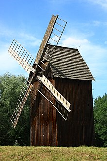
Bierkowice ( German Birkowitz , 1936–1945 Birkental ) is a district of the independent city of Opole in the Polish Opole Voivodeship . In Bierkowice there is the open-air museum of the Opole village (Polish: Muzeum Wsi Opolskiej ).
geography

Geographical location
Bierkowice is located in the historical region of Upper Silesia in the Opole region . The place is about five kilometers northwest of downtown Opole.
Bierkowice is in the Nizina Śląska ( Silesian Plain ) within the Równina Opolska ( Opole Plain ). The brook Prószkowski Potok ( Proskauer Bach ), a left tributary of the Oder, flows through the village . The state roads Droga krajowa 94 and Droga krajowa 46 and the provincial road Droga wojewódzka 414 also run through the village .
Neighboring places
Neighboring towns of Bierkowice are in the north Slawitz ( Sławice ), in the east Półwieś ( Halbendorf ), in the south on Zirkowitz ( Zerkowice ), in the southwest on Muchenitz ( Mechnice ) and in the west on Wreske ( Wrzoski ).
history
The place was first mentioned in a document in 1300 as "Bircovicz". The village was also mentioned in 1394 as Birkowicz and in 1532 as Birkhowitze . After the First Silesian War in 1742, Birkowitz fell with most of Silesia to Prussia .
After the reorganization of the province of Silesia which belonged rural community Birkowitz from 1816 to district Opole in the administrative district of Opole . In 1822 the Birkowitz Vorwerk burned down and was then rebuilt as a stone building. In 1845 there was a Vorwerk, a sub-forestry and 21 houses in the village. In the same year, 232 people lived in Birkowitz, eleven of them Protestants. In 1861 the place had 222 inhabitants. In 1865 the village had one farmer, seven gardeners, four farmhands, seven residents and 20 residents. During that time, the students were schooled in Halbendorf. In 1885 Birkowitz had 343 inhabitants.
In the referendum on March 20, 1921, 107 eligible voters voted to remain with Germany and 100 for Poland. Birkowitz remained with the German Empire. In 1933, 388 people lived in the village. On May 19, 1936, the place was renamed Birkental. In 1939 Birkental had 398 inhabitants. Until 1945 the place was in the district of Opole .
In 1945 the previously German place came under Polish administration and was renamed Bierkowice and joined the Silesian Voivodeship. In 1950 the place came to the Opole Voivodeship . Between 1961 and 1970, the Opole Village Museum was built in the eastern part of the village and opened on September 23, 1970. In 1975 the place was incorporated into the city of Opole . In 2015 the settlement osiedle Sady with 40 terraced houses at ul.Wrocławska was completed in Bierkowice .
Attractions
- Museum of the Opole Village
- Street chapel on Wrocławska Street from the 18th century
- Old cemetery on ul. Wrocławska from the 19th century
societies
- Football club LKS Bierkowice
- Riding club Ludowy Klub Jeździecki "Ostroga" Opole
Sons and daughters of the church
- Günter Spörrle (* 1936), actor
Web links
Individual evidence
- ^ Districts of Opole
- ↑ a b Johann Georg Knie : Alphabetical-statistical-topographical overview of the villages, towns, cities and other places of the royal family. Preuss. Province of Silesia. Breslau 1845, p. 37.
- ↑ Cf. Felix Triest: Topographisches Handbuch von Oberschlesien , Breslau 1865
- ^ A b Michael Rademacher: German administrative history from the unification of the empire in 1871 to the reunification in 1990. Opole district. (Online material for the dissertation, Osnabrück 2006).
- ^ Results of the referendum in Upper Silesia of 1921 for the Opole district ( memento from January 24, 2017 in the Internet Archive ) on home.arcor.de, accessed on February 18, 2016.
- ↑ Osiedle Sady
- ↑ LKS Bierkowice
- ↑ LKS Ostroga-Opole
Coordinates: 50 ° 41 ′ N , 17 ° 52 ′ E

