Boy's height
| Boy's height | ||
|---|---|---|
|
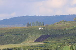
View from the Große Hub near Eltville on the Rhine to the |
||
| height | 267.6 m above sea level NHN | |
| location | at Martinsthal and Rauenthal ; Rheingau-Taunus-Kreis , Hessen ( Germany ) | |
| Mountains | Taunus | |
| Dominance | 0.4 km → field district Krautäcker on the southwestern outskirts | |
| Notch height | 5 m | |
| Coordinates | 50 ° 3 '5 " N , 8 ° 6' 26" E | |
|
|
||
The Bubenhäuser Höhe in the Taunus is 267.6 m above sea level. NHN high elevation in the Rheingau-Voraunus . It is located near Martinsthal and Rauenthal in the Hessian Rheingau-Taunus district .
The predominantly unwooded elevation offers good prospects, among other things, of Eltville am Rhein with the Rhine and the Taunushauptkamm . On its south-facing slopes are some vineyards in the Eltville district of Rauenthal.
geography
location
The Bubenhäuser Höhe rises on the southern edge of the Rhine-Taunus Nature Park with high and peaks within the park area. Its summit is 1 km west of Martinsthal, 900 m south-south-west of Rauenthal and 3 km north-north-west of the Eltville town center. The Great Buchwaldgraben flows north past the elevation and flows into the Sülzbach flowing to the west , and the Walluf runs east through Martinsthal and Rauenthal ; both flow into the nearby Rhine. The neighboring elevation to the south-east is the Große Hub ( 176.6 m ).
The Bubenhäuser Höhe is the last notable elevation of a four-kilometer-long ridge that branches off to the south at the Dreibornsköpf ( 547.6 m ) with the Hansenkopf ( 495 m ) to the east from the ridge of the Rheingau Mountains . The center of Rauenthal lies on this ridge in a saddle position about 900 m north of the Bubenhäuser Höhe. The survey's southwestern side crest of a hill not named in the field district Krautäcker (about 276 m ) on the southwestern outskirts. The last foothill of the ridge 500 meters southwest of the Bubenhäuser Höhe is known as Schollenberg (approx. 242 m ). In the west, the mountain flank breaks off steeply to the Sülzbachtal . The southern slope also falls steeply from the summit plateau on a front around 1000 m wide and is referred to as the Rauenthaler Berg on topographic maps .
Natural allocation
The Bubenhäuser Höhe lies on the border of the Rheingau-Vortaunus natural area (No. 300.00), which belongs to the natural spatial main unit group Taunus (30) and the main unit Vortaunus (300) to the subunit Rheingau-Wiesbadener Vortaunus (300.0), to the natural area Lower Middle- Rheingauhang (236.11), which belongs to the main unit group Rhein-Main-Tiefland (23) and the main unit Rheingau (236) to the sub-unit Middle Rheingau (236.1). The natural area Johannisberg-Hallgarter Oberer Mittel-Rheingauhang (236.10) also belongs to this subunit in the south-west .
Vineyards and forest
The Bubenhäuser Höhe has four of the Rauenthaler vineyards. The altitude around the summit region is taken up by the Rauenthaler Langenstück location . The Rauenthaler Gehrn covers the middle height of the southern slope. The foot of the mountain is shared by the Rauenthaler Baiken in the west, including the domain Rauenthal of the Hessian state winery Kloster Eberbach , and the Rauenthaler Wülfen in the east. To the east of Gehrn and Wülfen, the Bechtergrund with the Rauenthaler Rothenberg vineyard cuts into the Rauenthaler Berg and thus separates the Bubenhäuser Höhe from the Nonnenberg , after which the last, not yet mentioned, Rauenthaler individual vineyard is named.
With the exception of the wooded steep slopes in the west and northwest, the Bubenhäuser Höhe is unforested and used for agriculture. The summit plateau has a narrow grove about 200 meters long, in the middle of which there is a refuge. A stone has also been erected here, the inscription of which gives the name, position and height of the mountain.
Transport links and viewing opportunities
The federal road 42 runs over the mountain saddle at the transition from the Bubenhäuser Höhe to the Großer Hub in the southeast . There the Landesstraße 3036 branches off , which in Martinsthal meets the B 260 running north-east of the elevation and past Rauenthal. From this street, the district road 641 , which runs through Rauenthal and joins the B 260 north of it, branches off between the two villages .
The elevation is accessible from Rauenthal by a driveway that leads to a parking lot. The rest of the road network is only used for agricultural traffic. The little temple (approx. 230 m ) is located at a junction on the southern slope .
From the grove on the summit plateau of the Bubenhäuser Höhe there is a view in all directions. The view goes north to the Taunushauptkamm . The Hallgarter Zange , the Kalte Herberge and the Hohe Wurzel can be seen on the peaks . In the other direction, the view goes into the Rhine Valley and the northern edge of the Rhenish Hessian mountains rising behind it.
See also
Individual evidence
- ↑ a b Map services of the Federal Agency for Nature Conservation ( information )
- ↑ Floor names according to the real estate cadastre for geodata online , at gds.hessen.de
- ↑ Heinrich Müller-Miny, Martin Bürgener: Geographical land survey: The natural spatial units on sheet 138 Koblenz. Federal Institute for Regional Studies, Bad Godesberg 1971. → Online map (PDF; 5.7 MB)
Web links
- Outline of the Rauenthaler vineyards on the Bubenhäuser Höhe , on weinlagen-info.de

