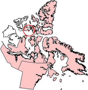
Byam Martin Island
| Byam Martin Island | |
|---|---|
| Waters | Viscount Melville Sound |
| Archipelago | Queen Elizabeth Islands |
| Geographical location | 75 ° 12 ′ N , 104 ° 17 ′ W |
| length | 48 km |
| width | 32 km |
| surface | 1 150 km² |
| Highest elevation | 152 m |
| Residents | uninhabited |
Byam Martin Island is an island of the Queen Elizabeth Islands in the Canadian territory of Nunavut and is located in the west of the Canadian Arctic Archipelago . It is in the Viscount Melville Sound . To the east it is separated from Bathurst Island by the Austin Channel . To the west is the Byam Channel and Melville Island . The island is 1150 km² in size, about 48 km long, 32 km wide and up to 152 m high.
history
The island was discovered on August 27, 1819 by William Edward Parry and named after Thomas Byam Martin (1773-1854), a British admiral and supreme "Comptroller" (today approximately auditor , controller ) of the Royal Navy . Parry made the first landing on the island the next day and carried out astronomical measurements. In doing so, he came across traces of Paleo-Eskimos . The next visit to the island took place in 1851 as part of Horatio Austin's search for the missing Franklin expedition . Leopold McClintock landed on the island on May 1st and mapped the south coast. The ship's doctor Leopold McClintock completely circled the island. In 1906 it was taken over by Joseph-Elzéar Bernier for Canada.
Individual evidence
- ^ UN System-Wide Earth Watch Web Site - Byam Martin
- ↑ The Atlas of Canada - Sea Islands ( Memento from October 6, 2012 in the Internet Archive ) (English)
- ^ Johann Jakob Egli : Nomina geographica. Friedrich Brandstetter, Leipzig 1872. p. 96.
- ^ William James Mills: Exploring Polar Frontiers: A Historical Encyclopedia . tape 1 . ABC-CLIO, 2003, ISBN 1-57607-422-6 , pp. 113 ( limited preview in Google Book search).
