Cameron Island
| Cameron Island | |
|---|---|
| Waters | Arctic Ocean |
| Archipelago | Queen Elizabeth Islands |
| Geographical location | 76 ° 30 ′ N , 103 ° 51 ′ W |
| length | 44 km |
| width | 30 km |
| surface | 1 059 km² |
| Highest elevation | Mount Wilmot 244 m |
| Residents | uninhabited |
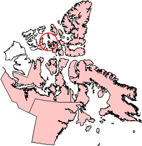
Cameron Island is an island of the Queen Elizabeth Islands and belongs to the Nunavut Territory in Canada . It is east of Borden Island and west of Amund Ringnes Island and south of Ellef Ringnes Island . In the south, only four kilometers away is the Île Vanier , separated by the Arnott Strait . Cameron Island is 1059 km² in size. In the southeast it reaches a height of 244 meters.
The island was named after Donald Cameron, a surveyor of Scottish origin who carried out boundary surveys with the American Archibald Campbell from 1872 to 1876.
Panarctic Oils Ltd., a Canadian consortium of industry and government, produced 2.8 million barrels of oil on Cameron Island between 1985 and 1996 . In 2013 it was announced that the Canadian government was planning to put the Bent Horn oil field out to tender for re- exploitation .
Individual evidence
- ↑ Cameron Island ( memento of August 20, 2012 in the Internet Archive ) in the island encyclopedia www.oceandots.com (English)
- ↑ UNEP Islands (English)
- ↑ Feds re-open abandoned Nunavut oil field for bidding , CBC News, March 3, 2013, accessed April 6, 2013
