Charleston, Tennessee
| Charleston | ||
|---|---|---|
 Entrance to Charleston |
||
| Location in Tennessee | ||
|
|
||
| Basic data | ||
| Foundation : | 1956 (incorporated) | |
| State : | United States | |
| State : | Tennessee | |
| County : | Bradley County | |
| Coordinates : | 35 ° 17 ′ N , 84 ° 45 ′ W | |
| Time zone : | Eastern ( UTC − 5 / −4 ) | |
|
Inhabitants : - Metropolitan Area : |
651 (as of 2010) 115,788 (as of 2010) |
|
| Population density : | 241.1 inhabitants per km 2 | |
| Area : | 2.7 km 2 (approx. 1 mi 2 ) | |
| Height : | 222 m | |
| Postal code : | 37310 | |
| Area code : | +1 423 | |
| FIPS : | 47-13020 | |
| GNIS ID : | 1305866 | |
| Mayor : | Walter Goode | |
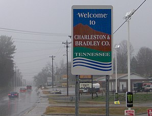
Charleston is a small town (with the status " City ") in Bradley County in the US -amerikanischen State Tennessee . In 2010 , Charleston had 651 residents, which increased to 665 by 2013.
Charleston is part of the Cleveland, Tennessee metropolitan area .
geography
Charleston is located in southeast Tennessee in the western Appalachian Mountains. The city is located on the Hiwassee River , which is part of the Mississippi River basin across the Tennessee River and Ohio .
The geographical coordinates of Charleston are 35 ° 17'14 "north latitude and 84 ° 45'30" west longitude. The urban area extends over an area of 2.7 km².
The sister city of Calhoun is located on the opposite bank of the Hiwassee River . Other neighboring towns of Charleston are Riceville (12.4 km northeast), Etowah (27.2 km east-northeast), Delano (22.2 km east), Benton (21.2 km southeast), Ocoee (24.7 km south-southeast), Cleveland (12 miles southwest), Hopewell (12 miles southwest), and Georgetown (17 miles west).
The nearest major cities are Lexington in Kentucky (382 km north), Knoxville (118 km northeast), Charlotte in North Carolina (473 km east), Georgia's capital Atlanta (206 km south), Chattanooga (70.4 km southwest), Tennessee's capital, Nashville (270 km west-northwest) and Kentucky's largest city, Louisville (446 km north-northwest).
traffic
The US Highway 11 leads northeast-southwest direction as the main road through Charleston. At the confluence with US 11 on the southern edge of the city, Tennessee State Route 308 reaches its eastern end point. All other roads are subordinate country roads, some unpaved roads and inner-city connecting roads.
A freight railroad line of the Norfolk Southern Railway (NS) runs through the metropolitan area of Charleston from northeast to southwest .
With the Cleveland Regional Jetport there is a small airfield 10 km southwest. The nearest commercial airports are Chattanooga Metropolitan Airport (57 km southwest) and Knoxville's McGhee Tyson Airport (122 km northeast).
economy
The German company Wacker Chemie operates a factory for polysilicon in Charleston as a preliminary stage for the solar market.
| Population development | |||
|---|---|---|---|
| Census | Residents | ± in% | |
| 1960 | 764 | - | |
| 1970 | 792 | 3.7% | |
| 1980 | 756 | -4.5% | |
| 1990 | 653 | -13.6% | |
| 2000 | 630 | -3.5% | |
| 2010 | 651 | 3.3% | |
| 2013 estimate | 665 | 2.2% | |
| 1960-2000 2010-2013 | |||
population
According to the 2010 census , Charleston had 651 people in 253 households. The population density was 241.1 people per square kilometer. Statistically, 2.57 people lived in each of the 253 households.
The racial the population was composed of 77.3 percent white, 19.8 percent African American, 0.2 percent Native American, 0.3 percent Asian and 1.7 percent from other ethnic groups; 0.8 percent were descended from two or more races. Regardless of ethnicity, 4.1 percent of the population was Hispanic or Latino of any race.
26.3 percent of the population were under 18 years old, 60.3 percent were between 18 and 64 and 13.4 percent were 65 years or older. 50.5 percent of the population were female.
The average annual income for a household was 33,911 USD . The per capita income was $ 20,625. 18.6 percent of the population lived below the poverty line.
Known residents
- George Washington Bridges (1825–1873) - Member of the US House of Representatives (1863) - born and raised in Charleston
Individual evidence
- Jump up ↑ Bradley County - Charleston, Tennessee. Retrieved February 1, 2015
- ↑ a b c American Fact Finder. Retrieved February 1, 2015
- ↑ Distance information according to Google Maps. Accessed February 1, 2015
- ↑ AirNav.com - Cleveland Regional Jetport Retrieved on February 1, 2015
- ↑ United States Census Bureau - Census of Population and Housing.Retrieved February 1, 2015
