Combapata district
| Combapata district | |
|---|---|
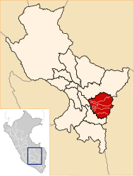
 The Combapata district is located in the central west of the Canchis Province (marked in red) |
|
| Basic data | |
| Country | Peru |
| region | Cusco |
| province | Canchis |
| Seat | Combapata |
| surface | 173 km² |
| Residents | 5060 (2017) |
| density | 29 inhabitants per km² |
| founding | December 22, 1912 |
| ISO 3166-2 | PE-CUS |
| politics | |
| Alcalde District | Fortunato Condori Ccanchi (2019-2022) |
Coordinates: 14 ° 6 ′ S , 71 ° 26 ′ W
The Combapata district is located in the Canchis Province of the Cusco region in south-central Peru . The district was established on November 22, 1912. It has an area of 173 km². At the 2017 census, 5060 inhabitants lived in the district. In 1993 the population was 5126, in 2007 it was 5162. The district administration is located in the 3475 m high town of Combapata with 2261 inhabitants (as of 2017). Combapata is located 29 km northwest of the provincial capital Sicuani . The road from Puno to Cusco runs along the Río Vilcanota.
Geographical location
The Combapata district is located in the Andean highlands in the central west of the Canchis Province. The district lies on the east bank of the Río Vilcanota (upper reaches of the Río Urubamba). Its right tributary Río Salcca crosses the district in a westerly direction. The Oroscocha volcano is located on its south bank near Chiara Chaupi . It had its last eruption 6,400 years ago. Lava fields extend over the volcano . Further south in the neighboring district is another volcano, the Quimsachata .
The Combapata district borders in the extreme southwest on the Pampamarca district ( Canas province ), in the west on the Mosoc Llacta district ( Acomayo province ), in the north on the Checacupe district , in the east and southeast on the San Pablo district and in the south on the districts San Pedro and Tinta .
Localities
In addition to the main town, the district has the following larger towns:
- Chiara Ccollpa
- Chiara Chichiranca (264 inhabitants)
- Cokatuna
- Cullcuire (388 inhabitants)
- Huantura Calle (234 inhabitants)
- Huatoccani
- Jayubamba
- Jucuire
- Paropata
Individual evidence
- ↑ Quimsachata . Global Volcanism Program. Retrieved July 20, 2020.
- ↑ Quimsachata volcano . Volcano Discovery. Retrieved July 20, 2020.
Web links
- Peru: Region Cusco (provinces and districts) at www.citypopulation.de
- INEI Perú