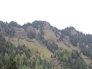
Crest Ault
| Crest Ault | ||
|---|---|---|
|
Crest Ault, taken from Alp Sut |
||
| height | 1942 m above sea level M. | |
| location | Canton of Graubünden , Switzerland | |
| Mountains | Adula Alps | |
| Dominance | 0.26 km → Crest dil Cut | |
| Notch height | 20 m ↓ Heinzenberggrat | |
| Coordinates | 748 265 / 181 336 | |
|
|
||
|
Summit cross on the Ault Crest |
||
The Crest Ault ( Rhaeto-Romanic crest = elevation , ault = high ) is a wooded mountain west of Rothenbrunnen in the canton of Graubünden in Switzerland with an altitude of 1942 m above sea level. M. It belongs to the Heinzenberggrat . Towards the east, the summit falls directly next to the summit cross in a steep rock face to Alp Sut ( 1573 m ). Therefore, the mountain offers a good view from Domleschg over Bonaduz and Chur to Flims .
Location and surroundings
The Crest Ault belongs to the Heinzenberggrat, a subgroup of the Adula Alps . It is located entirely in the municipality of Rhäzüns , but the municipal boundary to Versam is only about 40 m west of the summit. The Crest Ault is bordered in the northeast by the Chur Rhine Valley , in the southeast by the Domleschg and in the west by the Safiental .
The neighboring peak is Crest dil Cut . Valley locations are Bonaduz , Rhäzüns and Rothenbrunnen .
Heinzenberger tightrope walk
The Heinzenberger ridge hike is a scenic and varied day hike over the Heinzenberger ridge. It leads from Obertschappina via Tguma and Präzer Höhi to Präz and offers a great panoramic view of the Safiental , Domleschg , Albula and the surrounding mountains. Instead of going to Präz, the hike can be extended via Crest Ault to Bonaduz :
- Starting point: Glaspass ( 1831 m )
- Destination: Bonaduz ( 662 m )
- Route: Glaspass - Glaser Grat ( 2124 m ) - P. 1989 - Lüschgrat ( 2178 m ) - Bischolpass ( 1999 m ) - Tguma ( 2163 m ) - Präzer Höhi ( 2119 m ) - Crest dil Cut ( 2015 m ) - Crest Ault ( 1942 m ) - Alp Sura ( 1771 m ) - Alp Sut ( 1506 m ) - Scardanal ( 1131 m ) - P. 692 - Bonaduz
- Difficulty: T3 , mostly as trail white-red-white marks
- Duration: 8 h
Routes to the summit
General remark: The hiking trail over the Heinzenberger Grat does not lead over the summit, but about 30 m west of the summit.
From the north
- Starting point: Bonaduz ( 662 m ), Versam ( 908 m ) or Alp Sura (parking lot, 1771 m )
- Route: Scardanal, Alp Sut, Alp Sura, north ridge
- Difficulty: T2 , as trail white-red-white highlighted
- Time required: 5 hours from Versam, 4½ hours from Bonaduz or ¾ hours from Alp Sura
From the east
- Starting point: Rhäzüns ( 655 m ), Rothenbrunnen ( 625 m ) or Präz ( 1170 m )
- Rhäzüns route: Runcaglia, Tschanauntas, Alp Sura, north ridge
- Rothenbrunnen route: Trieg, Tschanauntas, Alp Sura, north ridge
- Prec route: Alp Sut, Alp Sura, north ridge
- Difficulty: T2 , as trail white-red-white highlighted
- Time required: 4¼ hours from Rhäzüns, 5¼ hours from Rothenbrunnen or 3 hours from Präz
Over the south ridge
- Starting point: Präz ( 1170 m )
- Via: Pranzolas, Prau da l'Alp, Präzer Alp, Südgrat, Crest dil Cut ( 2015 m )
- Difficulty: T2 , as trail white-red-white highlighted
- Time required: 3½ hours from Präz (¼ hour from Crest dil Cut)
panorama
literature
- Bernard Condrau: Club Guide, Bündner Alpen, Volume 2 (Bündner Oberland and Rheinwaldgebiet) 4th edition. Verlag des SAC, 1981, ISBN 3-85902-025-0 , pp. 301-302.
- National map of Switzerland, sheet 1215 Thusis, 1: 25000, Federal Office of Topography, 1985 edition
Web links
- www.hikr.org Tour report


