Dörnsteinbach
|
Dörnsteinbach
Mömbris market
Coordinates: 50 ° 5 ′ 31 ″ N , 9 ° 10 ′ 38 ″ E
|
|
|---|---|
| Height : | 294 m |
| Residents : | 636 (December 31, 2013) |
| Incorporation : | 1st January 1974 |
| Postal code : | 63776 |
| Area code : | 06029 |
|
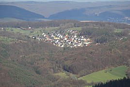
Dörnsteinbach from Hahnenkamm seen
|
|
Dörnsteinbach (in the local dialect: Dännstoamich ) has been part of the Mömbris market in the Lower Franconian district of Aschaffenburg since January 1st, 1974 . The place has 636 inhabitants (as of December 31, 2013) .
geography
Dörnsteinbach is located in the Kahlgrund on the edge of the Spessart between Niedersteinbach and Omersbach at 294.37 m above sea level. NN . East of Dörnsteinbach lies Krombach with the district Oberschur . The topographically highest point of the village marking is at the sports field, east of the village at 347 m above sea level. NN (location) , the lowest is on the Steinbach at 214 m above sea level. NN (location) .
Surname
etymology
The name Dörnsteinbach is derived from the field name in Dornich (from mhd. Durnîn for thorn bushes ) and from the Steinbach brook , which flows through the Alten Grund to Niedersteinbach der Kahl . The name Obersteinbach , used at times, indicates its location in the upper reaches of the stream; but should not be confused with the name of part of Niedersteinbach, which no longer exists today. In the vernacular of the place is Dännstoamich called.
Earlier spellings
Earlier spellings of the place from various historical maps and documents:
- 1562 Dürnstainberg
- 1842 Dörnsteinbach
- 1860 Durrensteinbach
- 1885 Dürrensteinbach
- 1902 Dörnsteinbach
history
The municipality Dörnsteinbach belonged to the Alzenau district office , which was formed on July 1, 1862. On January 1, 1939, this became part of the Alzenau district in Lower Franconia . When it was dissolved, Dörnsteinbach came to the newly formed district of Aschaffenburg on July 1, 1972 .
church
In 1911 the first chapel was built in Dörnsteinbach . After the Heilig-Geist-Kirche was built in 1960, the chapel house was temporarily used as a warehouse and bank building; today the volunteer fire brigade is housed there.
Web links
Individual evidence
- ^ Federal Statistical Office (ed.): Historical municipality directory for the Federal Republic of Germany. Name, border and key number changes in municipalities, counties and administrative districts from May 27, 1970 to December 31, 1982 . W. Kohlhammer GmbH, Stuttgart / Mainz 1983, ISBN 3-17-003263-1 , p. 736 .
- ↑ Chronicle of the Mömbris market: measured on the western edge of the church tower
- ↑ Bavaria Atlas of the Bavarian State Government ( notes )
- ^ Chronicle of the Mömbris market
- ^ Spessart map by Paul Pfinzing 1562
- ^ Atlas of Southwest Germany and the Alpine Country
- ↑ Topographical Atlas of the Kingdom of Bavaria on this side of the Rhine Sheet: 10 (1860)
- ↑ Special map of Lower Franconia
- ^ Southwest Germany up to the Alps with parts of neighboring countries


