The book (mountain)
| The book | ||
|---|---|---|
|
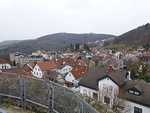
View from the citizen tower in Lindenfels northwards: on the left in the background the beautiful view on the federal road 47 ; in the center of the picture the book; right the southwest flank of the Schenkenberg ; between the two the settlement Litzelröder |
||
| height | 535.3 m above sea level NHN | |
| location | Hessen , Germany | |
| Mountains | Odenwald | |
| Dominance | 1.3 km → Raupenstein | |
| Notch height | 59 m ↓ Nice view | |
| Coordinates | 49 ° 41 '52 " N , 8 ° 46' 43" E | |
| Topo map | Hesse | |
|
|
||
The book is a 535.3 m above sea level. NHN high, densely forested mountain in the district of the core town of Lindenfels in the Bergstrasse district in the Hessian Vorderen Odenwald , which is surrounded by agricultural area. The forest area is around 120 hectares.
The book is located in the mountain range that extends from Neunkircher Höhe , the highest mountain in the Vorderen Odenwald, two and a half kilometers away , to the south over the Raupenstein ( 545.3 m ) and beyond the Bismarckwarte with the Schenkenberg ( 479.6 m ) reached the outskirts of Lindenfels . This mountain range separates the valleys of Gersprenz in the east and Lauter in the west.
Along the west and south face as achieved Nibelungenstraße known national highway 47 at the beautiful view its peak ( 447 m ) on the way from the mountain road in the west to Gersprenztal the east.
The closest localities are the Litzelröder settlement in the south, Winkel in the west and Winterkasten in the east.
The book shows some quarries and is the only Hessian site of the beryllium oxide -containing mineral bavenite .
Individual evidence
- ↑ a b Map services of the Federal Agency for Nature Conservation ( information )
- ↑ Area determined as a polygon in the Hessenviewer .

