Delfgauw
| province |
|
| local community |
|
|
Area - land - water |
1.87 km 2 1.17 km 2 0.7 km 2 |
| Residents | 9,220 (2018) |
| Coordinates | 52 ° 1 ' N , 4 ° 24' E |
| height | 0 m NAP |
| Important traffic route |
|
| prefix | 015 |
| Postcodes | 2641 |
| Website | Pijnacker-Nootdorp |
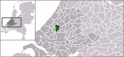
Delfgauw is a village in the municipality of Pijnacker-Nootdorp , in the Dutch province of Zuid-Holland .
The place lies between the city of Delft and Pijnacker on the N473 and the N470 , and is mostly built in the Noordpolder van Delfgauw . This polder borders in the north on the Bieslandse Bovenpolder , in the east on the Polder van Biesland and in the south on the Zuidpolder von Delfgauw . Delfgauw was part of the Ambachtsherrlichkeit Vrijenban (later municipality). When this was repealed in 1921, Delfgauw was added to the municipality of Pijnacker, which merged with the municipality of Nootdorp in 2002. Nonetheless, Delfgauw is one of the suburbs of Delft, while the other two towns, Pijnacker and Nootdorp, are suburbs of The Hague .
history
Emergence
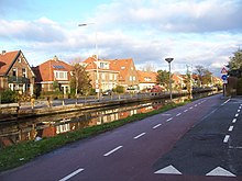
Delfgauw was originally an agricultural peasantry which in two settlement strips (Delftsestraatweg and Noord and Zuideindseweg and the canal Pijnackerse vaart ran). From the beginning of the 20th century, this neighborhood developed into a village along these historical bands. Due to its connecting position between Delft and Pijnacker, the Delftsestraatweg had a more urban character, while the Noord- and Zuideindseweg retained their rural character with farms and estates. The village center was at the intersection of the two bands of settlements. At that time, the Pijnackerse vaart was also of economic importance as a supply channel for goods. These were unloaded in the village center at the bridge and later at the unloading point on the Spui embankment .
Development of the districts
After the Second World War, Delfgauw continued to grow. Independent districts were built behind the settlement strips, which had no clear relationship to one another or to the existing old settlements. First, the Graaf Willem II district was built in the north-west of Delfgauw. Then followed the Burgemeestersbuurt district in the southwest. In the 1990s, the Graf Willem II district was expanded to include the Wethouder Sonneveldhof .
Development of horticulture
Horticulture has existed in Delfgauw since the 17th century. The location on the Pijnackerse vaart as a supply and disposal route played an important role here. Due to the population growth in Delfgauw and Pijnacker, the need for horticultural land increased rapidly from the 1950s. During this time, the construction of greenhouse complexes began. More and more land was cultivated in greenhouse horticulture and from this time the entire area between Delfgauw and Pijnacker was regarded as a "dynamic greenhouse horticulture area". Because of these developments, the village of Delfgauw became increasingly closed. The greenhouses are located directly on the east side of the village and define the townscape.
Forest and leisure facilities
In the 1970s, the Delftse Hout recreation area was established north of the Delfgauw recreation area . The Delft Arboretum- Heempark , which was laid out in 1966, is also located here .
Development of the district of Emerald
At the end of the 1990s, the district of Emerald was created on the southeast side of Delfgauw. With the help of the VINEX housing program , Delfgauw has grown from the original few dozen houses to a few hundred with Emerald. This quarter, which is many times larger than the old core of Delfgauw, is not seen as an extension of the existing village, but as a district with a more regional focus (with a focus on the connection with the A13 and Delft). During the conception, therefore, a conscious decision was made not to create a relationship between Emerald and the old Delfgauw. Emerald is more like its "back" facing the center of the old village and has its own facilities. The residents of old Delfgauw also benefit from this. There is also a Chinese school there.
Commercial areas
In 1997 the Ruyven business park was opened in the south of Delfgauw . The globally active logistics service provider Kuehne + Nagel has a branch here, as does the Royal IHC shipyard (formerly IHC Merwede ). There is also a distribution center for the Albert Heijn supermarket chain .
The preparatory work for the construction of another industrial park in Emerald ( Delftparc ) began in 2012. The residents of Emerald initially protested against the plans because of the presumably expected deterioration in air quality at the Raad van State . Small office and storage units are to be built on the site of the former adventure playground. The development of the location was delayed due to the economic crisis.
Environment and traffic
Heavy traffic exposure
The Delftsestraatweg (N473) is the traditional continuous connection between Delft and Pijnacker, which divides Delfgauw into two parts. This rather narrow street has become busier over the years. The Delftsestraatweg also acted as an access road to the Noordpolder horticultural area, which further increased truck traffic in the village.
Relief from the N470
With the construction of Provinciale Weg 470, which is south of Alt-Delfgauw and Emerald, a new connection between Delft and Zoetermeer was created. The opening of this street in April 2008 largely relieved the Delftsestraatweg from through traffic and reduced traffic in the local streets by a third. In addition, these speed limits, e.g. B. Tempo 30 zone set up.
Air quality
Delfgauw has an active residents' association ("Bewonersvereniging Delfgouw"), which organizes a variety of social activities. The association pays particular attention to improving the environmental conditions. Since Delfgauw is a very busy region, especially due to the proximity of the A13 motorway, residents are worried. a. about air quality. Since 2009 there have therefore been various local working and action groups to counter the increasing environmental pollution caused by settling companies. Delfgauw is also only seven kilometers from Rotterdam The Hague Airport. Machines approaching from the north fly directly over the town. Emissions measurements in the vicinity of airports regularly check the pollution. However, it is complained that no such measuring points have been set up in and around Delfgauw.
Web links
Individual evidence
- ↑ Kerncijfers wijken en buurten 2018 Centraal Bureau voor de Statistiek , accessed on May 9, 2019 (Dutch)
- ↑ website of Bewonersvereniging Delfgauw

