Eselsberg (Thuringian Slate Mountains)
| Eselsberg | ||
|---|---|---|
|
Rennsteigwarte observation tower on Eselsberg |
||
| height | 841.5 m above sea level NHN | |
| location | near Masserberg , Hildburghausen district, Thuringia , Germany | |
| Mountains | Thuringian Slate Mountains | |
| Coordinates | 50 ° 30 '38 " N , 10 ° 58' 11" E | |
|
|
||
| particularities | Rennsteigwarte ( AT ) | |

The Eselsberg is 841.5 m above sea level. NHN high mountain in the west of the Thuringian Slate Mountains in Thuringia . It is located in the Hildburghausen district near Masserberg, directly on the Rennsteig , a historic border path and today's hiking trail.
geography
location
Eselsberg is about 1 km south of Masserberg . Its massif goes north over the high elevations of Masserberg at Schartenhöhen of about 30 m in the Fehrenberg ( 835 m above sea level ) and the Ersteberg ( 823.5 m ), to the south follow the secondary peaks Sommerberg ( 800 m ), Zeupelsberg ( 760 m ) and Weißberg ( 748 m ), some distance south-southwest of the Grendel ( 787 m ) and various other secondary peaks.
In an easterly direction, along the Rennsteig, the massif merges into the Hohe Heide ( 832 m ) and continues into the Kleine ( 756 m ) and the Großer Sauberg ( 757 m ) to the south . The Eisfelder Ausspanne forms the gap to the Pechleite and thus the interface to the neighboring Bleßberg massif . To the north is the Goldberg ( 766 m ) above the Schwarza and the Goldisthal dam.
This massif, which merges into a temperate mountainous region to the southwest, is bordered by the young Werra in the southeast and by the valley of the Biber lock tributary in the northwest . In the north-east follows the low-lying valley of the Schwarza , behind which the Goldisthal pumped storage plant ( 877 m above sea level ) is located on the Großer Farmdenkopf ( 868.7 m ).
Since all of the aforementioned rivers ultimately flow into the Weser , but the Schwarza into the Saale - and thus into the Elbe - the Eselsberg lies on the Elbe-Weser watershed .
swell
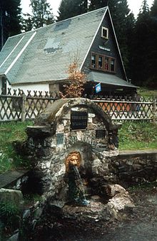
- On the southern slopes of Eselsberg, about 1 km north of Zeupelsberg and west of Rennsteig and also east of Fehrenbacher Schweiz, at 797 m above sea level. NN the source of the Werra, taken in 1897 . The second Werra source stream named Saar rises at 800 m above sea level. NN at the Bleßberg 7 km further south .
- On the southwest slope of the saddle between Eselsberg and Fehrenberg lies the source of the left lock- tributary Biber .
Rennsteigwarte observation tower
On the top of Eselsberg possible on Rennsteig a Ausflugsgaststätte and a 33 m high tower, the Rennsteig waiting ( ⊙ ). The tower was erected in 1974 after two wooden predecessors were destroyed by storm in 1951 and by lightning in 1974. It was rebuilt in the 1990s: the existing steel framework was clad with the inclusion of two glass surfaces that were opened across corners. Behind the glazed windows of the viewing platform there are photographs of the entire panorama with the inscription of important visual destinations.
From the tower you have - depending on the visibility - a wide panoramic view of the following places and mountains (arranged according to north-east-south-west and with distance in kilometers):
- Masserberg (1 km)
- Froebel Tower near Oberweißbach (15 km)
- Goldisthal pumped storage plant (4 km)
- Blessberg near Eisfeld (7 km)
- Großer and Kleiner Gleichberg (30 km)
- Schnett with the Simmersberg (5 km)
- Dolmar near Meiningen (35 km)
- Frauenwald (11 km)
- Size Beerberg and Schneekopf (22 km)
- Neustadt am Rennsteig (9 km)
- Veste Coburg (25 km)
See also
List of mountains and elevations in Thuringia

