
Flevum
| Flevum | |
|---|---|
| Alternative name | Velsen Castle |
| limes | Before the time of the Limes |
| Dating (occupancy) | A: 15 ± 1 to 28 AD. B: from 39 to around 50 |
| Type | Vexillation fort with harbor |
| unit | A: Vexillatio III of the Legio V Alaudae B: unknown |
| Construction | Wood-earth warehouse |
| State of preservation | Ground monument |
| place | Velsen |
| Geographical location | 52 ° 27 '7.2 " N , 4 ° 40' 10.2" E |
Flevum is the name of a Roman garrison with a fortified port facility on the North Sea. Today's ground monument is in the area of the city of Velsen in the Dutch province of North Holland . The remains of such a facility have been excavated there since 1945 , which corresponds to the Flevum mentioned by various ancient writers.
Location, sources and research history
Flevum is located around 1,500 m (Velsen 1) or 750 m (Velsen 2) southeast of Velsen-Süd, the successor settlement to medieval Velsen. In ancient times, the Roman camps were located on the southern bank of the Oer- IJ , which flowed into the North Sea around seven kilometers further west, at what is now Ijmuiden . The Oer-IJ was connected to the Oude Rijn via the Utrechtsche Vecht near Fectio . This northernmost branch of the Rhine Delta formed the northern border of the empire in the early period of the Roman occupation. In today's settlement image, the Velsen 1 site is located immediately south of the North Sea Canal . The western half of the area is cut through by the Dutch Rijksweg 9 motorway just before it tunnels under the canal. The discovery area of Velsen 2 is located around 750 m northwest of it, also south of the North Sea Canal and immediately south of the N202 motorway and immediately east of Rijksweg 22 . Nothing to be seen in the area.
Flevum , also Phleum ( Greek Φληούμ ) is a place name , which in the Geographia of Claudius Ptolemaios (around 100 to after 160) as one of the places in the west of Germania magna north on the sea coast (πόλεις) with 28 ° 45 ′ longitude ( Ptolemaic longitudes ) and 54 ° 45 ′ latitude.
- Flevum on historical maps after Ptolemy

Flevum as Phileum
(15th century)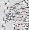
Flevum as a phleum (1511)

Flevum as Phileum (1513)

Flevum as L. [acus] Flevus (1700)

Flevum as Phleum , Flevo , Flevus and Flevum cast. [Ellum] (1865)


Pomponius Mela named Flevo in his work De chorographia libri tres , published around 43/44 .
In Pliny the Elder (23/24 to 79 n. Chr.) Took Flevum in the Naturalis Historia (4,101) mentioned.
In Tacitus ' (around 58 to around 120) annals (4.72) Flevum was mentioned in connection with a revolt of the Frisians in 28 AD.
As early as 1943 - without any archaeological findings available at that time - there was speculation that the Roman garrison Flevum was to be found in the area of Velsen. In 1945 the first discoveries were made in Velsen 2 (in a German anti-tank ditch from the Second World War), prospecting in the years 1952 to 1957 and systematic excavations in 1964 and 1970 brought no satisfactory results, but a whole series of finds . The situation was better in the area of Velsen 1, which was discovered later as Velsen 2, but which was extensively researched from 1972 to 1994 and was re-examined in 1996/1997.
Archaeological findings and garrison history
Flevum is divided into two main phases (Velsen 1 and Velsen 2), whereby the older phase Velsen 1 is subdivided again (periods 1a to 1c and periods 2a and 2b).
Velsen 1 (15 ± 1 to 28 AD)
The finds of the older phase Velsen 1 date from 15 ± 1 to 28 AD.
Period 1a (15 ± 1 AD)
The first fort, which was more of a simple and temporary building warehouse, was designated as period 1a. Its ground plan was more or less triangular and covered an area of around one hectare. The defenses consisted mainly of an earth wall with a simple ditch in front. A wooden palisade with a wooden gate defended the eastern part of the river bank. This camp did not yet have a port function, although ships could lie on the gently sloping river bank. Shortly afterwards, in a transition period between periods 1a and 1b (period 1a / 1b), the wooden fence was fitted with a reinforced gate. This port gate gave access to a short open jetty where larger ships could be loaded and unloaded so that they no longer had to be pulled ashore. Period 1a is numismatically dated to the period from 14 to 16 AD and thus falls into the time of the offensives of Germanicus , who a few years after the clades Variana carried out several retaliatory campaigns in Germania and probably also tried to re-establish the country for a longer period of time to conquer. The camp may have served as a base during these campaigns.
Period 1b (AD 16-22)
In period 1b, a more permanent fort with a similar floor plan replaced the previous camp. The new defenses followed almost exactly the course of the previous ones. The earth wall was now replaced by a box-like construction, a so-called wood-earth wall, which consisted of two parallel wooden walls that were embedded in a foundation trench and braced together. The approximately three meter wide space between the wooden walls was filled with the excavated material from the trench in front of it. The wood-earth wall was provided with simple wooden towers and probably with one or more simple gates, the floor plan of which could not be distinguished from that of the towers. The eastern bank area has now also been provided with a (somewhat narrower) wood-earth wall. During this period, extensive port facilities were built, the three moles can record (West Pier, North Pier and East Pier) and a single ship hall that would m with a width of 6.1 and a length of 22.1 m, a small galley.
Period 1c (22-25 AD)
After only a few years, the erosion caused by the river along the fort became noticeable and led to a necessary change in the port facility. The ship hall, which was partially washed away, was moved around 30 meters to the south and replaced by a similar construction of almost the same dimensions (6.4 m × 20.5 m). The fort itself seems to have remained unchanged, apart from a few repairs and minor modifications. At the northwest end of the defenses, for example, part of the former trench had been widened so much by erosion that it could be converted into a harbor basin with a protective cladding. To the west of the fort, the remains of a single ditch that ran parallel to the river bank point to a fenced working area outside the camp.
A small fortified camp on the other side of the river, opposite the main camp, is of particular interest. It was provided with a smaller harbor basin so that ships could anchor relatively safely here in enemy territory. Such small bridgehead forts are otherwise only known from late antiquity , when there were such facilities along the Rhine, the Iller and the Danube that allowed the Romans to land troops on Germanic banks.
It cannot be ruled out that this bridgehead was only built in period 2 or at least was still in use during this period.
Period 2a (25 AD)
Period 1b / 1c castle may have been abandoned for a short period of time. The second period began again with a construction warehouse. This time the defenses had an oval ground plan and again consisted of an earth wall with a single trench in front of it. The port facilities from the previous period (with the exception of the ship hall) and the wood-earth wall along the eastern bank promenade were integrated into the new warehouse.
Period 2b (AD 25-28)
In period 2b the fortress received its final trapezoidal shape . In the east the defenses followed those of period 2a, but to the west they were extended to the line of the western wood-earth wall of period 1b / 1c. The new defense system consisted of an earth wall with wooden towers and at least one double-winged wooden gate in the west. The facility was now surrounded by three trenches.
The entire bank design remained unchanged. In the port, open moorings replaced the massive jetties from period 1. There was also an additional mooring to the east outside the fence. This new jetty was controlled from a sturdy wooden platform attached to the eastern end of the earth wall. In the west (and perhaps also in the south and east) of the garrison, a new single trench was dug through which a larger, protected work area was created, in which, for example, ship repairs could be carried out. A fourth jetty and a new, this time twice as large (12.2 m × 29.7 m) ship hangar were also built. A big fountain with a floor plan of three by three meters is striking. From this well fresh, clean water was directed to the ship's hangar.
At the end of period 2b, in the year 28, the fort was attacked by the Frisians . The attackers probably did not occupy the camp itself, but rather the work area outside the fort, as indicated by the distribution of lead bullets. But even if the military camp itself remained undamaged, the loss of the work area was a problem, after all, the ship's hall and the most important well were located there. The Romans did not leave Velsen 1 immediately, but they had to find a solution to face the inadequate defenses of the work area. They achieved this by replacing the previous defensive structures with those that corresponded to those of the main fortress and connected the two structures with one another. The connection consisted of an earth wall with towers, which was preceded by two very deep trenches. Dendrochronologically , the complex was dated a little later than 28 AD. How long the occupation of Velsen 1 lasted is unclear. It is possible that this camp was used again as a temporary base around the year 40 (37 or later) to build Velsen 2.
It is conceivable that the Vexillatio V Alaudae III (3rd Detachment of the 5th Legion with the nickname "The Hooded Larchs") was stationed here in AD 28 , for which the find of a corresponding inscription stone ( V (exillationis) VA ( laudae) III ) speaks. It is known that the Legio V Alaudae under their legate Cethegus Labeo was involved in the campaign of the governor Lucius Apronius against the rebellious Frisians, or at least took part in the siege battle (see following section).
Rising of the Frisians and siege of Flevum (28 AD)
The tradition of the uprising of the Frisians in AD 28 comes from Tacitus, which is partly confirmed by the archaeological finds and findings in Velsen.
Tacitus reports that the Frisians "left peace" in the year 28, which was less because of their fault than because of Roman greed. At that time, Drusus the Elder would have imposed an acceptable tax burden on the Frisians, consisting of the delivery of ox hides for military purposes, without their nature having been specified in more detail. This did not lead to complaints until Olennius was commissioned with the tax collection. This now applied quality standards, as they would have been possible in the rest of Germany, but could not be achieved by the poor country of the Frisians.
Velsen 2 (39/40 to around 50 AD)
Velsen 2 was located around 750 m as the crow flies northwest of Velsen 1. Like the predecessor camp Velsen 1, it had a combined function as a troop camp and a naval base, with the proportion of military finds, in particular that of weapons up to ballista, being significantly higher. The camp had three construction phases over the short period of its existence. According to dendrochronological dating, it was built from wood that was felled in 39. Then it was reinforced with wood that was felled in winter 42/43. It has therefore been suggested that Velsen 2 may have been created for the campaign of Aulus Gabinius Secundus against the Chauken (41) and subsequently played a role in the invasion of Britain under Claudius by Aulus Plautius in 43. As early as 47 - presumably in connection with the stabilization of the Rhine border under Gnaeus Domitius Corbulo - the garrison seems to have lost its function and importance and the fort was (successively) abandoned, even if the Roman presence on site is attested for a few years .
Settlement structure and found material: cultural interaction and military situation
Velsen was located on the southern bank of the Oer-IJ, surrounded by an area relatively densely populated by the Frisians. In both Velsen 1 and Velsen 2, many pottery shards from Germanic production were found. Conversely, there are noticeable differences. While Roman imports from the time of Velsen 1 are almost completely absent in the local settlements, they are definitely present from the time of Velsen 2. It has therefore been suggested that Velsen 1 and Velsen 2 were founded in different military contexts. Velsen 1 must be considered an extremely isolated garrison, in fact it was the most northwestern Roman base in continental Europe. But the significant amount of native pottery in Velsen 1 suggests that there has been at least some type of contact with local people. The distribution of finds suggests that these contacts were limited to the inhabitants of the “Roman side” of the Oer-IJ. The situation is different at the time of Velsen 2. Together with Lugdunum Batavorum ( Katwijk - Valkenburg ) and Fectio ( Bunnik - Vechten) and founded at the same time, Velsen 2 was part of a strategically strong triangle. The Roman finds from the surrounding region indicate a somewhat closer contact with the local population, even if the Roman finds are limited. The scarce finds from Velsen 2, which continued over the years 50/55, seem to indicate that Velsen was viewed as strategically important some time after the Lower Germanic Limes was established.
Monument protection
The Roman remains in the soil of Velsen are under special protection as a registered Rijksmonument with the number 515772 on the basis of the monumentenwet (Monument Protection Act) of 1988.
literature
- Arjen VAJ Bosman: Rome aan de Nordzee. Burgers en Barbaren te Velsen . Sidestone Press, Leiden 2016, ISBN 978-90-8890-363-2 .
- Arjen VAJ Bosman: Archeology. Onderzoek started after tweede Romeinse in Velsen . Monumenteel 7.2 (2009)
- Arjen VAJ Bosman: Letters in a Romeins kamp. Het oudste alfabet van Nederland gevonden in Velsens Bodem. In: Velisena. (Sandpoort) 16, 2007, pp. 1-6.
- Arjen VAJ Bosman, Maarten de Weerd: Velsen. The 1997 Excavations in the Early Roman Base and a Reappraisal of the Post-Kalkriese Velsen / Vechten Dating Evidence. In: Frank Vermeulen, Kathy Sas, Wouter Dhaeze (eds.): Archeology in Confrontation. Aspects of Roman Military Presence in the Nortwest. Studies in Honor of Prof. Em. Hugo Thoen . (= Archaeological Reports Ghent University (ARGU ). 2). Academia Press, Ghent 2004, ISBN 90-382-0578-3 , pp. 31-62. (also as Google Book ).
- Arjen VAJ Bosman: Het culturele vondstmateriaal van de vroeg-Romeinse versterking Velsen 1 . University of Amsterdam, Amsterdam 1997.
- Arjen VAJ Bosman: Velserbroek B6 — Velsen 1 — Vensen 2 — Is there a Relationship between the military equipment from a ritual site and the fortresses of Velsen? In: Journal of Roman Military Equipment Studies. 6, 1995, pp. 89-98.
- Arjen VAJ Bosman: The Velsem Gems (2). In: Babesch. 69, 1994, pp. 155-164.
- Jaap MAW Morel: De vroeg-Romeinse vererking te Velsen 1. Fort en haven . Dissertation. Amsterdam 1988.
- Jaap MAW Morel: The early roman harbors. Velsen. In: RW Brandt, W. Groenman-van Waateringe, SEvan der Leeuw (eds.): Assendelver Polder Papers 1. Amsterdam 1987, pp. 169–175.
- Marinus Polak, SL Wynia: The Roman Forts at Vechten. A Survey of the Excavations 1829-1989 . Rijksmuseum van Oudheden, Leiden 1991.
- Wietske Prummel: Poultry and fowling at the Roman castellum Velsen 1. In: Palaeohistoria. 29, 2015, pp. 183-201.
- Pauline van Rijn: The Roman Harbor of Velsen . Terra et Aqua, The Hague 1995, pp. 25-28.
- Maarten D. de Weerd: Archaeological observations based on the found coins from Kalkriese and from the Tiberian camps Vechten and Velsen. Continuity and discontinuity. Germania inferior at the beginning and at the end of Roman rule. In: Contributions to the German-Dutch colloquium at the Katholieke Universiteit Nijmegen (June 27th to 30th, 2001). 35, 2003, p. 181.
Web links
- The early Roman defended harbors of Velsen 1 in The NAVIS II project on the website of the Römisch-Germanisches Zentralmuseum (RGZM) in Mainz, accessed on July 3, 2017.
- Flevum (Velsen?) On livius.org, the website of the Dutch historian Jona Lendering, ( English ), accessed on May 13, 2018th
Individual evidence
- ↑ Velsen 1 at 52 ° 27 '7.15 " N , 4 ° 40' 10.2" E
- ↑ Velsen 2 at 52 ° 27 '22.95 " N , 4 ° 39' 33.9" E
- ↑ Velsen-Zuid at 52 ° 27 '37.75 " N , 4 ° 39" 6.75 " E
- ^ Ptolemy: Geographia 2, 11, 12
- ^ Günter Neumann : Flevum. In: Reallexikon der Germanischen Altertumskunde (RGA). 2nd Edition. Volume 9, Walter de Gruyter, Berlin / New York 1995, ISBN 3-11-014642-8 , p. 191, ( chargeable via GAO , De Gruyter Online).
- ^ "Rhenus, from Alpibus decidens, prope a capite duos lacus efficit, Venetum et Acronium: mox, diu solidus, et certo alveo lapsus, haud procul a mari huc et illuc dispergitur; sed, ad sinistram, amnis etiam tum, et donec effluat, Rhenus; ad dextram, primo angustus et sui similis, post, ripis longe ac late recedentibus, jam non amnis, sed ingens lacus, ubi campos implevit, Flevo dicitur; ejusdem nominis insulam amplexus, fit iterum arctior, iterumque fluvius emittitur. "
- ↑ “In Rheno autem ipso, prope C in longitudinem, nobilissima Batavorum insula et Cannenefatium et aliae Frisiorum, Chaucorum, Frisiavonum, Sturiorum, Marsaciorum, quae sternuntur inter Helinium ac Flevum. ita appellantur ostia, in quae effusus Rhenus a septentrione in lacus, from occidente in amnem Mosam se spargit, medio inter haec ore modicum nomini suo custodiens alveum. "
- ^ "Eodem anno Frisii, transrhenanus popolus, pacem exuere, nostra magis avaritia quam obsequii impatientes. tributum iis Drusus iusserat modicum pro angustia rerum, ut in usus militaris coria boum penderent, non intenta cuiusquam cura quae firmitudo, quae mensura, donec Olennius e primipilaribus regendis Frisiis impositus terga urorum delegit quorum ad formam acciperentur. id aliis quoque nationibus arduum apud Germanos difficilius tolerabatur, quis ingentium beluarum feraces saltus, modica domi armenta sunt. ac primo boves ipsos, mox agros, postremo corpora coniugum aut liberorum servitio tradebant. hinc ira et questus et postquam non subveniebatur remedium ex bello. rapti qui tributo aderant milites et patibulo adfixi: Olennius infensos fuga praevenit receptus castello cui noun Flevum; et haud spernenda illic civium sociorumque manus litora Oceani praesidebat. "
- ↑ a b c d e f g The early Roman defended harbors of Velsen 1 in The NAVIS II project on the website of the Römisch-Germanisches Zentralmuseum (RGZM) in Mainz, accessed on July 3, 2017.
- ↑ Arjen VAJ Bosman, Maarten de Weerd: Velsen. The 1997 Excavations in the Early Roman Base and a Reappraisal of the Post-Kalkriese Velsen / Vechten Dating Evidence. In: Frank Vermeulen, Kathy Sas, Wouter Dhaeze (eds.): Archeology in Confrontation. Aspects of Roman Military Presence in the Nortwest. Studies in Honor of Prof. Em. Hugo Thoen . (= Archaeological Reports Ghent University (ARGU ). 2). Academia Press, Ghent 2004, ISBN 90-382-0578-3 , pp. 33f.
- ↑ Arjen VAJ Bosman, Maarten de Weerd: Velsen. The 1997 Excavations in the Early Roman Base and a Reappraisal of the Post-Kalkriese Velsen / Vechten Dating Evidence. In: Frank Vermeulen, Kathy Sas, Wouter Dhaeze (eds.): Archeology in Confrontation. Aspects of Roman Military Presence in the Nortwest. Studies in Honor of Prof. Em. Hugo Thoen . (= Archaeological Reports Ghent University (ARGU ). 2). Academia Press, Ghent 2004, ISBN 90-382-0578-3 , pp. 32f.
- ↑ Arjen VAJ Bosman, Maarten de Weerd: Velsen. The 1997 Excavations in the Early Roman Base and a Reappraisal of the Post-Kalkriese Velsen / Vechten Dating Evidence. In: Frank Vermeulen, Kathy Sas, Wouter Dhaeze (eds.): Archeology in Confrontation. Aspects of Roman Military Presence in the Nortwest. Studies in Honor of Prof. Em. Hugo Thoen . (= Archaeological Reports Ghent University (ARGU ). 2). Academia Press, Ghent 2004, ISBN 90-382-0578-3 , pp. 34-36.
- ↑ Jona Lendering: Fectio on livius.org (English), accessed on July 5, 2017.
- ↑ a b c d e David Blackman, Boris Rankov, Kalliopi Baika, Henrik Gerding, Jari Pakkanen: Shipsheds of the Ancient Mediterranean . Cambridge University Press, New York 2013, ISBN 978-1-107-00133-6 .
- ↑ a b Tacitus, Annales, 4.72 to 4.74
- ↑ AE 1997 01165c
- ↑ Tacitus, Annales 4.73.
- ^ Emil Ritterling : Legio (V Alaudae). In: Paulys Realencyclopadie der classischen Antiquity Science (RE). Volume XII, 2, Stuttgart 1925, Sp. 1564-1571.
- ↑ Arjen Bosman VAJ: Rome aan de Noordzee. Burgers en Barbaren te Velsen . Sidestone Press, Leiden 2016, ISBN 978-90-8890-363-2 , pp. 58-75.
- ↑ Rijksmonument 515772: Terrein waarin de resten van een fort met haven uit de Romeinse tijd in Velsen Zuid in the Rijksmonumentenverzeichnis of the Netherlands, accessed on November 2, 2018.

Flevum | March Camp Ermelo | Roman camp Holsterhausen | Aliso | Roman camp Haltern | Roman camp Olfen | Beckinghausen Roman Camp | Roman camp Bielefeld-Sennestadt | Roman camp Oberaden | Kneblinghausen Roman Camp | Roman camp Anreppen | Roman camp Porta Westfalica | Hedemünden Roman Camp | Roman camp Limburg | Roman camp Oberbruch | Roman camp Lahnau-Dorlar | Roman camp Marktbreit | Roman marching camp near Hachelbich | Roman marching camp from Wilkenburg