Futuna (Vanuatu)
| Futuna | ||
|---|---|---|
| Map (1870) | ||
| Waters | Pacific Ocean | |
| Geographical location | 19 ° 31 '47 " S , 170 ° 13' 8" O | |
|
|
||
| surface | 13 km² | |
| Highest elevation | Tatafou 666 m |
|
| Residents | 535 (2009) 41 inhabitants / km² |
|
| main place | Mohoun'gha | |
| Nautical chart (1901) | ||
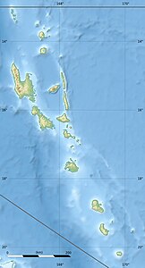
Futuna is a small island (with about 13 km² land area) in the southeast of the island state of Vanuatu . The island belonging to the province of Tafea is 310 km (as the crow flies) from the Vanuatu capital Port Vila and 101 km from the much larger island of Tanna . Between 1999 and 2009 the population increased from 402 to 535.
Futuna is bordered by a coral reef in the east .
There are five villages on Futuna, starting clockwise to the northwest:
- Mohoun'gha
- Ipao
- Matin'gi (consisting of Iraro, Marae, Itavai and Iakana)
- Napoua
- Iasoa
The main town is Mohoun'gha in the northwest. Ipao in the northeast is immediately west of the airport.
A current (2015) map source shows a total of more than 20 place names.
The island has ten traditional regions: Iraro, Itapapa, Itapasiesi, Matangi, Matowei, Nabao, Nariari, Rakaoroa, Serinao, and Tchinaroa.
Individual evidence
Web links
- Statistical map (2015)


