Gilet (Valencia)
| Gilet parish | ||
|---|---|---|
| coat of arms | Map of Spain | |

|
|
|
| Basic data | ||
| Autonomous Community : | Valencia | |
| Province : | Valencia | |
| Coordinates | 39 ° 41 ′ N , 0 ° 19 ′ W | |
| Height : | 76 msnm | |
| Area : | 11.3 km² | |
| Residents : | 3,324 (Jan 1, 2019) | |
| Population density : | 294.16 inhabitants / km² | |
| Postal code : | 46149 | |
| Municipality number ( INE ): | 46134 | |
| administration | ||
| Website : | www.gva.es/gilet | |
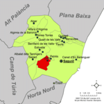
| Location of the municipality | ||

|
||
Gilet is a municipality ( municipio ) in the administrative district ( comarca ) of Camp de Morvedre in the province of Valencia in the Valencian Community .
The municipality consists of the three districts Gilet, Sant Esperit and La Penya.
Individual evidence
- ↑ Cifras oficiales de población resultantes de la revisión del Padrón municipal a 1 de enero . Population statistics from the Instituto Nacional de Estadística (population update).


