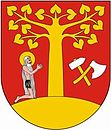
Gmina Stryszów
| Gmina Stryszów | ||
|---|---|---|

|
|
|
| Basic data | ||
| State : | Poland | |
| Voivodeship : | Lesser Poland | |
| Powiat : | Wadowicki | |
| Geographic location : | 49 ° 50 ' N , 19 ° 37' E | |
| Height : | 315-603 m npm | |
| Residents : | see Gmina | |
| Postal code : | 34-146 | |
| Telephone code : | (+48) 33 | |
| License plate : | KWA | |
| Gmina | ||
| Gminatype: | Rural community | |
| Gmina structure: | 6 school offices | |
| Surface: | 46.05 km² | |
| Residents: | 6847 (June 30, 2019) |
|
| Population density : | 149 inhabitants / km² | |
| Community number ( GUS ): | 1218072 | |
| administration | ||
| Address: | Stryszów 149 34-146 Stryszów |
|
| Website : | www.stryszow.pl | |
The Gmina Stryszów is a rural municipality in the powiat Wadowicki of the Lesser Poland Voivodeship in Poland . Its seat is the village of the same name with around 2100 inhabitants.
geography
The municipality is crossed by the 16 km long Stryszawka, this brook flows as right inflow in Dąbrówka in the reservoir of the Skawa . A small part of the Jezioro Mucharskie reservoir is located in the municipality. Neighboring municipalities are Budzów , Kalwaria Zebrzydowska , Lanckorona , Mucharz , Wadowice and Zembrzyce .
history
From 1975 to 1998 the municipality belonged to the Bielsko-Biała Voivodeship .
structure
The following six villages with a Schulzenamt belong to the rural community (gmina wiejska) Stryszów :
Dąbrówka , Leśnica , Łękawica , Stronie , Stryszów and Zakrzów .
Attractions
The following are entered in the voivodeship's list of monuments:
- Church from 1748 in Stryszów
- 16th century mansion in
Individual evidence
- ↑ Julian Zinkow: Wokół Kalwarii Zebrzydowskiej i lanckorona . Wydawnictwo "CALVARIANUM", Kalwaria Zebrzydowska 2000, ISBN 83-8739541-2 , p. 309-314 (Polish).
- ↑ population. Size and Structure by Territorial Division. As of June 30, 2019. Główny Urząd Statystyczny (GUS) (PDF files; 0.99 MiB), accessed December 24, 2019 .
- ↑ Dz.U. 1975 no 17 poz. 92 (Polish) (PDF file; 783 kB)


