
Great nakedness
| Great nakedness | ||
|---|---|---|
 Summit region |
||
| height | 527.8 m above sea level NN | |
| location | District of Northeim , Lower Saxony , Germany | |
| Mountains | Solling , Weserbergland | |
| Dominance | 44.8 km → Große Wulpke ( Harz ) | |
| Notch height | 333 m ↓ peas | |
| Coordinates | 51 ° 46 '50 " N , 9 ° 35' 32" E | |
|
||
| particularities | highest elevation in the Solling | |

The great nakedness is 527.8 m above sea level. NN is the highest mountain of Solling , Weserbergland and Solling-Vogler Nature Park and belongs to the district of Northeim in Lower Saxony ( Germany ).
Geographical location
The heavily forested mountain is located about 7 km (as the crow flies ) southwest of Dassel between the nearby villages of Hellental in the north-northeast and Silberborn in the south-west. It rises on the southeastern flank of the Hellentaler Graben, through which the Helle flows. Beyond or northwest of this trench is the second highest mountain in the Solling, the Great Ahrensberg .
Summit area
About 150 m south-east past the little pronounced summit of the Great Pale, the state road 549 runs through dense forest in a northeast-southwest direction from Dassel via Silberborn and Neuhaus to Boffzen .
A trail leading from the summit has been signposted for cross-country skiing since 2010.
photos

State road 549 in the summit area, view to the east (towards Dassel)

Stein next to the state road 549 in the summit area
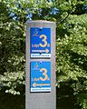
Marking of a cross-country skiing route on the Große Pare


Individual evidence
- ↑ Notch height according to TK 25 with the help of Elevation Contours in Google Maps .
- ↑ Map services ( Memento of the original from December 19, 2012 in the Internet Archive ) Info: The archive link has been inserted automatically and has not yet been checked. Please check the original and archive link according to the instructions and then remove this notice. of the BfN
- ↑ trail at the highest point