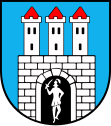
Grójec
| Grójec | ||
|---|---|---|

|
|
|
| Basic data | ||
| State : | Poland | |
| Voivodeship : | Mazovia | |
| Powiat : | Grójec | |
| Geographic location : | 51 ° 52 ' N , 20 ° 52' E | |
| Height : | 138-167 m npm | |
| Residents : | 16,745 (Jun. 30, 2019) |
|
| Postal code : | 05-600 | |
| Telephone code : | (+48) 48 | |
| License plate : | WGR | |
| Economy and Transport | ||
| Street : | E 77 Radom - Warsaw | |
| Next international airport : | Warsaw | |
| Gmina | ||
| Gminatype: | Urban and rural municipality | |
| Gmina structure: | 39 school authorities | |
| Surface: | 120.64 km² | |
| Residents: | 25,769 (Jun. 30, 2019) |
|
| Population density : | 214 inhabitants / km² | |
| Community number ( GUS ): | 1406053 | |
| Administration (as of 2008) | ||
| Mayor : | Jacek Stolarski | |
| Address: | ul.Józefa Piłsudskiego 47 05-600 Grójec |
|
| Website : | www.grojecmiasto.pl | |
Grójec is a city in Poland in the Masovian Voivodeship . It is the seat of the powiat of the same name .
history
The first written mention of the city comes from the year 1234. The elevation to the city took place in 1419 by Duke Janusz I. Starszy according to Kulm law . During the third partition of Poland , Grójec came to Prussia in 1795. With the creation of the Duchy of Warsaw , the city became part of the same and then in 1815 part of Congress Poland . The construction of the road from Radom to Warsaw through Grójec at the beginning of the 19th century helped the city flourish. In 1914 the city was connected to the rail network, which enabled a direct connection to Warsaw. In September 1939, the city was occupied by the Wehrmacht as part of the attack on Poland and then annexed by Germany in violation of international law. A Jewish ghetto existed in the city from 1940 to 1942 . The occupation by the Germans lasted until the Vistula-Oder operation of the Red Army , as a result of which the city was captured by the Soviet troops on January 15, 1945. In the following years Grójec became part of the Warsaw Voivodeship . With the restructuring of the Polish administration, the city came to the Radom Voivodeship in 1975 . Since 1999 the place is part of the Masovian Voivodeship .
local community
In addition to the city of Grójec, the urban and rural municipality includes the following 39 localities with a school administration office :
- Bikówek
- Częstoniew A
- Częstoniew B
- Dębie
- Duży Dół
- Falęcin
- Głuchów
- Grudzkowola
- Gościeńczyce
- Janówek
- Kępina
- Kobylin
- Kociszew
- Kosmin
- Krobów
- Las Lesznowolski
- Lesznowola
- Lisówek
- Maciejowice
- Marianów
- Mieczysławówka
- Mięsy
- Mirowice Parcela
- Mirowice-Wieś
- Pabierowice
- Piekiełko
- Podole
- Skurów
- Słomczyn
- Szczęsna
- Uleniec
- Wola Krobowska
- Wola Worowska
- Worów
- Wólka Turowska
- Zakrzewska Wola
- Zalesie
- Załącze
- Żyrówek
Population development

traffic
Grójec is on the European route 77, which also forms the state road 7 ( droga krajowa 7 ). In a northerly direction the road reaches Warsaw after around 40 kilometers , in a southerly direction it crosses Radom after around 50 kilometers . State road 55 continues through the city in a west-east direction . After about 25 kilometers it reaches the city of Mszczonów in the west . To the east, the road crosses Góra Kalwaria at about the same distance .
Grójec has not been served by the narrow-gauge Warsaw – Nowe Miasto nad Pilicą railway since 1988 (towards Mogielnica ) or 1991 (towards Tarczyn ). The short branch line to Jasieniec has not been used for passenger traffic since 1966.
The nearest international airport is Frédéric Chopin Airport in Warsaw , which can be reached via the European route 77.
sons and daughters of the town
- Artur Kolodziejski (* 1979), basketball player
Web links
- City website (Polish)
- Portal about the city (Polish)
Individual evidence
- ↑ Private website about Grójec ( Memento of the original from January 16, 2008 in the Internet Archive ) Info: The archive link was inserted automatically and has not yet been checked. Please check the original and archive link according to the instructions and then remove this notice.
- ↑ a b population. Size and Structure by Territorial Division. As of June 30, 2019. Główny Urząd Statystyczny (GUS) (PDF files; 0.99 MiB), accessed December 24, 2019 .
- ↑ grojeckie.info HISTORIA GRÓJCA , accessed on January 16, 2007
