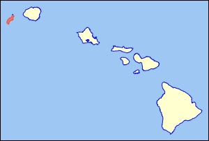
Ni'ihau
| Ni'ihau | |
|---|---|
| Aerial view from the northeast | |
| Waters | Pacific Ocean |
| Archipelago | Hawaii |
| Geographical location | 21 ° 54 ′ N , 160 ° 10 ′ W |
| length | 29 km |
| width | 10 km |
| surface | 179.9 km² |
| Highest elevation | Mount Pānīʻau 381 m |
| Residents | 160 (2000) <1 inh / km² |
| main place | Pu'uwai |
| USGS map of Niihau (1926) | |
Niʻihau ( German : Niihau ), the "Forbidden Island", is a small island in the Hawaiian Archipelago largely untouched by tourism . It has been privately owned since it was purchased for $ 10,000 in 1864.
The island covers only 180 square kilometers. With the Halulu Lake, Niʻihau has the largest inland lake in the entire archipelago.
population
Currently (as of 2000) around 160 people live on Ni'ihau - mostly Polynesians. Their main occupation is cattle breeding and the cultivation of rushes from which mats are woven. The Niʻihau Ranch is owned by the Robinson and Gray families.
The population development from 1850 to 1896:
| 1850 | 1853 | 1860 | 1866 | 1872 | 1878 | 1896 |
|---|---|---|---|---|---|---|
| 714 | 790 | 647 | 325 | 233 | 177 | 164 |
Census results since 1900:
| 1900 | 1910 | 1920 | 1930 | 1940 | 1950 | 1960 | 1970 | 1980 | 1990 | 2000 |
|---|---|---|---|---|---|---|---|---|---|---|
| 172 | 208 | 191 | 136 | 182 | 222 | 254 | 237 | 226 | 230 | 160 |
Swell:
As Aylmer Robinson was keen to preserve the original Hawaiian way of life, entering the island is still not permitted without express permission.
economy and politics
There is no money in circulation. Schnapps or cigarettes are frowned upon. Whoever has debts pays with mussels.
Even if the island is officially administered from Kaua'i , there are no official representatives of the administration, doctors, priests or police. There is also no power grid. However, some islanders use generators. There is also a Macintosh computer in the school building that runs on solar energy. There is now a helicopter on the island.
According to an unwritten law, whoever has left the island must never return. In the meantime, however, the strict isolationism has been loosened somewhat and not only helicopter flights are offered from Kaua'i, but also half-day excursions with a stay on a remote beach. Contacting the villagers does not seem to be possible in this way.
nature
Puʻukole is a small rock (70 by 35 meters), about 275 meters northwest of Puʻukole Point , the northernmost point of the island. 1100 meters before Puʻukole Point is the island of Lehua . 34.4 km southwest of Keelinawi Point on the southwest coast of Niʻihaus is the island of Kaʻula . The two rocky volcanic islands are bird sanctuaries and may not be entered or only under certain conditions.
Picture gallery
Web links
- Helicopter excursion with a beach stay (photos too)
- About the Geology Niʻihaus (English)
- Traditional regional divisions of Niʻihau and Kauaʻi
- More recent findings on the traditional regional divisions
- Traditional regional division based on a map from 1837
Individual evidence
- ↑ Halulu Lake in the Geographic Names Information System of the United States Geological Survey , cf. Halulu in Place Names of Hawaii
- ↑ NHSC Demographics (Wiki) ( Memento of the original from February 10, 2012 in the Internet Archive ) Info: The archive link was inserted automatically and has not yet been checked. Please check the original and archive link according to the instructions and then remove this notice.
- ↑ PDF at hawaii.gov


