Hanley Hills
| Hanley Hills | |
|---|---|
|
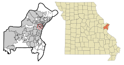
Hanley Hills in St. Louis County
|
|
| Basic data | |
| State : | United States |
| State : | Missouri |
| County : | St. Louis County |
| Coordinates : | 38 ° 41 ′ N , 90 ° 21 ′ W |
| Time zone : | Central ( UTC − 6 / −5 ) |
| Residents : | 2,101 (as of 2010) |
| Population density : | 2,259.1 inhabitants per km 2 |
| Area : | 0.93 km 2 (approx. 0 mi 2 ) of which 0.93 km 2 (approx. 0 mi 2 ) is land |
| Height : | 165 m |
| FIPS : | 29-30196 |
| GNIS ID : | 0756148 |
Hanley Hills is a community with a status of "Village" in St. Louis County in the US state of Missouri . In 2010 Hanley Hills had 2101 residents.
geography
The coordinates of Hanley Hills are 38 ° 41'11 "north latitude and 90 ° 19'35" west longitude. According to the 2010 United States Census , the metropolitan area of Hanley Hills covers an area of 0.93 square kilometers (0.36 sq mi). Hanley Hills is bordered by Vinita Terrace and University City to the south, Pagedale to the south and east, and Vinita Park to the west .
population
According to the 2010 United States Census , Hanley Hills had 2,101 people in 867 households and 571 families. The population density was 2,259.1 people per square kilometer (5836.1 / sq mi).
The 2010 population was composed of 12.0% White, 85.3% African American, 0.4% Asian, 0.1% Native American, and 0.3% from other races, and 1.9% from two or more races . 1.3% of the population were Hispanics or Latinos. Of the 867 households, 34.1% had children under 18 and 7.7% of the households had people over 65 living alone. Of the 2101 inhabitants, 25.1% were under 18 years, 8.9% between 18 and 24 years, 25.8% between 25 and 44 years, 30.9% between 45 and 64 years and in 9.2% of the people were 65 years of age or older. The median age was 38.1 years and 44.6% of the population were male.
