Hanseatic Ring Wismar
|
Address: |
|
|
|
|
||
| Route type: | temporary racetrack
counter clockwise |
|
|---|---|---|
| Opening: | 1954 | |
| Decommissioned: | 1959 | |
| Track layout from 1954 to 1959 | ||
| Route data | ||
| Route length: | 2.953 km (1.83 mi ) | |
Coordinates: 53 ° 53 ′ 13 " N , 11 ° 26 ′ 48.8" E
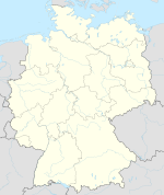
The Hanseaten ring Wismar was 1954-1959 a temporary track on the two separated by a green strip carriageways today Mayor main street in Wismar . The route length was 2.953 km.
National car and motorcycle races with and without sidecars took place on the racetrack. Classes were u. a. Formula 3 for racing cars, A, B, C for motorcycles and various cubic capacity classes of sidecar motorcycles (also known as sidecar or three-wheeled vehicles).
Individual evidence
- ^ Wismar Hanseatenring ; List of races 1954–1959 in the Jordan Motor Racing Archives.

