Hasselbach (Waldkappel)
|
Hasselbach
City of Waldkappel
Coordinates: 51 ° 10 ′ 3 ″ N , 9 ° 49 ′ 45 ″ E
|
|
|---|---|
| Height : | 274 (246-284) m above sea level NHN |
| Area : | 4.6 km² |
| Residents : | 155 (Feb 17, 2015) |
| Population density : | 34 inhabitants / km² |
| Incorporation : | December 31, 1971 |
| Postal code : | 37284 |
| Area code : | 05656 |
|
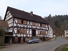
Half-timbered house in Hasselbach
|
|
Hasselbach is a district of Waldkappel in the Werra-Meißner district in North Hesse .
geography
Hasselbach is located in northern Hesse 8.5 km southeast of Waldkappel an der Wehre . The federal highway 7 leads past the place to the northeast . The Lossetalbahn ran parallel to this .
history
The village was first mentioned in writing in 1273. The Counts of Bielstein donated interest goods to the Teutonic Order House in Reichenbach, i.e. income and rights in Haselbach, the place was owned by the Lords of Cappel. The Germerode monastery appears as a further landlord in this area . After the secularization the lords of Hundelshausen the most important landlords are, that was to the rulers already in 1391 by Cappelsche fief home like .
In the Middle Ages, the place was conveniently located on Lange-Hessen-Strasse . The Hasselbacher Kirche is a branch church of Harmuthsachsen. There are four medieval desolations within the district : Geisenrod , Steinbach , Ichendorf and Weissner .
The place belonged to the Hessian office Lichtenau until 1821 and then to the district of Witzenhausen . During the French occupation, the place belonged to the canton of Bischhausen in the Kingdom of Westphalia (1807-1813).
In 1939 the place had 193 inhabitants. In the course of the regional reform in Hesse , Hasselbach came to the city of Waldkappel on December 31, 1971. Before that, the place belonged to the district of Witzenhausen .
Attractions
The place has numerous listed half-timbered houses from the middle of the 18th century. The manor with its manor was built at the end of the 17th century.
The core of the church is a small, late medieval building made of sandstone. Numerous modernizations took place in the 18th century. A simple roof turret sits on the roof as a substitute for a tower.
The Hasselbach station of the Lossetalbahn is now in ruins and is located north of the village.
literature
- Waldemar Küther : Hasselbach . In: Hessischer Heimatbund (Hrsg.): Witzenhausen district. Handbook of the Hessian Homeland Federation. IV, JA Koch Buchdruckerei, Marburg ad Lahn 1971, pp. 122–123.
- Literature on Hasselbach in the Hessian Bibliography
Web links
- Hasselbach district on the website of the city of Waldkappel.
- Hasselbach, Werra-Meißner district. Historical local dictionary for Hessen. In: Landesgeschichtliches Informationssystem Hessen (LAGIS).
Individual evidence
- ^ A b Hasselbach, Werra-Meißner district. Historical local dictionary for Hessen. (As of December 18, 2015). In: Landesgeschichtliches Informationssystem Hessen (LAGIS).
- ↑ Hasselbach district on the website of the city of Waldkappel, accessed in February 2016.
- ↑ Wolfgang Metz : Germerode Monastery and the settlement of the Meißner foreland . In: Werratalverein Eschwege eV (Ed.): The Werraland . Issue 1, Eschwege 1952, pp. 9-11.
- ^ Albrecht Eckhardt: Small territorial history of the district of Witzenhausen . Part II. In: Werratalverein Eschwege eV (Hrsg.): The Werraland . Issue 3, Eschwege 1971, pp. 38-43.
- ^ Federal Statistical Office (ed.): Historical municipality directory for the Federal Republic of Germany. Name, border and key number changes in municipalities, counties and administrative districts from May 27, 1970 to December 31, 1982 . W. Kohlhammer GmbH, Stuttgart and Mainz 1983, ISBN 3-17-003263-1 , p. 389 .

