Hembach (Rednitz)
| Hembach | ||
|
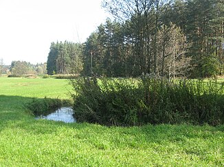
The Hembach between Furth and Schwand |
||
| Data | ||
| Water code | DE : 242156 | |
| location | Germany | |
| River system | Rhine | |
| Drain over | Rednitz → Regnitz → Main → Rhine → North Sea | |
| source | approx. 1300 m north of Pyrbaum 49 ° 18 ′ 28 ″ N , 11 ° 17 ′ 37 ″ E |
|
| Source height | 429 m | |
| muzzle | in Rednitzhembach in the Rednitz coordinates: 49 ° 18 '14 " N , 11 ° 4' 33" E 49 ° 18 '14 " N , 11 ° 4' 33" E |
|
| Mouth height | 315 m | |
| Height difference | 114 m | |
| Bottom slope | 5.3 ‰ | |
| length | 21.7 km | |
| Catchment area | 56.64 km² | |
| Communities | Pyrbaum, Wendelstein, Schwanstetten, Rednitzhembach | |
The Hembach is a year-round flowing water of the 2nd and 3rd order in the Bavarian districts of Neumarkt and Roth .
course
The Hembach arises approx. 1300 m north of Pyrbaum , as a confluence of five sources from the forest areas Stümpfling , Laubenheid and Dachsbau , at an altitude of 429 m above sea level .
In the Brachergraben basin , it flows westwards, crosses under the NM 17 district road and then feeds the 1 km² large pond, to which the Mühlbachgraben and the Moosgraben flow from the south. From the stock pond , the stream initially runs parallel to the NM 17 district road to the northwest through Oberhembach , takes in the treated wastewater from the local sewage treatment plant at the end of the village and flows through the Neumühlweiher and Neuweiher, which are used for fish farming, on to Dürrenhembach . Here the right tributary of the Dürrenbach comes from the north and after a further two kilometers through the Dürrenhembach forest the BAB 9 is crossed. Here the Hembach reaches its northernmost point and changes its direction to the southwest, flows through Sperberslohe and in turn takes up the treated wastewater from the sewage treatment plant at the end of the village. The next three km run through the very dense fir stands of forest areas boiler in the north and lifting Bach in the south where is added as a left tributary of the very clear Höllenbach before the historic Köhlereiort Furth is achieved. The Hembach probably got its name from the Hebenbach forest and is now described in the water cadastre as 2nd order flowing water. The character of the water changes here gradually from a forest to a meadow stream. From the forest of Lach , the Lachgraben comes from the left and gradually the name "Flüßchen" would be more appropriate. This is followed by further ponds used for fishing, abandoned sand pits and the tributaries of several nameless meadow streams, first the Schwander industrial area and then the village of Schwand, which is partially flown through. From the outskirts of Schwand the Hembach changes its direction again and now flows northwest, this time parallel to the district road RH 1 , begins to meander there and reaches Mittelhembach . It flows south past the place, into a modern inlet structure with flotsam rake and then crosses under the Main-Danube Canal in a stately 120 meter long and 9 meter deep culvert . After passing the deserted Holzgut , Hagershof , Unter- and Oberfichtenmühle , it is crossed by the highway 2 , which has been developed here , before it flows into the Rednitz after another 500 meters between Plöckendorf and Rednitzhembach at an altitude of 315 m above sea level .
Water quality
The Hembach already flows as critically polluted from the Upper Palatinate into the Roth district. After the inclusion of the Dürrenbach, however, the water quality improves considerably and, thanks to the self-cleaning powers of nature, remains only moderately polluted in the course of the subsequent forest areas up to Schwand. Sections of water with moderate pollution and a good oxygen supply show a very large biodiversity and individual density of algae, snails, small crustaceans, insect larvae and fish. Stocks of aquatic plants sometimes cover larger areas depending on their individual location requirements. From Schwand , however, the Hembach is again considered to be critically burdened. The entry of organic, oxygen-consuming substances causes a critical condition. Fish deaths due to lack of oxygen are possible and a decline in the number of macrophytes as well as a tendency towards mass development of individual plant and animal species can be observed. From around the Oberfichtenmühle to the confluence with the Rednitz, the condition of the water gradually improves again to become moderately polluted.
literature
- BAIER, A. (2004): Geology and hydrogeology of the Hembach and Höllenbach area in the southern Nuremberg Reichswald: Geogenic and anthropogenic influences on two near-natural rivers on the southern edge of the Nuremberg Basin - Geol. Bl. NO-Bayern 54, 1-4: 101- 168, 25 figs., 5 plates, Erlangen 2004. * URL: [1]
Web links
- The Hembach on BayernAtlas
- Water quality in the district of Roth
- Geology and hydrogeology of the Hembach and Höllenbach areas in the southern Nuremberg Reichswald (2004)
Individual evidence
- ↑ a b List of brook and river areas in Bavaria - Main river area, page 39 of the Bavarian State Office for the Environment, as of 2016 (PDF; 3.3 MB)
- ↑ Water cadastre in LKr Roth, Hembach
- ↑ | Headwaters of the Hembach, BayernAtlas
- ^ Course of the Hembach, Bavaria Atlas
- ↑ Water quality in the district of Roth, accessed on January 28, 2015 ( Memento from March 4, 2016 in the Internet Archive )
