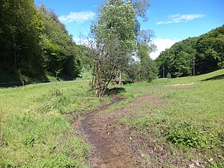
Hemsbach (Kahl)
| Hemsbach | ||
| Data | ||
| location |
Spessart
|
|
| River system | Rhine | |
| Drain over | Kahl → Main → Rhine → North Sea | |
| source | southeast of the town of Großhemsbach 50 ° 4 '11 " N , 9 ° 7' 7" E |
|
| Source height | 325 m above sea level NHN | |
| muzzle | in bridges in the Kahl coordinates: 50 ° 5 ′ 21 ″ N , 9 ° 8 ′ 42 ″ E 50 ° 5 ′ 21 ″ N , 9 ° 8 ′ 42 ″ E |
|
| Mouth height | 153 m above sea level NHN | |
| Height difference | 172 m | |
| Bottom slope | 54 ‰ | |
| length | 3.2 km | |
| Catchment area | 3.4 km² | |
|
The Hemsbach flows into the Kahl |
||
The Hemsbach is an approximately 3.2 km long and left tributary of the Kahl in the Lower Franconian district of Aschaffenburg in the Bavarian Spessart .
Surname
The name Hemsbach consists of the Middle High German words hagen (later Hain ), which means “little wood” and bach . The explanation arises from this "stream that flows through a wood". The Hemsbach gave the place Hemsbach its name. The nearby places Heimbach and Heimbuchenthal also have the same name origin .
geography
course

The Hemsbach rises at an altitude of 325 m above sea level. NHN in a small valley southeast of the town of Großhemsbach , which belongs to the Mömbris market .
The Hemsbach flows through the village to the northeast and is reinforced by three other streams. One of these rises in the earlier granite quarry of the Hohen Mark (today Hahnenkammsee ), whose slightly reddish water still flows into the Hemsbach at Wendelinusstein .
From there until just before the village of bridges , of Hemsbach forms the border between the districts Mömbris and Hemsbach. Another stream runs down the valley from Kleinhemsbach an der Daunert . In bridges the brook operated the Hemsbach mill until 1970. Today the Hemsbach is completely piped in the place.
It finally ends at the former fire station on the Kahl – Schöllkrippen railway line at an altitude of 153 m above sea level. NHN from the left into the bald .
The 3.2 km long course of the Hemsbach ends about 172 meters above sea level below its source, so it has a mean bed gradient of about 54 ‰.
Catchment area
The 3.4 km² catchment area of the Hemsbach lies in the Spessart and is drained through it via the Kahl, the Main and the Rhine to the North Sea.
It borders
- in the southeast to the catchment area of the Fleutersbach , which flows into the Kahl
- in the south to that of the Kahl tributary Reichenbach
- in the west to that of the Krebsbach , which is also a tributary of the Kahl
- and in the north to the catchment areas of the small bald tributaries Speichenbach , Kertelbach , Hitziger Lochgraben and Wüstenbach .
The highest point is 436 m above sea level. NHN high Hahnenkamm in the west of the catchment area.
Kahl river system
nature and environment
When the quarry was operating, the red, heavily polluted water could still be seen in the Kahl a few meters after the mouth of the Hemsbach . In 2013 the piping of the Hemsbach in bridges was renewed.
history
Landmarks

Between the villages of Hemsbach and Brücken, the Hemsbach was not always just a border creek of the districts. In 1810 he separated the historical areas of two earlier states in the Rhine Confederation . On the left was the territory of the Grand Duchy of Hesse , to which the town of Hemsbach in the Alzenau district in the Starkenburg province belonged. On the right side was the Grand Duchy of Frankfurt with the parish Mömbris in the department of Aschaffenburg . There were also a number of historical boundary stones on this boundary line along the course of the stream, but they no longer exist today.
Mills
- Hemsbachmühle
See also the list of mills in the Kahlgrund .

