Hertzallee
| Hertzallee | |
|---|---|
| Street in Berlin | |
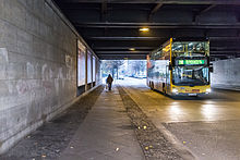
| View down Hertzallee to the tram bridge at Zoo station | |
| Basic data | |
| place | Berlin |
| District | Charlottenburg |
| Created | in the 19th century |
| Newly designed | last in 1964 (abbreviation) |
| Hist. Names |
Kurfürsten Allee, Kurfürstenallee |
| Cross streets |
Jebensstrasse , Fasanenstrasse |
| Places | Hardenbergplatz |
| use | |
| User groups | Road traffic |
| Technical specifications | |
| Street length | 330 meters |
The Hertzallee is after the German physicist Heinrich Hertz named street in Berlin district Charlottenburg ( Charlottenburg-Wilmersdorf ) on the border of the district zoo ( district center ). It was created in the 1860s according to the Hobrecht Plan , which included the expansion of old Berlin .
course
Hertzallee leads from Hardenbergplatz in front of the Zoological Garden to Fasanenstraße , passing under the viaduct of the Stadtbahn . Finally it ends on the campus of the Technical University .

The section between Ernst-Reuter-Platz and Fasanenstrasse, which will later become the main site of the Technical University , is used as a parking lot and a non-public access road to the buildings. The former street character has been clearly preserved, only at the northwest end at Ernst-Reuter-Platz was the building of the Institute for Mining and Metallurgy built across the street from 1955 and seals off the campus from the square.

The north side of the street is in the Tiergarten district, the numbered plot No. 41 is the zoo nursery.
History and naming
The route of Kurfürstenallee , laid out in accordance with section V / 1 of the development plan in 1842, did not have a specific name until 1860. On the map from 1862 it was marked as Churfürsten Allee . According to the chronicler Otto A. Borchert, the street was named around 1862 in honor of Elector Friedrich III. and was planted with linden trees on both sides . There was no development for a few years.

In 1900 the street had the following course according to the address book : Lot 42 begins on Berliner Straße with an apartment building, followed by Eichler's and Sauter's houses , then the two built-up lots 39 and 38, then the Pilgersche Haus , the royal tree nursery , the new building for the University of Music and a section up to the tram . From here it led back northwest again; behind the Fasanenstrasse are the United Artillery and Engineering School and the Sports Field of the West . At the intersection with Joachimsthaler Straße , Kurfürsten-Straße then led (without numbering) to the Royal University in what would later become the Tiergarten district .
In the following four years, extensive development of the entire area began, along the south side of Kurfürsten-Allee , further buildings for the Technical University and a newly founded Military Technical Academy in Charlottenburg were planned and built. In 1904, Kurfürsten-Allee began specifically as a junction with Berliner Strasse (from 1957: Otto-Suhr-Allee ), crossed Joachimsthaler Strasse, Fasanenstrasse and led to the Stadtbahn and back again. House numbers were counted in a horseshoe shape up to number 42 on Berliner Straße . It thus formed a direct extension of this street with the Zoologischer Garten train station. To the southeast, the route followed the bank of the Landwehr Canal and ended in Fasanerieallee (later Lichtensteinallee). This route was still recognizable in the city map in 1926, but only the section between Knie (since 1953: Ernst-Reuter-Platz ) and Joachimsthaler Straße (at this point since 1958: Hardenbergplatz ) kept its name.
By 1930 the following buildings had been built on Kurfürstenallee (in the meantime written in one word): No. 15-10 Charlottenburg student house with an academic health insurance company, a university / foreign publishing house and book distribution as well as a student residence ; No. 9, a building owned by the Berlin tax authorities for the Prussian Building and Finance Directorate, for the institute and the student committee for physical exercise, as well as some residential units. Directly next to the Stadtbahn were the barracks of the Eastern Railway Directorate , on Hardenbergstrasse (without number) the engineering school, the United State Schools for Free and Applied Arts , the tree nursery. The numbers Hertzallee 36 to 43 were postally assigned to Hardenbergstrasse 38 to 43 and marked apartment buildings.
Before 1943, the plot numbers were reassigned in a zigzag system, i.e. left side odd, right side even. They designated: 1–11 a green area, 13–29 the Prussian Treasury , 29 a coal yard. All even numbers from 12 to 42 were now assigned to Hardenbergstrasse (numbers 42, 41, 40, […], 32a), most of them belonged to institutions of the Technical University (such as the Physikalisches Institut; Hertzallee 18/22 → Hardenbergstrasse 34/35 ).
In 1950 the Berlin Senate decided to rename Kurfürstenallee to Hertzallee in honor of the physicist Heinrich Hertz .
A part of the street at the bus station in Tiergarten was also given the name Hertzallee on December 18, 1961. On May 19, 1964, the part of Hertzallee between Ernst-Reuter-Platz and Fasanenstrasse, which runs through the grounds of the TU, was finally de-dedicated. This part is to be rebuilt by 2016 and reopened as a public (but partially car-free) street. The installation of a glazed facade in the Institute for Mining should enable a line of sight to Ernst-Reuter-Platz.
Noteworthy in the street
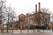
The Cranzbau ( Jebensstrasse 1, after Carl Cranz , 1903–1920 Full Professor at the Military Technical Academy) is a monument from 1905. The Royal Building Councilor Karl Weisenberg had worked out the plans for a ballistic and chemical laboratory at the Military Technical Academy in Charlottenburg in detail. (This academy was later merged with the Technical University of Charlottenburg to form the TU Berlin.)
Behind the junction of the railway lines running parallel Jebensstraße is located on the northern side of the Hertzallee a Busaufstellfläche (former tram turning loop) of the BVG , the Zoologischer to stop the garden as a hub of public transport in Berlin is significant. Behind the bus station on Fasanenstrasse, into which Hertzallee flows, is the central library of the TU and UdK Berlin , which opened in 2004 .
Planning a viewing wheel
On part of the zoo Wirtschaftshofs and on the route of Hertzallee next to the zoological garden that was Great Berlin Wheel planned a 185-meter high observation wheel with 36 air-conditioned gondolas. In 2007 the Governing Mayor of Berlin, Klaus Wowereit , broke the first symbolic groundbreaking ceremony , but no further work followed. In the 2010s, the real estate fund for the ferris wheel was liquidated and the project is no longer operated.
Web links
-
Hertzallee. In: Street name lexicon of the Luisenstädtischer Bildungsverein (near Kaupert )
- Kurfürstenallee . In: Luise.
- Homepage of Great Berlin Wheel GmbH
Individual evidence
- ^ Kurfürstenallee . In: Street name lexicon of the Luisenstädtischer Bildungsverein
- ^ Berliner Strasse . In: Berliner Adreßbuch , 1875, V, Charlottenburg, p. 206 ( Churfürsten-Allee 1875 is not yet designated as a street with its own information , it only appears as a cross street at Berliner Straße 149/150.).
- ^ First draft for the University of Music / Academy of Fine Arts on Hardenbergstrasse at the corner of Hertzallee; 1896. In: Archive of the TU Berlin . On the representation is the elector-Allee right indicating the rails taken straight running horse tram, as well Hardenbergstraße. The second design by August Orth - architekturmuseum.ub.tu-berlin.de - relocated the main entrance of the academy building to Kurfürsten-Allee , which is shown here with its lush tree population.
- ^ Kurfürsten-Allee . In: Address book for Berlin and its suburbs , 1900, V, Charlottenburg, p. 41 (street course Kurfürsten-Allee).
- ↑ Surroundings of Berlin, Tiergarten around 1894 . ( Page no longer available , search in web archives ) Info: The link was automatically marked as defective. Please check the link according to the instructions and then remove this notice. Bibliographical Institute in Leipzig
- ^ Charlottenburg. ( Page no longer available , search in web archives ) Info: The link was automatically marked as defective. Please check the link according to the instructions and then remove this notice. In: Sanwald Plan Berlin. Verlag Karl Sanwald, Pasing before Munich 1926.
- ^ Kurfürstenallee . In: Berliner Adreßbuch , 1930, IV, Charlottenburg, p. 1270.
- ^ Kurfürstenallee . In: Berliner Adreßbuch , 1943, IV, Charlottenburg, p. 1091.
- ↑ Charlottenburg around 1961. ( Page no longer available , search in web archives ) Info: The link was automatically marked as defective. Please check the link according to the instructions and then remove this notice. Big Berlin city map, Richard Schwarz Nachf.
- ↑ Big plans for the extended Hertzallee. In: Berliner Zeitung , October 6, 2014.
- ^ Weisenberg, Karl . In: Berliner Adreßbuch , 1904, I, p. 2023. “Charlottenburg, Wilmersdorfer Str. 72”.
- ↑ Former laboratory building of the Military Technical Academy, 1904–1905 by Weisenberg
- ↑ Construction plans by Karl Weisenberg for the specialized building of the military academy . In: Archive of the TU Berlin .
Coordinates: 52 ° 30 ′ 34 ″ N , 13 ° 19 ′ 54 ″ E


