Hochjoch (Schnalskamm)
| Hochjoch / Giogo Alto | |||
|---|---|---|---|
|
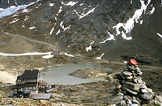
The shelter beautiful view from the northwest with the glacier lake fed by the Hochjochferner |
|||
| Compass direction | North | south | |
| Pass height | 2861 m above sea level A. (2875 m) | ||
| Territory: Country / Province State: |
Venter Valley Tyrol Austria |
Schnalstal South Tyrol Italy |
|
| Watershed | Venter Ache → Ötztaler Ache → Inn → Danube ( Black Sea ) | Schnalser Bach → Etsch ( Adriatic Sea ) | |
| Valley locations | Vent | Kurzras | |
| expansion | Mule track | ||
| Mountains | Ötztal Alps | ||
| map | |||
|
|
|||
| Coordinates | 46 ° 47 '17 " N , 10 ° 47' 58" E | ||
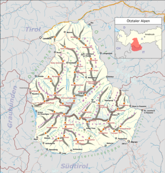
The Hochjoch ( Italian Giogo Alto ) is a transition in the Ötztal Alps with a height of 2861 m above sea level. A. (according to other sources 2875 m above sea level ). It connects the Schnalstal ( South Tyrol , Italy ) with the Rofen , Venter and Ötztal ( North Tyrol , Austria ). It is typically understood as a depression in the Schnalskamm , but occasionally also as a point of separation between the Schnalskamm and the Weißkamm . Since the Treaty of Saint-Germain came into force in 1920, the border between Italy and Austria has run across the Hochjoch .
The transition has been known for centuries and is used annually for a large sheep drive in June and September . In the past it was often used as a smuggler route . The Schnalser and Vinschgau farmers have centuries-old grazing rights in the Venter Valley , which have survived the political disputes.
The ascent from the south takes about 2 hours from Kurzras in Schnalstal via the Schöne Aussicht shelter . At 2,750 m, just south of the pass, there is a glacier lake, which is fed by the Hochjochferner . The Hochjoch can also be reached from the Grawand mountain station of the Schnalstaler Gletscherbahn . From there the descent is about 3/4 of an hour.
From the north, the ascent is via the 2412 m above sea level. A. high-altitude Hochjochhospiz .
Web links
- Contact Official Journal for Herrnhut, p. 22. (accessed January 15, 2016)
- Via Alpina hiking guide, p. 28 (accessed January 15, 2016)
supporting documents
- ↑ a b according to AMap or BEV (reload page if there is no display)
- ↑ a b c Ernst Höhne: Knaur's Lexicon for Mountain Friends / The Alps between Chiemsee and the Dolomites . Droemer Knaur, Munich 1986, ISBN 3-426-26222-3 , pp. 121 .

