Hummelsheim (Leverkusen)
|
Hummelsheim
City of Leverkusen
Coordinates: 51 ° 1 ′ 37 ″ N , 7 ° 4 ′ 29 ″ E
|
||
|---|---|---|
| Height : | 65 m above sea level NN | |
|
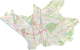
Location of Hummelsheim in Leverkusen |
||
|
Hummelsheim with the Hummelsheimer Hof 2017
|
||
Hummelsheim is a district in the Schlebusch district of District III of the city of Leverkusen . It emerged from the Hummelsheimer Hof .
Location and description
The place is on the edge of the city limits of Leverkusen to Bergisch Gladbach in the Dhünn floodplain on the state road 288 between Schildgen and Schlebusch. It is essentially shaped by the agricultural property Hummelsheimer Hof, which is also considered the origin of the place.
history
The Topographia Ducatus Montani by Erich Philipp Ploennies from 1715, Blatt Amt Miselohe , proves that the place existed as early as 1715 and was called Homelterhöf . Carl Friedrich von Wiebeking names the court on his charter of the Duchy of Berg in 1789 as Homelterhoff . It shows that Hummelsheim was part of the Schlebusch parish at the time.
Under the French administration between 1806 and 1813, the Miselohe office was dissolved and Hummelsheim was politically assigned to Mairie Schlebusch in the canton of Opladen in the Dusseldorf arrondissement . In 1816 the Prussians converted the Mairie to the mayor's office in Schlebusch in the Opladen district .
In 1807, Grand Duke Joachim Murat donated the County of Morsbroich and the Hummelsheim court to his finance minister and provisional state secretary Jean Antoine Michel Agar de Mercuès , officer of the Legion of Honor, and his wife Alexandrine Andrieu de Soulomès (Murat's niece) on the occasion of their marriage.
The Opladen district became part of the Solingen district in 1819 . In 1820 the place classified as a Hofstatt had 46 inhabitants. The inhabitants were all Catholic. The place is recorded on the topographical survey of the Rhineland from 1824 as Humelsheim and on the Prussian first survey of 1840 as Humelsheim . From the Prussian new admission in 1892, it is regularly recorded as Hummelsheim on measuring table sheets .
In 1815/16 46 people lived in Hummelsheim, in 1830 56 people. In 1832 the place was still part of the community of Schlebusch within the Schlebusch mayor. The place, which was categorized as a court town according to the statistics and topography of the Düsseldorf administrative district , had six residential buildings and 13 agricultural buildings at that time. At that time, 38 residents lived in the place, all of them of Catholic faith. The municipality and estate district statistics of the Rhine Province list the place in 1871 with eight houses and 54 inhabitants. In the municipality lexicon for the province of Rhineland from 1888, eight houses with 45 inhabitants are given for Hummelsheim. In 1895 the district had eight houses with 48 inhabitants, in 1905 eight houses and 48 inhabitants are also given.
After the merger of the district of Solingen with the district of Lennep in 1929 to form the district of Solingen-Lennep , the community of Schlebusch, together with the communities of Steinbüchel and Rheindorf, joined the community of Wiesdorf on April 1, 1930, which at the same time received city rights and was renamed Leverkusen.
Femestein
The so-called Femestein , a listed building , is on the list of architectural monuments in Leverkusen . It is a boundary stone from 1648 with a coat of arms (Thunabesen, Donnerbesen or Femregel). In 2007 it was transferred to the Villa Römer on permanent loan . The meter-high stone bears the inscription 1648 and marked the border between the Bergisch offices of Miselohe and Porz .
See also
Individual evidence
- ^ Wilhelm Fabricius : Explanations for the Historical Atlas of the Rhine Province. Second volume: The map from 1789. Division and development of the territories from 1600 to 1794. Bonn 1898.
- ↑ JC Dänzer: Décret impérial sur la circonscription territoriale du grand-duché de Berg… Imperial decree on the division of the Grand Duchy of Berg . 1808, urn : nbn: de: hbz: 061: 1-84858 .
- ^ Portal of the archives in NRW. Retrieved June 8, 2017 .
- ↑ Alexander A. Mützell: New topographical-statistical-geographical dictionary of the Prussian state . tape 1 . Karl August Künnel, Halle 1821.
- ↑ Description of the government district of Düsseldorf according to its size, administrative division and population. Düsseldorf 1817.
- ↑ a b c Johann Georg von Viebahn : Statistics and Topography of the Düsseldorf Government District , 1836
- ↑ Friedrich von Restorff : Topographical-statistical description of the Royal Prussian Rhine Province , Nicolai, Berlin and Stettin 1830
- ↑ Royal Statistical Bureau Prussia (ed.): The communities and manor districts of the Prussian state and their population . The Rhine Province, No. XI . Berlin 1874.
- ↑ Königliches Statistisches Bureau (Prussia) (Ed.): Community encyclopedia for the Rhineland Province, based on the materials of the census of December 1, 1885 and other official sources, (Community encyclopedia for the Kingdom of Prussia, Volume XII), Berlin 1888.
- ↑ Königliches Statistisches Bureau (Prussia) (Ed.): Community encyclopedia for the Rhineland Province, based on the materials of the census of December 1, 1895 and other official sources, (Community encyclopedia for the Kingdom of Prussia, Volume XII), Berlin 1897.
- ↑ Royal Statistical Bureau (Prussia) (Ed.): Community encyclopedia for the Rhineland Province, based on the materials of the census of December 1, 1905 and other official sources, (Community encyclopedia for the Kingdom of Prussia, Volume XII), Berlin 1909
- ↑ Monument protection
- ↑ Markus Danner: 111 places in Leverkusen that you have to see: travel guides . Emons Verlag, 2016.

