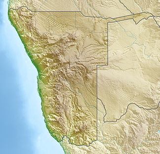
Hunsberge
| Hunsberge | ||
|---|---|---|
| location | ǁKaras , Namibia | |
|
|
||
| Coordinates | 27 ° 55 ′ S , 17 ° 29 ′ E | |
| particularities | second largest canyon on earth ( Fish River Canyon ) | |
The Hunsberge ( English Huns Mountains ) are a mountain range in the ǁKaras region in southern Namibia . Its highest point is 1636 meters above sea level .
At the edge of the Hunsberge is the Fish River Canyon, the second largest canyon on earth. The area is also known for the ǀAi-ǀAis hot springs and the Apollo 11 cave .
The Hunsberge have been part of a national park since 1988, today's ǀAi-ǀAis Richtersveld Transfrontier Park .
See also
Individual evidence
- ↑ Ai-Ais Huns Mountains. Namibian.org.Retrieved May 23, 2013
- ↑ / Ai- / Ais - Richtersveld Transfrontier Park. Ministry of Environment and Tourism ( Memento of the original dated December 4, 2014 in the Internet Archive ) Info: The archive link was inserted automatically and has not yet been checked. Please check the original and archive link according to the instructions and then remove this notice. (PDF; 153 kB) accessed on May 23, 2013
annotation
- ↑ Note: This article contains characters from the alphabet of the Khoisan languages spoken in southern Africa . The display contains characters of the click letters ǀ , ǁ , ǂ and ǃ . For more information on the pronunciation of long or nasal vowels or certain clicks , see e.g. B. under Khoekhoegowab .


