Kammerwoog-Krechelsfels
Coordinates: 49 ° 42 ′ 7 ″ N , 7 ° 18 ′ 15 ″ E
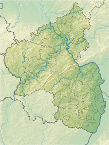
The Kammerwoog-Krechelsfels nature reserve is located in the Birkenfeld district in Rhineland-Palatinate .
The approximately 49 hectare area, which was placed under nature protection in 1998 , extends in two sub-areas along the Nahe between the city of Idar-Oberstein in the north and the Enzweiler district in the south. The B 41 runs between the two sub-areas . In the southern area, the B 41 and the state road L 176 run on the western edge.
The protection purpose of the area is development and conservation
- the geological-morphological peculiarity
- as a site of rare wild plants and plant communities that are threatened in their existence
- as a habitat for endangered animal species.
See also
Web links
- Kammerwoog-Krechelsfels (map) on protectedplanet.net
- 13424 Ordinance on the "Kammerwoog-Krechelsfels" nature reserve in the Birkenfeld district of March 16, 1998 (PDF) on naturschutz.rlp.de


