Mörschieder Burr
|
NSG Mörschieder Borr (Burr)
|
||
|
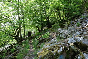
Path in the nature reserve (2014) |
||
| location | Mörschied , Rhineland-Palatinate , Germany | |
| surface | 19.7 ha | |
| Identifier | NSG 7134-076 | |
| WDPA ID | 82188 | |
| Geographical location | 49 ° 47 ' N , 7 ° 17' E | |
|
|
||
| Sea level | from 550 m to 646 m | |
| Setup date | 1940 | |
The nature reserve Mörschieder Borr (Burr) lies within the boundaries of the municipality of Mörschied ( Verbandsgemeinde Herrstein ) in the Rhineland-Palatinate district of Birkenfeld . It was designated in 1940 and has a size of approximately 19.7 hectares . The NSG ID is 7134-076. Since the establishment of the Hunsrück-Hochwald National Park in 2015, the nature reserve has been located in nature zone 1b (development zone) in the northeast corner of the national park.
location
The nature reserve is located in the southern Idarwald , a central part of the Hunsrück . It is located southwest of the center of Mörschied in the triangle of the local communities Mörschied, Kempfeld and Herborn .
The area has a length of 1.12 km and a maximum width of about 270 m. The highest point is the 646 m high Mörschieder Burr, consisting of Taunus quartzite , which is located in the state forest of Mörschieder Wald just under 2 km northeast of the Wildenburger Kopf (with the Wildenburg ruins and the Wildenburg nature reserve ).
description
The area is predominantly forested, but also includes largely vegetation-free scree slopes ( quartzite rocks) on the south-eastern slope of the mountain.
Marked hiking trails run along the NSG and the Saar-Hunsrück-Steig leads to the summit of the Mörschieder Burr.
See also
Individual evidence
- ↑ Ordinance on the “Mörschieder Borr (Burr)” nature reserve of April 22, 1940. (PDF; 57 kB) In: www.naturschutz.rlp.de. Retrieved February 13, 2016 .
- ↑ Zoning. (No longer available online.) In: www.nationalpark-hunsrueck-hochwald.de. Archived from the original on February 15, 2016 ; accessed on February 14, 2016 (see map there). Info: The archive link was inserted automatically and has not yet been checked. Please check the original and archive link according to the instructions and then remove this notice.
- ↑ Saar-Hunsrück-Steig stage 12 on the homepage of the Saar-Hunsrück-Steig


