Kandahar
|
قندهار Kandahar |
||
|---|---|---|
|
|
||
| Coordinates | 31 ° 36 ′ N , 65 ° 42 ′ E | |
| Basic data | ||
| Country | Afghanistan | |
| Kandahar | ||
| ISO 3166-2 | AF-KAN | |
| height | 1000 m | |
| Residents | 461,900 (calculation 2017) | |
Kandahar ( Greek Alexandreia; Pashto : کندهار Kandahār , Persian قندهار Qandahār ) with a population of around 461,900 (according to 2017 calculations) is the third largest city in Afghanistan after the capital Kabul and Herat . Kandahar is located in the south of the country on the Arghandāb (Dari) or Argandau (Pashto) rivers. It is the administrative seat of the Kandahar province of the same name .
Surname
The assumption that the name Kandahar is derived from Alexandreia is not tenable according to the Encyclopædia Iranica . The current name has been used since the Muslim period and appears for the first time as al-Qandahār in the works of the chronicler al-Balādhurī . The Muslim conqueror ʿAbbād bin Ziād renamed the city to inAbbādiya after himself, but this form quickly disappeared. Other names of the city were Dawlatābād (during the Mongol rule) and Ḥosaynābād (in the 18th century). Inexplicably, Kandahar is not mentioned in the 11th and 12th centuries. The Ghaznavids , who ruled the region, do not mention the city.
Possible origins of the word Kandahar are the ancient kingdom of Gandhara or the name of an Indo-Greek city Gondophareia, the existence of which is not certain. It would also be possible to derive it from the city of Condigramma, which Pliny the Elder mentioned in his Naturalis historia . The area around Kandahar also belonged to the Gandutava district of the ancient Persian province of Arachosia .
population
According to calculations for 2012, the province has 2,846,954 inhabitants; in comparison there were 567,000 in 1979. Kandahar is the third largest city in Afghanistan and an important trading center, mainly for agricultural products.
Infrastructure
Kandahar International Airport is approximately 16 km southeast ( 31 ° 30 ′ 49 ″ N , 65 ° 51 ′ 40 ″ E ) on the road to Quetta. It is connected to Kabul and Herat via the ring road .
climate
Kandahar has an arid , continental climate characterized by low rainfall and a high variation between summer and winter temperatures. The extremely dry summer begins in mid-May and lasts until the end of September. It reaches its peak in July with average temperatures of around 31 ° C. This is followed by a dry autumn between the beginning of October and the end of November with average temperatures of around 18 and 12 ° C, respectively.
Winter begins in December and has the highest annual rainfall in the form of rain. Temperatures average between 6 and 8 ° C, although lows can drop below freezing. Winter ends at the beginning of March and is followed by a mild spring that lasts until the end of April and brings temperatures on average around 14 and 20 ° C.
| Kandahar | ||||||||||||||||||||||||||||||||||||||||||||||||
|---|---|---|---|---|---|---|---|---|---|---|---|---|---|---|---|---|---|---|---|---|---|---|---|---|---|---|---|---|---|---|---|---|---|---|---|---|---|---|---|---|---|---|---|---|---|---|---|---|
| Climate diagram | ||||||||||||||||||||||||||||||||||||||||||||||||
| ||||||||||||||||||||||||||||||||||||||||||||||||
|
Monthly average temperatures and rainfall for Kandahar
Source: wetterkontor.de
|
|||||||||||||||||||||||||||||||||||||||||||||||||||||||||||||||||||||||||||||||||||||||||||||||||||||||||||||||||||||||||||||||||||||||||||||||||||||||||||||||||||||
history

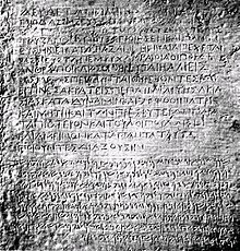
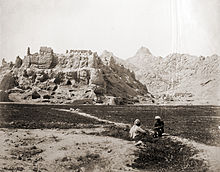
Kandahar was founded in the 4th century BC. Founded by Alexander the Great near the ancient city of Mundigak (founded around 3,000 BC). Due to its strategically important location in Central Asia, the city was a frequent target of conquests: for example by the Arabs in the 7th century, by the Turkic Ghaznavids in the 10th century, by the Mongols under Genghis Khan in the 12th century and in 1383 by Timur . Babur took Kandahar in the 16th century.
The city belonged to the Sawafid Persia at the beginning of the 18th century, which however lost power. In 1709 a regional Pashtun group under Mir Wais Hotak gained power. From 1739 to 1747 Kandahar came under the control of Nadir Shah . Ahmad Shah Durrani , Emir of the Durrani Empire , the forerunner of the Afghan state, took the city in 1747 and made it the capital of his kingdom a year later. Today's old town was built by Ahmed Shah and is dominated by his mausoleum. In 1780 Kabul became the new capital.
British troops occupied Kandahar at the beginning of the First Anglo-Afghan War (1839–1842). In 1842 they withdrew and returned with Indian troops in the Second Anglo-Afghan War in 1878. In the fight against Ayub Khan , they were defeated in the Battle of Maiwand in 1881 . Life in Kandahar remained peaceful for the next hundred years, with the exception of 1929 when Habibullah Kalakâni besieged the fortified city and harassed the population until he was driven out by Mohammed Nadir Shah .
After the end of the Soviet-Afghan war , the rulers changed frequently. At the end of 1994, the Taliban began to conquer the south, east and center of Afghanistan from Kandahar. On December 7, 2001, troops of the Afghan Northern Alliance, with US support, liberated Kandahar from the Taliban.
Personalities
Natives
- Abdul Rahim Hatef (1925–2013), politician
- Nashenas (born 1935), Pashto singer
- Ghulam Haider Hamidi (1947–2011), former mayor
- Hamid Karzai (* 1957), President of Afghanistan from 2004 to 2014
- Aatifi (* 1965), artist and calligrapher
See also
Web links
- Kandahar . In: Ehsan Yarshater (Ed.): Encyclopædia Iranica (English, including references)
literature
- Jürgen Paul : Central Asia. S. Fischer, Frankfurt am Main 2012 ( New Fischer World History , Volume 10).
Individual evidence
- ↑ Afghanistan: Provinces & Cities - Population Statistics, Maps, Charts, Weather, and Web Information. Retrieved February 6, 2018 .
- ↑ World Gezatteer for the province of Kandahar ( Memento of the original from December 29, 2011 in the Internet Archive ) Info: The archive link was inserted automatically and has not yet been checked. Please check the original and archive link according to the instructions and then remove this notice.
- ↑ Afghanistan Ministry of Transport and Civil Aviation Kandahar Airport ( Memento of the original from May 31, 2011 in the Internet Archive ) Info: The archive link was automatically inserted and not yet checked. Please check the original and archive link according to the instructions and then remove this notice. , accessed September 4, 2010
- ^ Jürgen Paul: Central Asia. 2012, p. 355

