
Călugăreni Castle
| Călugăreni Castle | |
|---|---|
| Alternative name | Mikháza / Călugăreni fort |
| limes | Dacian Limes |
| section | A / VII / 33 |
| Dating (occupancy) | 2nd to 3rd century |
| Type | Auxiliary fort |
| unit | Vexillatio of Legio XIII Gemina Cohors I Alpinorum equitata Cohors I Augusta Ituraeorum Cohors I Ubiorum equitata (?) |
| size | 163 m × 141 m = 2.3 ha |
| Construction | A) Wood and earth warehouse B) Stone fort |
| State of preservation | Ground monument, archaeological park under construction |
| place |
Eremitu - Călugăreni Mureș County |
| Geographical location | 46 ° 37 '36.2 " N , 24 ° 52' 34.8" E |
| height | 445 m |
| Previous |
Brâncoveneşti Castle (northwest, A / VII / 32) |
| Subsequently |
Sărățeni Castle (south, A / VII / 34) |

Fort Călugăreni was a Roman auxiliary troop camp on the northeastern Dacian Limes in what is now the area of Călugăreni , a village in the municipality of Eremitu / Mureș district in Romanian Transylvania .
location
The fort is located on the northwestern periphery of the modern village of Călugăreni, on the southern bank of the Niraj at a reference altitude of around 445 m above the level of the Black Sea. In ancient times it was in the province of Dacia superior on the eastern Limes road between the forts Brâncoveneşti in the north and Sărățeni in the southeast. With a chain of watchtowers and taking advantage of the natural barriers of the mountains near Gurghiu and the Subcarpaţii Târnavei Mici , its crews had the task of safeguarding the upper Niraj valley and the valley near Săcădat, through which the roads leading to the Barbaricum, which had been used since pre-Roman times.
Research history
The fort was first described in the early 18th century by Luigi Ferdinando Marsigli , who was also the first to draw up a topographical map. At the end of the 18th and beginning of the 19th centuries (1733, 1778, 1787, 1830 and 1842) the square was mentioned repeatedly in some newspapers. The first information about excavations in this area was published by Károly Benkő in 1868. He also mentioned for the first time at least halfway correctly the size of the fort with 170 by 150 steps. In the same year Balázs Orbán measured the area and came up with 210 by 160 steps, but explicitly pointed out the rounded corners with towers and two gates. The first at least summarily documented excavations (by F. Deák) took place in 1878 under the direction of F. Kovács. During these excavations, parts of the Porta principalis sinistra (left side gate) were found. In addition, a roughly hewn, lying sandstone lion one meter in length and a fragmentary grave inscription were discovered at a depth of two meters. The scientists of the late 19th century mainly published on the already published data or added minor details.
The publications from the first half of the 20th century mainly dealt with the history of Roman Dacia and the military history of the region, as well as the connecting road known as Trajan Street and above all a building that was still visible at that time, known as the Thermen interpreted. During this time, people also wanted to find channels that connected the bathhouse with the Niraj in order to drain the thermal baths. During his exploration of the eastern Limes, István Paulovics visited Călugăreni in 1942 and, based on his precise field observations, created an exact topographical plan of the site. The first systematic archaeological investigations of the military site were carried out in 1961 by Dumitru Protase . Most other publications up to the end of the 20th century were based on existing knowledge without adding anything new. That only changed in 2004, when Nicoleta Man began her long-term investigations of the place (see literature and web links below).
In the years between 2013 and 2015, an interdisciplinary research team investigated as part of an Erasmus intensive program , coordinated by the Winckelmann Institute of the Humboldt University of Berlin with the participation of the University of Cologne , the University of Pécs , the Technical and Economic University of Budapest , the Eötvös- Loránd University, Budapest , the Erfurt University of Applied Sciences , the Babeş-Bolyai University Cluj and the University of Petru Maior cover the area of Călugăreni. The Winckelmann Institute carried out geophysical and field archeological investigations through which important settlement and building structures could be clarified.
In the meantime the fort and the vicus area as well as the thermal baths have been placed under monument protection. Since 2008, various projects have been and are being carried out in international cooperation to research, preserve and present the monuments on the eastern border of the Roman Dacia in terms of air archeology, geophysics, architectural history, topography and systematic research excavations at the Roman garrison site of Călugăreni.
Findings
The Călugăreni fort had a rectangular circumference of 163 m by 141 m (equivalent to 2.3 hectares) and was surrounded by a triple wall and ditch system. Two construction phases were identified. Initially, the military camp was constructed using a wood-and-earth construction, and at a later date the fence was replaced by a stone wall. With its Praetorial Front (front) it was oriented to the east, on the border running through the Carpathians . The road leading from the west ran around the fort on its north side and must then have led further east. Inside the camp, the principia (staff building), the praetorium (commandant's house), a horreum (storage building) and various team barracks could be determined geophysically . During the excavation in 2004, six contubernia of one of these barracks were uncovered. The civil settlement, the vicus, extended west of the fort. The densely built and parallel strip houses were oriented towards the main street that came from the interior of the province. The main road was crossed in the vicus area by three smaller side roads, which led north in the direction of the Niraj brook. On one of these side streets, where it approached the stream, massive building structures could be identified, which were identified as thermal baths (see below).
Based on the results of geophysical prospection, a total of three excavation cuts were made in 2013 in the areas of the Principia, the Vicus and the stream. In the Principia, three rooms on the back and the rear part of the basilica in front were exposed. The largest of the three rooms had a solid mortar floor and an apse-shaped rear wall, so that it could be addressed as a flag shrine. Layers of fire were discovered in the basilica and several finds came to light, including parts of scale armor and scales, as well as an iron lamp. At the intersection of the main street and one of the side streets, a larger building seems to have stood, the function of which remained unclear. In particular, due to high quality finds such as shards of terra sigillata , fragments of glass vessels and windows, part of an amber ring, a glass ring and terracotta fragments, an outstanding residential area within the vicus seems to have been located in this area. The third section in the area of the stream was intended to clarify whether the building was the thermal baths of the Vicus. The surface finds, including fragments of hypocaust bricks, gave rise to this assumption. This assumption was confirmed by the probing, during which numerous pillars of a hypocaust system and some tegulae mammatae (wall tiles used in bathrooms) were found.
The excavations in the mentioned areas continued in 2015. A wooden predecessor building was identified in the Principia, so that there are definitely at least two construction phases. In the layers of rubble above the younger building, there were again numerous small finds, including a rare iron handcuff and many bronze and iron militaria . The building complex was examined further in the vicus area. The river gravel areas identified as early as 2013 were encountered again in different structures, which have straight borders and are arranged at right angles to one another. It is not yet clear whether these are indoor floors or outdoor running horizons. The buildings were wooden constructions, the roofs of which were covered with organic materials. Further rooms were uncovered in the thermal baths, some of which were hypocausted. Fragments of wall plaster confirmed the once colored painting of their walls.
garrison
When the troops stationed in Călugăreni were inscribed the vexillatio of
- Legio XIII Gemina , the
- Cohors I Alpinorum equitata and the
- Cohors I Augusta Ituraeorum detected.
Furthermore, the Cohors I Ubiorum equitata was sometimes suspected there.
Monument protection and presentation
The entire archaeological site and in particular the castle are protected as historical monuments according to Law No. 422/2001 passed in 2001 and are registered with the LMI code MS-ImB-15354.01 in the national list of historical monuments (Lista Monumentelor Istorice) . Responsible is the Ministry of Culture and National Heritage (Ministerul Culturii şi Patrimoniului Naţional), in particular the General Directorate for National Cultural Heritage, the Department of Fine Arts and the National Commission for Historical Monuments and other institutions subordinate to the Ministry. Unauthorized excavations and the export of ancient objects are prohibited in Romania.
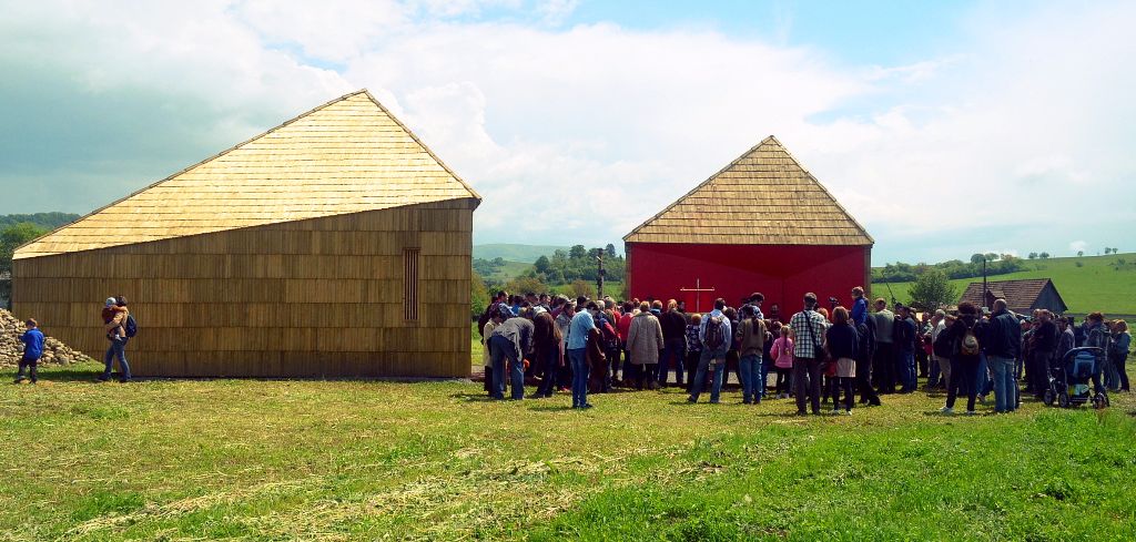
| Inauguration of the Time Box pavilions |
|---|
|
Link to the picture |
In 2015, thanks to cooperation between local and regional authorities, it was possible to end the agricultural use of a few hectares of farmland and to start designing an archaeological park (Parcul Arheologic de la Călugăreni). The Muzeul Județean Mureș / Mureș County Museum manages the park. Since the inauguration, information boards have been informing visitors about the most important parts of the site and since 2016 two wooden buildings, the so-called Time Box Pavilions, have housed a permanent exhibition.
See also
literature
- Nicolae Gudea : The Dacian Limes. Materials on its story . In: Yearbook of the Römisch-Germanisches Zentralmuseum Mainz 44 (1997), p. 57f., ( Digitized version ).
- Constanze Hoepken et al .: Watchtowers on the Dacian East Limes between Brâncoveneşti and Călugăreni (jud. Mureş / RO). In: Archäologisches Korrespondenzblatt 46.2 (2016), pp. 241–254.
- Nicoleta Man, C. Crişan and D. Cioată: Călugăreni, com. Hermit, jud. Mures. Punct: Castru roman . In: MV Angelescu, I. Oberländer-Târnoveanu and F. Vasilescu (eds.): Cronica cercetărilor arheologice din România . Campania, Bucharest 2004, pp. 101-102.
- Nicoleta Man: Ceramica ştampilată descoperită în castrul roman de la Călugăreni . In: Marisia 28, 2006, pp. 113-117.
- Nicoleta Man and DM Cioată: Archaeological Researches in the Military Vicus from Călugăreni . In: Marisia 32, 2012, pp. 85-99, ( digitized version ).
- Nicoleta Man et al .: Călugăreni, com. Hermit, jud. Mures. Punct: Vicusul castrului roman de la Călugăreni . In: MV Angelescu (ed.): Cronica cercetărilor arheologice din România . Campania, Bucharest 2012, pp. 34–37.
- Felix Marcu: The Internal Planning of Roman Forts of Dacia . (= Bibliotheca Mvsei Napocensis XXX), Mega Publishing House, Cluj-Napoca 2009, ISBN 978-606-543-058-7 , pp. 121f.
- Florian Matei-Popescu: Trupele auxiliare pe limesul estic al Daciei. Stadiul problemei . ANGVSTIA, Studii şi cercetări de Arheologie 17–18 (2014), pp. 205–216, here p. 207, ( digitized version ).
- Florian Matei-Popescu and Ovidiu Ţentea: The Eastern Frontier of Dacia. A Gazetteer of the Forts and Units . In: Vitalie Bârcă (ed.): Orbis Romanus and Barbaricum. The Barbarians around the Province of Dacia and Their Relations with the Roman Empire . Mega Publishing House, Cluj-Napoca 2016, ISBN 978-606-543-755-5 , pp. 7–24, here p. 10, ( digitized version )
- Szilamér-Péter Pánczél: The Roman Fort from Călugăreni (Mureş County, Romania) . In: L. Vagalinski and N. Sharankov (eds.): Limes XXII. Proceedings of the 22nd International Congress of Roman Frontier Studies, Ruse, Bulgaria, September 2012 . (= Bulletin of the National Archaeological Institute XLII, 2015), National Archaeological Institute with Museum at the Bulgarian Academy of Sciences, Sofia 2015, ISSN 0323-9535 , pp. 909-916, (extensive research history that goes down to the smallest detail with extensive Bibliography).
- Szilamér-Péter Pánczél et al .: Research on the Dacian East Limes between Brâncoveneşti and Sărățeni . In: Der Limes 8/2 (2014), 23–27, ( digitized version ).
- Szilamér-Péter Pánczél, Silvia Mustață and Alpár Dobos: The research at the Roman auxiliary fort of Mikháza / Călugăreni . In: Hungarian Archeology (2018 Spring), pp. 13-20, ( digitized ).
Web links
- Digitizing the Roman Limes. Sector Brâncoveneşti-Sărățeni. On a website of the Muzeul Județean Mureș / Mureș County Museum (English), accessed on December 8, 2018
- Nicoleta Man: Călugăreni | Comuna: Eremitu | Judeţ: Mureş | Punct: Castrul roman | Anul: 2004 on the website of the Institutul Național al Patrimoniului (Romanian), accessed December 8, 2018
- Nicoleta Man: Călugăreni | Comuna: Eremitu | Judeţ: Mureş | Punct: Vicus-ul castrului roman de la Călugăreni | Anul: 2011 on the website of the Institutul Național al Patrimoniului (Romanian), accessed December 8, 2018
- Nicoleta Man: Călugăreni | Comuna: Eremitu | Judeţ: Mureş | Point: Castrul roman, termae şi vicusul militar | Anul: 2014 on the website of the Institutul Național al Patrimoniului (Romanian), accessed December 8, 2018
- Nicoleta Man: Călugăreni | Comuna: Eremitu | Judeţ: Mureş | Point: Castrul roman, termae şi vicusul militar | Anul: 2015 on the website of the Institutul Național al Patrimoniului (Romanian), accessed December 8, 2018
- Călugăreni in the final report of the 2013 excavation campaign of the Humboldt University Berlin, accessed on December 8, 2018
- Călugăreni in the final report of the 2015 excavation campaign of the Humboldt University Berlin, accessed on December 8, 2018
Individual evidence
- ^ Route / section / fort number (based on Nicolae Gudea , 1997).
- ↑ a b CIL 03, 08064,01w , CIL 03, 08064,01x , CIL 03, 08065,01w and CIL 03, 08065,01x .
- ↑ a b CIL 03, 06256
- ↑ a b Szilamér-Péter Pánczél, Silvia Mustață and Alpár Dobos: The research at the Roman auxiliary fort of Mikháza / Călugăreni . In: Hungarian Archeology (2018 Spring), p. 17, ( digitized ).
- ↑ Szilamér-Péter Pánczél: The Roman Fort from Călugăreni (Mures County, Romania) . In: L. Vagalinski and N. Sharankov (eds.): Limes XXII. Proceedings of the 22nd International Congress of Roman Frontier Studies, Ruse, Bulgaria, September 2012 . (= Bulletin of the National Archaeological Institute XLII, 2015), National Archaeological Institute with Museum at the Bulgarian Academy of Sciences, Sofia 2015, ISSN 0323-9535 , pp. 909f.
- ^ Danubius Pannonico-Mysicus. Observationibus geographicis, astronomicis, hydrographicis, historicis, physicis perlustratus. Vízügyi Múzeum, Budapest 2004, ISBN 963-217-033-4 (reprint of the edition The Hague 1726), p. 59f. and Figure 27.
- ↑ Károly Benkő: ismertetése Marosszék . Kolozsvár 1868, pp. 190f.
- ↑ Balázs Orbán: A Székelyföld leírása. Történelmi, régészeti, természetrajzi s népismei szempontból. Képeket szerzö fnyképei s raizai után fára rajzolták Greguss János és Bicsérdy János . Tettey, Pest 1871, pp. 88f.
- ^ F. Deák ,: Hazai tud. intézetek és leletek. A mikházi ásatások . Archaeologiai Értesítő 12/7, pp. 267–269.
- ↑ CIL 3, 7716
- ↑ István Paulovics: Dacia keleti határvonala és az ugynevezet “dák” -ezüstkincsek kérdése . Kolozsvár 1944, p. 34f. and Figure 5.
- ↑ Dumitru Protase: Le coorti I Hispanorum miliaria e I Ubiorum in Dacia . In: Dacia NS 6 (1962), pp. 505-508 and Ders .: Castrul roman de la Călugăreni (r. Tîrgu Mureş). Săpăturile din anul 1961 . In: Acta Musei Napocensis 2 (1965), pp. 209-214.
- ↑ Szilamér-Péter Pánczél: The Roman Fort from Călugăreni (Mures County, Romania) . In: L. Vagalinski and N. Sharankov (eds.): Limes XXII. Proceedings of the 22nd International Congress of Roman Frontier Studies, Ruse, Bulgaria, September 2012 . (= Bulletin of the National Archaeological Institute XLII, 2015), National Archaeological Institute with Museum at the Bulgarian Academy of Sciences, Sofia 2015, ISSN 0323-9535 , pp. 909-916.
- ↑ Szilamér-Péter Pánczél, Silvia Mustata and Alpár Dobos: The research at the Roman auxiliary fort of Mikháza / Călugăreni . In: Hungarian Archeology (2018 Spring), p. 13, note 1, ( digitized version ).
- ↑ Large-scale around 46 ° 37 ′ 37.75 ″ N , 24 ° 52 ′ 27.9 ″ E
- ↑ To 46 ° 37 '39.25 " N , 24 ° 52' 25.85" O
- ↑ Repertoriul Arheologic Naţional (RAN) Code 116616.01 on the archaeological monuments website at the Ministry of Culture of Romania (Romanian), accessed on December 7, 2018.
- ↑ Szilamér-Péter Pánczél, Silvia Mustata and Alpár Dobos: The research at the Roman auxiliary fort of Mikháza / Călugăreni . In: Hungarian Archeology (2018 Spring), pp. 13f., ( Digitized version ).
- ↑ Szilamér-Péter Pánczél et al .: Research on Dacian Ostlimes between Brâncoveneşti and Sarateni . In: Der Limes 8/2 (2014), 25–27, ( digitized version ).
- ↑ a b Călugăreni in the final report of the 2013 excavation campaign by Humboldt University Berlin, accessed on December 7, 2018.
- ↑ Călugăreni in the final report of the 2015 excavation campaign of the Humboldt University Berlin, accessed on December 7, 2018.
- ↑ List of historical monuments on the website of the Ministry of Culture and National Heritage
- ↑ Parcul Arheologic Calugareni on the website of the Muzeul Județean Mureș / Mureș County Museum (Romanian), accessed on December 8, 2018.
- ↑ At 46 ° 37 '37.6 " N , 24 ° 52' 26.7" E
- ↑ Szilamér-Péter Pánczél, Silvia Mustata and Alpár Dobos: The research at the Roman auxiliary fort of Mikháza / Călugăreni . In: Hungarian Archeology (2018 Spring), pp. 19f., ( Digitized ).
Brâncoveneşti Castle | Călugăreni Castle | Sărățeni Castle | Praetoria Augusta (Inlăceni Castle) | Odorheiu Secuiesc Castle | Sânpaul Castle | Olteni Castle