
Fort Pöchlarn
| Fort Pöchlarn | |
|---|---|
| Alternative name |
a) Arelape b) Arlape c) Ariate |
| limes | Limes Noricus |
| section | Route 1 |
| Dating (occupancy) | 1-5 Century AD |
| Type |
Auxiliary , Alen and Fleet Fort |
| unit |
a) Cohors I Flavia Brittonum , b) Equites Dalmatae Arelape , c) Classis Arelapensis et Marginensis |
| size |
a) Wood and earth fort, 3.3 ha, b) Stone fort I, 2.5 ha |
| Construction | Wood, earth and stone construction |
| State of preservation | Rectangular complex with corner and intermediate towers, larger modifications in late antiquity (fan and horseshoe towers), no longer visible above ground |
| place | Pöchlarn |
| Geographical location | 48 ° 12 ′ 0 ″ N , 15 ° 12 ′ 0 ″ E |
| Previous | Watchtowers Ybbs (west) |
| Subsequently | Melk Fort (east) |


.JPG)
.JPG)


The Pöchlarn Fort was part of the chain of fortresses of the Roman Danube Limes in Pöchlarn , Melk District , Lower Austria , Austria .
The auxiliary troop and cavalry camp belonging to the Noric Limes was built near the confluence of the Erlauf into the Danube and was presumably continuously occupied by Roman soldiers from the 1st to the 5th century AD. Almost all of the main geographic sources for antiquity indicate the location. In the 4th century the stationing of a unit of the Danube fleet made it more important. An oxbow lake used as a harbor separated the fort, which was presumably located on an island, from the civilian settlement. Otherwise very little was known about the structural development of the fort. This only changed when the Federal Monuments Office carried out extensive investigations between 2002 and 2009. The camp could be clearly proven archaeologically . The northern part was washed away by the Danube, the southern part is completely built over by the old town. Remnants of a late antique fan tower and wall remains (see stone fort II) have been preserved in the basement of the care center and on the area in front of the parish church and Thörringplatz.
In addition to the fort, this article also deals with the neighboring watchtowers of Sarling and Säusenstein .
Surname
The assignment of this late antique fort location for Pöchlarn is now considered certain by experts. The name Arelape was mentioned by Ptolemy , in the Tabula Peutingeriana (Areiate), in the Itinerarium Antonini and in the Notitia Dignitatum . The name is probably derived from the ancient river name of the Erlauf ( apa or Latin amnis "river", "water"). An Illyrian origin of the name of the Erlauf would also be conceivable, namely Arilapa ("eagle river"), which was later transferred to the fort and its civil settlement, somewhat modified.
location
The Pöchlarner Basin is situated in the hill country of the Bohemian Massif at the confluence of the Erlauf into the Danube. The terrain in the area of the town of Pöchlarn still had the character of a primeval landscape and was shaped by the Danube, which ran a little further north in Roman times. The river formed a swampy floodplain with numerous side arms and gravel islands, which extended to 1.5 km south of its current bank area. The fort itself was probably on a gravel island, a little east of the Erlauf. Its confluence is about one kilometer east of the city. The Erlauftal is divided into narrow and wide areas by the occasional crystalline application in the Quaternary terraces. Several connecting routes through the Erlauftal and a trade route that lead to the Eastern Alps and u. a. also via the old iron road ("Dreimärktestraße") to the ore mining areas ( ferrum noricum ) in the Eisenerzer Alps . East-west traffic ran through the foothills of the Alps along the Danube. The crossing at Marbach led to today's Waldviertel .
Research history
Early observations
The location of the fort has been known for 400 years. In the 16th century, the humanist Wolfgang Lazius and others reported that the Danube still flowed here over Roman masonry and cobbled streets. Numerous found coins and tombstones were also documented in this context. In 1534 two inscription stones were still known in Pöchlarn, including a gravestone that had been placed for Sucessus, Ursina and their son Sucessianus. The other was walled up in the church of St. Peter, which was demolished in 1780, and made for the veteran Marcus Ulpius Longinus. Both are missing today.
19th century
In 1856 Wilhelm Gärtner (1811–1875), who lived in Klein-Pöchlarn , carried out the first excavations on a meadow near Harlanden , during which he presumably succeeded in uncovering the remains of the heating system of an ancient bathing building. However, Gärtner only documented the findings in a very unprofessional manner, so that his excavation results could no longer be scientifically evaluated later. Incidentally, Harlanden was also often given as a place of discovery for relief and inscription stones, but the exact location of the places of discovery could no longer be determined afterwards. The sites located in the flood-prone area also suggest the course of the Limes Road in this region. During this time, an antique pottery kiln was uncovered east of the palace park.
20th century
During canal work in 1927 in Jubiläumsstrasse and Parkstrasse (today Oskar-Kokoschka-Strasse) about 50 m from the bank of the Danube, employees of the Federal Monuments Office (BDA) recognized the profile of a double pointed trench, and further south of it another trench. This finding was the decisive proof for the existence of an early imperial Roman fortification.
In 1930, when the World War Memorial was being built on Wiener Strasse / Nibelungenstrasse, a Roman wall was discovered. Subsequent excavations revealed that part of the east wall of the fort was cut here.
In 1951, on the occasion of sewer works (at secondary school, elementary school / Nibelungenstrasse), the remains of the ancient settlement were found at a depth of three to four meters. This 1.4 m high quarry stone wall formed the boundary of a building that was at least 10.6 m long. After the unpublished excavations from 1912 to 1913 (Beneficiat Aichinger), this finding could be part of a thermal bath . The area was photographed at the time but then filled in again. In 1955 a well-preserved funeral urn, ceramics and a fragment of a millstone were recovered from a foundation excavation.
In 1961, during construction work in Rüdigerstrasse opposite the cemetery, the Austrian Archaeological Institute and the Federal Monuments Office recovered an urn, ceramics, a lamp and an inscription stone in situ. It was the tombstone of Pompeius Celer, a soldier of the Cohors I Flaviae Brittonum , who could be dated to the 2nd century. In 1966 several urns were raised on plot 299/1. Here the easternmost edge zone of the burial ground is assumed.
In 1978 the eastern gate of the fort was destroyed at the intersection of Wienerstraße / Nibelungenstraße during construction work.
1982–1983 the Federal Monuments Office was able to document several important findings during sewer work. During these years Gustav Melzer observed the course of other Roman defensive trenches and the location of the southwest corner tower of the stone camp. On the basis of these older excavations, a total of three Roman fortifications could be distinguished, two of which were probably built using the wood-earth technique; perhaps they were only short-term camps .
In 1983 a 1.80 m wide wall was found on Thörringplatz, which could be referred to as the western defensive wall of the fort. The reconstruction plan of the fort had to be corrected 40 to 50 m to the east. In Oskar-Kokoschka-Strasse, double pointed trenches had been cut in several places. In the Weigelsbergergasse, discolouration of the earth in a trench running through WO was observed. This means that the stone warehouse was a little smaller than previously assumed. In front of house no. 16, two NNE-SSW oriented pointed trenches were discovered at a depth of 1.8 m. They could be examined to a depth of 3.40 m and had a width and depth of approx. 4.5 m. They belonged to the early wood-earth camp, which was probably located southeast of the stone fort. In the Seilergasse a sloping earth discoloration was uncovered, which was referred to as a Roman point.
21st century
From 2002 to 2003 the Federal Monuments Office and ARGIS Archeology Service examined an area of around 2000 m² on the occasion of the new building of the care center. The southern fortifications of the stone fort were uncovered to the north and west of today's castle building. The wall discovered in the process and two inner towers are multi-phase and were structurally heavily modified in late antiquity. A probe on the fort wall revealed a total of three upstream weir ditches. The area excavation inside the fort brought u. a. Barracks that were built in wood at the end of the 1st or the beginning of the 2nd century and later replaced by stone buildings. Their use extended into late antiquity. To the south of the castle there was still a multi-phase building complex with stone foundations, which, however, was already part of the vicus. Since 2010, the Institute for Prehistoric and Protohistoric Archeology and Provincial Roman Archeology at the Ludwig Maximilians University in Munich has been carrying out excavations in Pöchlarn in cooperation with the ZEA department of the ÖAI and the Federal Monuments Office (headed by Michael Mackensen). However, after the excavations were completed, these walls were poured over with concrete to build the foundation for a new community center. In 2012 the south gate could tw. to be examined.
development
Finds of holey axes and stone hatchets from the Neolithic indicate that there was an initial settlement in the area of Brandhof - Röhrapoint - Rampersdorf. In addition, early and late Bronze Age finds and remains of Urnfield Age building traces west of Ornding in the reed "Griesgrub" and at Kuhbühel were excavated. The finds, the locations of which are no longer known today, are kept in the Welserturm Museum in Pöchlarn.
According to the finds (terra sigillata ceramics), the fort was built in the late 1st century. To the north of the Danube, in the area of today's Klein-Pöchlarn, there was probably a fortified bridgehead. The expansion in stone (stone fort I) probably took place after the Marcomann Wars. The last major renovations are estimated to have been in the Valentine period (stone fort II). The use of the fort area can be traced back to the early 5th century. The main task of the crew was probably the flank protection for the legionary camp Lauriacum , the protection of the mouth of the Erlauf , the Limes road (Via iuxtra Danuvium) as well as the Danube and shipping. Possibly the fort also controlled a Danube crossing and the eastern access to the route Enns – Steyr – Pyhrnpass , an important trunk road to Italy.
Presumably on the occasion of the last large-scale border security measures by Valentinian I (364 to 375 AD), the probably already greatly reduced crew left - as could also be observed with some other forts on the Noric-Pannonian Limes (e.g. Cannabiaca ) the rest of the walled area for the civilian population, which lost its military function and turned into a civilian oppidum . Whether it was still fulfilling its military function in full at this point appears doubtful for the time being.
In the most important source for the late antique Norikum, the vita of Severin von Noricum , Arelape is not mentioned. However, this does not have to mean that it was already given up or completely abandoned at that time. When Severin came to Ufernorikum before 467, Roman rule there had almost completely collapsed. Six years after his death in 488, Odoacer ordered the Romans to evacuate the province and migrate to Italy. It cannot be said with certainty whether the fort was completely abandoned in addition to the civil settlement at the latest after their departure. Between the 5th and the 14th / 15th In the 19th century, no significant settlement activity could be found on the investigated area. There was no evidence of early medieval use, and the remains of the so-called “ Herilungoburg ” could not be uncovered. It is mentioned in a deed of donation dated October 6, 832, when King Ludwig the German assigned a place in the Avar Province with the former fortress and its surrounding areas to the Regensburg monastery.
It is not clear whether the area was assigned to Regensburg earlier and the donation was only confirmed by a deed in 832, or whether the donation was related to another transaction. Immediately afterwards, however, the colonization and Christianization of the region will have started. The place names of Harlanden (first mentioned in 1334 as Harlant) and Knocking point to their origin in the 9th century. It can also be assumed that a baptistery was already being built in Pöchlarn at this time - the Peterskirche in question, which was completely demolished in 1793, was located near the banks of the Danube, a little outside the city in the so-called Bräuhausgarten. The center of the Regensburg administration was also in Pöchlarn itself. But here, too, it is questionable whether the diocese actually had the Roman praetorium rebuilt between the church and the rectory and set up an administrative building here in the “first castle” of Pöchlarn. A few finds only suggest that the place was repopulated in the 13th century.
Fort
The first archaeological traces of a Roman fortification are two pointed ditches running from east to west. Missing find material does not allow exact dating. They probably belonged to the construction camp or marching camp.
In the area of the stone camp, which was first documented by Gustav Melzer, most of the southern defense - presumably the decuman front of the camp - and also remnants of the interior buildings were exposed. The fortifications essentially consisted of two parallel stone walls with inwardly protruding corner and intermediate towers, which in late Roman times were rebuilt too far in front of the camp walls protruding U and fan towers. Previous wooden buildings could not be verified. In front of it there were two pointed trenches, which were leveled and replaced by a pointed trench at a later date, probably as part of the renovation of the towers.
In 1928 Eduard Nowotny was able to define the area of the stone fort a little more precisely. Nothing could be seen above ground from the fort until the excavations in 2002/2003. The remains of the southern part of the (most likely) rectangular, east-west-oriented camp are now located under the medieval town center; the northern area was washed away by the Danube over the centuries or destroyed during the construction of the flood dam.
The ancient remains are covered by a large area of proven "black layer", a natural soil formation that has grown over a long period of time. It forms a clearly recognizable border between Roman and medieval settlement layers. The exact cause of this phenomenon, which could also be observed in other forts in the Noric Limes, has not yet been clearly clarified. Agricultural processing, livestock keeping or a long-term abandonment of the area are accepted for this. Concrete traces of major building activity can only be found from the late Middle Ages.
Wood and earth fort
Judging by the oldest recovered finds, the wood-earth warehouse was probably built in the late 1st century. The unit responsible for this cannot be named. The first signs of Roman activity could only be observed in the form of east-west trench profile traces that have been preserved southeast of the late antique stone fort and speak for a wood-earth fort with an area of approximately 3.3 hectares. Two east-west oriented crew barracks are known of the interior structures. The long rectangular buildings show the remains of adjacent chambers. The wood and earth fort was probably destroyed during or around the time of the Marcomann Wars. Its last remains were probably destroyed during the construction of Stone Fort I. On the north bank of the Danube, in the area of Klein-Pöchlarn, there was probably a bridgehead fortification.
Stone fort I
New findings clearly show that stone fort I was in the same place as the wood and earth fort in the second half of the 2nd century AD. According to Nowotny, the first stone fort probably took up an area of 2.5 hectares. The course and appearance of its southern - around 155 m long - enclosing wall are primarily known from the excavation campaign of 2002. As with most of the forts on the Limes in Norway, the four corners of the defensive wall were probably rounded (playing card shape), which was no longer visible after the late antique renovations due to the covering with new towers. The fortifications essentially consisted of a massive, 1.2 m wide stone wall with square towers attached at regular intervals on the inside, one could be detected. Presumably at the same time as this, a second, parallel wall was built behind it, but its function has not yet been clarified due to the lack of comparative examples. It may be a further reinforcement measure or an elaborately designed support for the battlement. After evaluating the excavation results and observations so far, a more precise reconstruction of the southern fortifications of the fort was possible. They extended over a length of about 150 m from the senior citizen center (city palace) to Thörringplatz. In front of the southern fort walls, a double system of ditches was also created as an obstacle to the approach. The east gate at the junction Wienerstraße / Nibelungenstraße was destroyed in the 1970s. The porta principalis sinistra (west gate) was most likely located between the houses at Thörringplatz 4 and 5. The north gate was washed away by the Danube, the exact location of the southern gate could not yet be determined. After the older wooden structures were demolished, new wooden team barracks were erected at the same location, although the orientation and location hardly changed.
Stone fort II
In late antiquity, a new camp wall was built in the southern part, which probably also made the fort slightly smaller. The inwardly protruding square intermediate and corner towers were replaced by external, massive horseshoe-shaped or fan-shaped additions and thus significantly enlarged and reinforced. During the 2002–2003 excavations, the foundations of the fan-shaped towers on the southwest and southeast corners and a horseshoe tower on the south wall were uncovered. During the excavations, several construction phases could also be identified. The remains of the wall of the southeast fan-shaped tower (cheek walls) were preserved by the Federal Monuments Office and integrated into the cellar of the new building for the senior citizens' care center.
Interior constructions
Inside the fort, in addition to an approximately three meter wide warehouse lane running parallel to the wall, three approximately 10 × 10 m large buildings were found, which were initially made of wood and later, around the middle of the 2nd century, slightly offset, this time in stone. A similar structure also appeared in the area of the excavation area from 2008 to 2009. Due to their location as well as their size, all four were probably the quarters of the centurions at the head of the team barracks. Some of these were inhabited until late antiquity, as a heating duct built in the early 4th century and rebuilt several times in one of the buildings suggests. To the east of one of the warehouse buildings on Thörringplatz, a sewer made of mortar- plastered rubble was built on Wallstrasse (Via sagularis) . When the canal was built, a breakthrough was created in the south wall for the drainage of the sewage. A “canal widening” is seen as a collecting basin, the lack of a mortar canal base indicates a wood-lined channel. The canal was no longer used from the 3rd century.
The multi-phase, east-west oriented wooden post structures had rows of rooms next to each other. In the course of the 2nd century AD, these were replaced by similar structures that rested on sill beams oriented from north to south, but which were only slightly sunk into the ground. Most of them could only be recognized by what was left of the floor. It was essentially always barracks or farm buildings. This was followed by several stone construction phases in the 3rd century AD, which were based on the previous floor plans. In contrast to the excavation results in the area of the castle, the western wooden buildings were not always replaced by stone buildings later. A punctiform foundation and the remainder of a narrow L-shaped angled wall on a gravel primer are the only remains known so far. They are connected to a wooden structure, which, however, could only be examined roughly. Presumably, this fort area was still built on with buildings using the classic cantilever beam technology. However, the traces of these buildings were no longer archaeologically detectable.
garrison
The following crew units are known for Arelape :
| Time position | Troop name | comment | Illustration |
| 2nd century AD |
Cohors prima Flavia Brittonum (the first Flavian cohort of the British ) |
This mid-imperial occupation unit is known for the tombstone of Pompeius Celer, who served in it. This cohort was probably stationed here from 130 onwards. It was probably moved to the middle Danube in the course of the Nerva and Trajan campaigns . |
.jpg)
Equipment of an auxiliary soldier in the 3rd century (figurine in Kastell Saalburg )
|
| Late antiquity |
|
The garrison of the late period can only be recorded using the Noric Dux troop list in the Notitia Dignitatum. It names a cavalry unit and a fleet prefect for Arelape , the Praefectus Classis Arlapensis et (Co) Marginensis (prefect of the flotillas of Arelape and Comagena ). These units were essentially responsible for protecting the mouths of the Ybbs, Erlauf and Pielach as well as patrols on the Danube. It is possible that the unit from Fort Comagena was later relocated to the more conveniently located Arelape .
The brick stamps widespread in Noricum and Pannonia with the imprint OF AR and OF ARN (perhaps to be read as officina Arlapensis nova ) possibly refer to a large military brick factory operated in Arelape , which can also be assigned to the period of late antiquity. Since the stamp abbreviations AR , ARN and ARAN , which are also known from Hungary , cannot be clearly explained for the time being, translation suggestions remain purely speculative. |
Port facility
An arm of the Danube in the Steinwand-Erlauf area separated the fort from the camp village. The Danube port is believed to be halfway between the former fort and the civil settlement between Harlanden and the Erlauf. From the 4th century it became more important when a unit of the Danube Fleet ( Classis Arlapensis ) was stationed . Subsequently, a civil settlement was built in Harlanden. Whether iron rings that have been lost since 1905 " ... on the rocky border of the former Danube country ... " were part of an investor from Roman times can no longer be clarified today.
Vicus
The camp was surrounded by a civilian settlement ( vicus ) in the south and south-east, and some street findings were also found here. A precise determination of these findings is difficult due to the lack of documentation and publication. Likewise, the question of the extent and chronology of the camp village cannot be answered exactly. In the southern section of the vicus there was a building complex covered by its stone foundations, which was south of today's castle. The northern part was washed away by the Danube over time, the southern part is completely built over by the old town. The settlement remnants cited in the older literature near Harlanden (thermal baths?), About seven kilometers away, are not cited due to the greater distance to Pöchlarn.
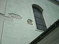
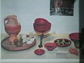
- Roman relief stones on the parish church and grave goods from Pöchlarn / Erlauf


.JPG)
.JPG)
.JPG)
.JPG)
.JPG&filetimestamp=20100814201400&)

Burial grounds
While in the west of the fort, in Brunn, only a single finding of a burial site is known, in the east in the area of Rüdigerstraße there is a late antique burial ground with numerous burials, stone box graves and urn burials. The finds date from the 4th and 5th centuries AD. Many graves were without gifts, in some of them there were only fragments of clothing accessories (fibulas, leather buckles, buttons). Occasionally there were also vessel additions. A total of 37 skeletal burials were examined in 1960. The burial site has probably been in use since the fort was founded. Occasionally, already disturbed graves were discovered on Wienerstraße, which are located on the extension of the street that leads through the eastern camp gate, which has now completely disappeared.
Limes course between Burgus Ybbs and Burgus Bacharnsdorf
| Surname | Description / condition | Illustration |
|---|---|---|
| Säusenstein watchtower | In the village of Säusenstein, the remains of a watchtower were discovered south of the train station around 1957. The site is between the embankment of the Western Railway and the Danube. On plot 144/3 in the cadastral community of Säusenstein, the landowner reported masonry that had been discovered earlier to the Federal Monuments Office. The Federal Monuments Office (HG Walter) carried out relevant surveys in 1957. The remains of the wall were viewed as a watchtower that was in visual contact with the Sarling tower, 2.3 km to the south. The square wall was torn to a depth of 50–60 cm. It consisted of rubble stones, mixed with pieces of roof tiles (tegulae) , and was connected with a light, hard mortar mixture. Inside the square of the wall there was still a roughly hewn sandstone sculpture. | |
| Watchtower / Sarling Temple | Two kilometers to the south, in Sarling, district of Veitsberg / Weinberg, stands the small St. Vitus Church on a hill sloping towards the Danube, where the remains of the wall inside have also been interpreted as part of a Roman building. In 1950 three Roman consecration altars were found at this church. During an archaeological investigation by the Federal Monuments Office (Gustav Melzer) in 1961 and 1962, Roman-era masonry was uncovered inside the branch church, which is interpreted as a watchtower due to its exposed location; on the other hand, a function as a temple is also considered. The reason for this was provided by the three altars, which are already heavily weathered today, which are set up on the southern outer wall of the church. During the archaeological investigation of the branch church, which u. a. whose building history was to be explored in more detail, the remains of an approximately 4 × 5.50 meter wide rectangular room were excavated in the southwest area of the nave, the axis orientation of which differed from the subsequent superstructures. Its further expansion to the east could no longer be determined due to later construction disruptions. A horizon of destruction with mortar and broken bricks could also be recognized between the walls, which continued in a northerly direction. The remains of the wall are now covered by the church floor. |


Note

The Welserturm dates from 1484, stands directly on the Danube and once secured the north-western corner of the late medieval fortification. Subsequently, it also served as a branch and salt depot for Wels merchants. In 1997, the new city museum was set up here, with a permanent exhibition mainly about the Roman past of Pöchlarn. In the three-storey tower, the permanent exhibition “Arelape - the Roman Pöchlarn”, designed in cooperation with the Federal Monuments Office, with the latest excavation finds from 2002/2003 can be viewed on two levels. The remains of the SO fan tower in the basement of the care center can be viewed on request on weekdays (only in the morning hours). The interior of the St. Veit Church in Sarling is also accessible on prior request.
Monument protection
The facilities are ground monuments within the meaning of the Austrian Monument Protection Act . Investigations and targeted collection of finds without the approval of the Federal Monuments Office are a criminal offense. Accidental finds of archaeological objects as well as all measures affecting the soil must be reported to the Federal Monuments Office (Department for Archaeological Monuments).
See also
literature
- Thomas Fischer : Noricum. (Orbis Provinciarum. Special Volumes of the Ancient World). Philipp von Zabern, Mainz 2002, ISBN 3-8053-2829-X , p. 44.
- Kurt Genser : The Austrian Danube Limes in Roman times, a research report . (The Roman Limes in Austria, 33). Publishing house of the Austrian Academy of Sciences, Vienna 1986, pp. 251–263.
- Manfred Kandler, Hermann Vetters (ed.): The Roman Limes in Austria. A leader . 2nd, unchanged edition. Publishing house of the Austrian Academy of Sciences, Vienna 1989, ISBN 3-7001-0785-4 , pp. 127–128.
- Michael Doneus, Edith Bilek-Czerny: Carnuntum and Limes. Office of the Lower Austrian State Government, Dept. Art and Culture (Ed.). (Communications from Lower Austria, Volume 45). St. Pölten 2011, pp. 32–34.
- Hertha Ladenbauer-Orel: New finds from Pöchlarn . In: Annual books of the Austrian Archaeological Institute. 37, 1948, pp. 179-184.
- Franz Langer: New Roman finds in Pöchlarn . In: Our home. 17, 1946, p. 168.
- Karl Wais: The history of the museums and the finds of the city of Pöchlarn . In: Johann Vieghofer (Hrsg.): Heimatbuch der Stadt Pöchlarn. St. Pölten 1967, pp. 215-238.
- Karl Wais: Pöchlarn. Political district Melk, in: The cities of Lower Austria. Part 2: H – P, edited by Friederike Goldmann, Evelin Oberhammer and Johanne Pradel, Vienna 1976 (Österreichisches Städtebuch IV / 1).
- Heinrich Zabehlicky: The late antiquity and migration period body graves from the Noric part of Lower Austria. Dissertation. University of Vienna, 1976.
- Eduard Nowotny: Two Noric Limes forts. Scoreboard of the Academy of Sciences, Philosophical-Historical Class; 6–9, Vienna 1928, pp. 28–68.
- About the latest excavations in Gross-Pöchlarn. In: Mittheilungen der kk Central-Commission for the research and preservation of architectural monuments. 2, 1857, pp. 47-50 PDF
- Hannsjörg Ubl: Late Roman burial ground of Pöchlarn. In: Severin between Roman times and the Great Migration . Exhibition catalog, Enns 1982, p. 523.
- Rene Ployer: Sarling - watchtower. In: Verena Gassner, Andreas Pülz (Hrsg.): The Roman Limes in Austria. Guide to the archaeological monuments. Publishing house of the Austrian Academy of Sciences, Vienna 2015, ISBN 978-3-7001-7787-6 , p. 193.
- René Ployer: The Norwegian Limes in Austria. Find reports from Austria, Materialhefte series B 3, Österr. Federal Monuments Office, Vienna 2013.
- Martina Hinterwallner, Sebastian Schmid: Pöchlarn - Arelape. Auxiliary fort. In: Verena Gassner, Andreas Pülz (Hrsg.): The Roman Limes in Austria. Guide to the archaeological monuments. Publishing house of the Austrian Academy of Sciences, Vienna 2015, ISBN 978-3-7001-7787-6 , pp. 194–197.
- Nikolaus Hofer, Paul Mitchell: KG Pöchlarn, SG Pöchlarn, VB Melk, in: Find reports from Austria 42, 2003, on the excavations from 2002 to 2003 see also the entry on Pöchlarn in: Österreichische Zeitschrift für Kunst und Denkmalpflege 57/1, 2003 , Pp. 151-152.
Web links
- Location of the fort on Vici.org
- Location of the Säusenstein tower on Vici.org
- Fort Pöchlarn - The Limes in Austria
- Animated film of the Roman Limes in Tullnerfeld
- Austrian City atlas, history of the city of Pöchlarn
Remarks
- ↑ Kurt Genser: 1986, p. 236 ff.
- ↑ 2, 13, 3; 8, 7, 5.
- ↑ Segmentum IV, 5th
- ↑ 234, 3; 248, 5, Arlape station , on the road from Vindobona to Lauriacum .
- ↑ occ. XXXIIII, 34 and XXXIIII, 42.
- ^ Heinrich Dittmaier: The names of the waters on "apa" , dissertation Bonn 1943.
- ↑ CIL 3, 5667 .
- ↑ CIL 3, 5670 .
- ^ Find reports from Austria , Volume 1, 1930–34, p. 57.
- ↑ Karl Wais 1967, p. 230.
- ^ Find reports from Austria , Volume 6, 1951–55, p. 98; Karl Wais 1967, p. 233; Find reports from Austria , Volume 9, 1966–70, p. 81.
- ^ Find reports from Austria , Volume 8, 1961–65, p. 100.
- ^ Find reports from Austria , Volume 8, 1961–65, p. 101; Manfred Zabehlicky 1976, p. 179.
- ↑ Gustav Melzer, in: Find reports from Austria 22, 1983, p. 301.
- ^ Find reports from Austria , Volume 21, 1982, p. 291.
- ^ Find reports from Austria , Volume 21, 1982, p. 292.
- ↑ Find reports from Austria , Volume 42, 2003, pp. 26–27, Urban Renewal Concept Chapter 2.4 Archive link ( Memento from October 20, 2013 in the Internet Archive )
- ↑ 832: locus ubi antiquitus castrum fuit qui dicitur Herilungoburg , Verena Gassner / Sonja Jilek / Sabine Ladstätter: On the edge of the realm. The Romans in Austria, Vienna 2002 (Austrian history 15 BC - 378 AD, edited by Herwig Wolfram), p. 340.
- ↑ Michael Doneus, Edith Bilek-Czerny, 2011, p. 34, Wais 1976, p. 322.
- ↑ Eduard Nowotny: 1928, p. 42.
- ↑ Michael Doneus, Edith Bilek-Czerny, 2011, p. 34.
- ↑ Michael Doneus, Edith Bilek-Czerny, 2011, p. 34.
- ↑ Eduard Polaschek: 1936b, p. 1001.
- ↑ Occ. XXXIV, 34 and XXXIV, 42.
- ↑ K. Genser: 1986, p. 247.
- ↑ Ádám Szabó , Endre Tóth (ed.): Bölcske. Roman inscriptions and finds - In memoriam Sándor Soproni (1926–1995) (Libelli archaeologici Ser. Nov. No. II). Hungarian National Museum, Budapest 2003, ISBN 963-9046-83-3 , p. 80.
- ^ Gertrud Pascher: Roman settlements and roads in the Limes area between Enns and Leitha . In: The Roman Limes in Austria 19, Vienna 1949, p. 111.
- ↑ Kandler / Vetters, 1989, p. 127.
- ↑ Nikolaus Hofer, Paul Mitchell 2003, pp. 26–27, here 26.
- ↑ Hannsjörg Ubl: 1982, p. 523.
- ↑ List is from west to east.
- ^ Pro Austria Romana. Volume 8, 1958, p. 6.
- ^ Find reports from Austria. Volume 5, 1946-50, p. 113.
- ^ Find reports from Austria. 8, 1961-65, pp. 101, 192; Gustav Melzer: Archaeological investigations in the St. Veit branch church in Sarling, municipality of Ybbs on the Danube . In: Find reports from Austria . 14, 1975, pp. 27-30.
Boiotro Castle | Boiodurum Castle | Burgus Passau-Haibach | Burgus Oberranna | Small fort Schlögen | Eferding Castle | Burgus Hirschleitengraben | Lentia Castle | Legion camp Lauriacum | Legion camp Albing | Fort St. Pantaleon-Stein | Wallsee Castle | Locus Felicis | Watchtowers Ybbs | Arelape Castle | Melk Castle | Limestorms in the Wachau | Favianis Castle | Burgus Hollenburg | Traismauer Castle | Zwentendorf Castle | Comagena Castle | Fort Zeiselmauer