Kesselberg (Bavaria)
| Kesselberg | |||
|---|---|---|---|
|
|
|||
| Compass direction | North | south | |
| Pass height | 858 m above sea level NN | ||
| district | Bad Toelz-Wolfratshausen , Bavaria | ||
| Valley locations | Kochel am See | Urfeld on the Walchensee | |
| expansion | Bundesstrasse 11 | ||
| Motorcycle lock | Weekend driving ban in the direction of Walchensee | ||
| Mountains | Bavarian Prealps | ||
| profile | |||
| Ø pitch | % (253 m /? Km) | % (56 m /? Km) | |
| map | |||
|
|
|||
| Coordinates | 47 ° 37 '17 " N , 11 ° 20' 57" E | ||
The height of the pass between Kochelsee and Walchensee or between Herzogstand and Jochberg as well as the section of federal road 11 that crosses over there are referred to as Kesselberg . The pass is at 858 m above sea level. NN .
Kesselberg
The Kesselberg was an Alpine gate during the Würme Ice Age ; Here a branch of the Isar glacier, which in turn was a branch of the Inntal glacier , flowed through it at a height of approx. 1,400 m above sea level .
“The Kesselberg is so named because a rock there was carved out by falling water like a kettle.” This quote will refer to one of the distinctive pools in the Kesselbach that flows down from the Kesselberg into the Kochelsee.
From the Kesselberg, slight climbs lead to the two surrounding mountains, the Jochberg in the east and the Herzogstand in the west. Both are popular destinations. The lines of the Walchensee power plant run roughly under the Kesselberg .
Kesselbergstrasse
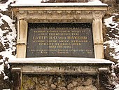
The Kesselbergstraße leads approx. 9 km in length from Kochel am See to Urfeld and overcomes an altitude difference of 255 m to the pass. The first Kesselbergstrasse was built in 1492 under Duke Albrecht IV of Bavaria . On this occasion, a large marble plaque was installed, which is still on display on the old Kesselbergstrasse - but as a replica, the original is in the Bavarian National Museum in Munich. The expansion of the road was of great importance for the development of the economic region (especially the regional trade between southern Bavaria and Tyrol). In the 17th century a postal route of the taxi post led over the Kesselberg.
From 1893 to 1897, the road under Luitpold von Bayern was largely laid out on a new route by the Weilheim Royal Road and Water Construction Authority. Between 1962 and 1994 the B 11 was gradually expanded and permanently renewed by the Weilheim road construction authority.
The Kesselbergstraße is a busy and well-developed connection road ( Bundesstraße 11 ) and leads in numerous bends up to the pass. On the way there are several viewpoints with a view over the Kochelsee and parts of the Alpine foothills.
Time and again there are numerous fatalities on this route due to illegal races and excessive speed. As a consequence, there is a continuous speed limit of 60 km / h and a no-overtaking ban on the entire route. The route towards Walchensee is closed to motorbikes on Saturdays, Sundays and public holidays.
Kesselberg race
In 1905 and 1907 the first road races took place on Kesselbergstrasse, in which both automobiles and motorcycles took part. The wide curves at the top of the pass allowed high speeds for the time. 60 motorcycles and 80 touring and racing cars took part in the first race.
After a twenty-one year break, races were held again from 1928 to 1935.
Web links
- Johannes Haslauer: Kesselbergstrasse in: Historisches Lexikon Bayerns
- Map, GPS track and elevation profile of the route over the Kesselberg
- History of the Kesselberg race (PDF; 771 kB)
Individual evidence
- ^ Municipality of Kochel a.See and the administrative community Kochel a.See, Kochel a. Lake: Arrival to Walchensee ( Memento of the original from July 2, 2017 in the Internet Archive ) Info: The archive link has been inserted automatically and has not yet been checked. Please check the original and archive link according to the instructions and then remove this notice. , accessed on November 21, 2017.
- ↑ Quotation of unknown origin in the Tölzer Kurier of February 3, 1924
- ^ Johannes Haslauer: Kesselbergstrasse. Functions and effects of the upgraded road. In: Historical Lexicon of Bavaria. Bayerische Staatsbibliothek, 2010, accessed on April 5, 2020 .
- ↑ https://www.merkur.de/lokales/bad-toelz/kochel-am-see-ort28931/unfall-am-kesselberg-zwei-motorradfahrer-schwer-verletzt-9862106.html


