Little Heckberg
| Little Heckberg | ||
|---|---|---|
|
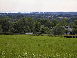
View from the Kleiner Heckberg west-southwest |
||
| height | 348.1 m above sea level NHN | |
| location | Bergisches Land , Rheinisch-Bergischer Kreis , North Rhine-Westphalia ( Germany ) | |
| Mountains | Rhenish Slate Mountains | |
| Coordinates | 50 ° 56 '52 " N , 7 ° 23' 1" E | |
|
|
||
The Kleine Heckberg is 348.1 m above sea level. NHN is the highest point in the Rheinisch-Bergisches Kreis in North Rhine-Westphalia ( Germany ). It is located in the Bergisches Land near the Overather district of Federath in the Heckberger Forest (Heck) .
Geographical location
The Kleine Heckberg rises as the western foothills of the Heckberg ( 384.3 m ), about 2 km from its summit, about 1.2 km west-southwest of the triangle of the Rhein-Sieg-Kreis , Rheinisch-Bergischer Kreis and Oberbergischer Kreis . In the Bergisches Land nature park , it is about 6.5 km west-southwest of the Overather town center.
In the urban area of Overath (Rheinisch-Bergischer Kreis) are on or on the mountain: Federath on the southwestern highlands, Kaltenborn in the west, Wüststeimel and Schlingenthal in the west-northwest, Schalken in the northeast, Siebelsnaaf in the southeast and Abelsnaaf in the southeast. To the east, Heckhaus lies in the municipality of Much (Rhein-Sieg district).
The south-west flowing Naafbach rises on the south-east flank of the Kleiner Heckberg, which is fed by the Brungssiefen and Hentgesnaafer Siefen brooks on its south flank in Federath , and the west-running Schlingenbach on its east flank . The Wahnbach rises on the east of the Heckberg .
Natural allocation
The Kleine Heckberg is in the natural spatial main unit group Süderbergland (No. 33) on the border of the subunits Heckberger Wald (339.3) in the northeast, which belongs to the main unit Bergland of the Upper Agger and Wiehl (339), and Marialinder Riedelland (338.43) in the southwest, which belongs to the main unit Bergische Hochflächen (338). The landscape leads to the southeast into the subunit Mucher plateau (338.5).
Individual evidence
- ↑ a b Map services of the Federal Agency for Nature Conservation ( information )
- ↑ Heinz Fischer: Geographical Land Survey: The natural spatial units on sheet 124 Siegen. Federal Institute for Regional Studies, Bad Godesberg 1972. → Online map (PDF; 4.1 MB)

