Stern house
|
Stern house
Much parish
Coordinates: 50 ° 56 ′ 46 ″ N , 7 ° 23 ′ 58 ″ E
|
||
|---|---|---|
| Height : | 330–355 m above sea level NHN | |
| Residents : | 17 (2012) | |
| Postal code : | 53804 | |
| Area code : | 02245 | |
|
Location of Heckhaus in Much |
||
|
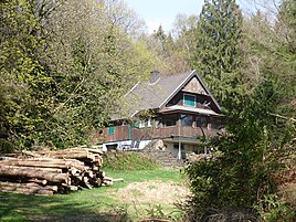
Old forester's house in Heckhaus
|
||
Heckhaus is a district of the municipality of Much in the Rhein-Sieg district .
location
At the height of the Heckberg ( 383.4 m above sea level ), Heckhaus is located on Brüderstraße . It is the highest and northernmost point in the municipality of Much. From here you have a wide view over the southern Bergisches Land and the Siebengebirge to the Hohe Acht in the Eifel.
history
In the vicinity of Heckhaus, mining for non-ferrous metal ores has been carried out since the middle of the 19th century . The Silberkaule mine was in the immediate vicinity . A little further north was the Bliesenbach mine . Both mines were major employers in the region.
In 1901, Heckhaus was a homestead with eight residents. Here lived Ackerin widow Joh. Höger and the gamekeeper Wilhelm Kreuzer.
Individual evidence
- ↑ Müller's Large German Local Book 2012: Complete local dictionary. 33. revised and exp. Ed., Walter de Gruyter, Berlin and Boston 2012, ISBN 978-3-11-027420-2 , online at Google Books , p. 549
- ↑ Hike around the Heckberg, accessed on October 28, 2014
- ^ Resident directory Siegkreis 1901
Web links
- "Heckberg" nature reserve in the specialist information system of the State Office for Nature, Environment and Consumer Protection in North Rhine-Westphalia


