
Cancer sponsors
|
Cancer sponsors
City of Schwerin
Coordinates: 53 ° 35 ′ 37 ″ N , 11 ° 24 ′ 8 ″ E
|
|
|---|---|
| Height : | 44 m |
| Area : | 5.09 km² |
| Residents : | 5656 (Sep. 30, 2017) |
| Population density : | 1,111 inhabitants / km² |
| Incorporation : | October 1, 1936 |
| Postal code : | 19061 |
| Area code : | 0385 |
 Location of Krebsförden in Schwerin
|
|
Krebsförden is a district of the Mecklenburg-Western Pomerania state capital Schwerin .
geography
The district is located south of the Lower Ostorfer See in the southern half of the urban area. Neighboring districts are Ostorf , Gartenstadt , Großer Dreesch , Göhrener Tannen , Wüstmark and Görries . In the southeast of the Krebsförden there is a larger mixed forest area with the hazel wood . Part of it is used as a burial place with the forest cemetery . Small forest areas exist directly on the Ostorfer See. The Krebsbach, which flows through the Krebsförden, flows into this.
In the south of the district there was once the Göhren treasury, which Count Helmold donated to the city in 1282. The street name Hof Göhren and the adjacent forest area Göhrener Tannen in the district of the same name still remind us of this today .
history
Krebsförden was first mentioned in 1285 as Creuesforde .
In view of the housing shortage in Schwerin, 24 employees in Schwerin and workers and craftsmen striving to live in rural surroundings built houses in Krebsförden in 1926/27 , which was not very popular with the long-established farmers. It was feared that the new settlers would be a burden to the community's poor fund and also to the deterioration of decency and morals.
Together with other communities, the at that time still predominantly agricultural Krebsförden was incorporated into Schwerin on October 1st, 1936. The affected locations were not involved in the negotiations.
With the increasing population of Schwerin, the area in the old cemetery of the city was soon no longer sufficient, so that in 1970 the main cemetery (today: Waldfriedhof) was opened near the former village of Krebsförden, which was expanded from 19.6 hectares to 26 hectares by 1989 and is equipped with a crematorium built in 1994/95.
In the 1980s there were plans to build a new, known as Dreesch IV , prefabricated building area in Krebsförden and Wüstmark with a total of 5800 apartments for around 16,800 residents. Decisive for the choice of location were the favorable location near the workplaces and on the already existing tram line and the developed road, already existing supply lines and the proximity to the recreation area on Ostorfer See. The owners of the apartments were / are the municipal housing association in Schwerin and the housing association Schwerin. Not all of the planned apartments were built. Due to the need to save, an extensive social infrastructure was not built in the district. Schools in the other three construction phases of the Großer Dreesche should also be used and the polyclinic in Wüstmark should guarantee medical care. The building project, which had already been partially realized, was not ended by the fall of the Berlin Wall . For this purpose, in addition to the already existing, old settlement area, which is still village-like today, residential buildings were built on the right and left of today's bypass road.
The Sieben Seen Center shopping center, built in 1995, contributed significantly to ending shopping tourism in western federal states. In addition to retail stores, a sports park was also located here.

Original settlement area with a village character
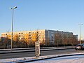
Prefabricated buildings from the 1980s

building area created after 1990


Attractions

At Dorfstraße 8 there is a low German hall house in two-column construction from the years 1670–72. Originally it was part of a ducal lease. The passage house, which once had six compartments and a half-hip roof , was expanded to nine compartments in 1852/53 and equipped with a full hipped roof. The building, which was restored in 1994, has housed a family and village history museum called Dat oll 'Hus since 1995 , which is run by private individuals on a voluntary basis.
Transport links
The federal highways 106 and 321 , which are four lanes, lead through Krebsförden . The Schwerin − Hagenow railway line runs along the western border of the district , from which the Schwerin – Parchim railway line branches off and forms the south-western border of Krebsförde. The next train station is in the neighboring district of Görries. Tram lines 3 and 4, which connect the industrial areas in Wüstmark with the city center or the Großer Dreesch, as well as the bus lines 7, 13 and 16 of the Schwerin local transport , operate in Krebsförden .
literature
- Bernd Kasten and Jens-Uwe Rost: Schwerin. History of the city. Thomas Helms Verlag, Schwerin 2005. ISBN 3-935749-38-4
Web links
Individual evidence
- ↑ Bernd Kasten and Jens-Uwe Rost: Schwerin. History of the city. Thomas Helms Verlag, Schwerin 2005. ISBN 3-935749-38-4 , city map on p. 77
- ↑ KASTEN / ROST, p. 13
- ↑ Chronik Wüstmark, Timeline - wuestmark.de
- ↑ Box / Rost, p. 74
- ↑ Box / Rost, p. 90
- ↑ Box / Rost, p. 266
- ↑ Box / Rost, p. 264 f.
- ↑ Box / Rost, p. 348
- ^ Georg Dehio : Handbook of German Art Monuments. Mecklenburg-Western Pomerania , Deutscher Kunstverlag, revision, Munich / Berlin 2000, ISBN 3-422-03081-6